- All Categories (614)
- Data (12)
- News (38)
- Missions (3)
- Events (14)
- Tools (2)
- Activities (12)
- Documents (533)
News - General News

ESA's improved Earth system data records: what is in store for the future?
Fundamental Data Records (FDRs) are instrumental in advancing our understanding of Earth systems and for addressing societal challenges effectively. These long-term records contain uncertainty-quantified, calibrated and geo-located multi-instrument/multi-platform satellite sensor data spanning several decades to support climate-related applications.
News - Data Release news
CHAMP L3 magnetic data now available on Swarm dissemination server
We are pleased to announce the release of magnetic field data from CHAMP mission on Swarm dissemination server.
News - Data Release news
Additional EFI TII Raw And Corrected Imagery and Spectra (TRACIS) dataset 0201 available for Swarm
Additional EFI TII Raw And Corrected Imagery and Spectra (TRACIS) data is now available on the Swarm dissemination server for all the Swarm satellites.
News - Data Release news

Additional EFI TII Cross Track Flow dataset 0302 available for Swarm
Additional TII cross-track flow data is now available on the Swarm dissemination server for all the Swarm satellites.
Document - Newsletter

Earth Online Newsletter - 08 March 2024
This issue of the Earth Online Newsletter covers a selection of the latest news and events from ESA.
News - Data Release news
FDR4ALT - ESA unveils new cutting-edge ERS/Envisat Altimeter and Microwave Radiometer Datasets
The European Space Agency (ESA) has developed a comprehensive suite of innovative Earth system data records as part of the Fundamental Data Records for Altimetry project - FDR4ALT.
Data - EO Sign In Authentication (Open)
Sea Ice Thematic Data Product [ALT_TDP_SI]
This is the Sea Ice Thematic Data Product (TDP) V1 resulting from the ESA FDR4ALT project and containing the sea ice related geophysical parameters, along with associated uncertainties: snow depth, radar and sea-ice freeboard, sea ice thickness and concentration. The collection covers data for the ERS-1, ERS-2 and Envisat missions, and bases on Level 1 data coming from previous reprocessing (ERS REAPER and the Envisat V3.0) but taking into account the improvements made at Level 0/Level 1 in the frame of FDR4ALT (ALT FDR). The Sea Ice TDP provides data from the northern or southern hemisphere in two files corresponding to the Arctic and Antarctic regions respectively for the winter periods only, i.e., October to June for the Arctic, and May to November for the Antarctic. For many aspects, the Sea Ice TDP is very innovative: First time series of sea-ice thickness estimates for ERS Homogeneous calibration, allowing the first Arctic radar freeboard time series from ERS-1 (1991) to CryoSat-2 (2021) Uncertainties estimated along-track with a bottom-up approach based on dominant sources ERS pulse blurring error corrected using literature procedure [Peacock, 2004] The FDR4ALT products are available in NetCDF format. Free standard tools for reading NetCDF data can be used. Information for expert altimetry users is also available in a dedicated NetCDF group within the products. Please consult the FDR4ALT Product User Guide before using the data. The FDR4ALT datasets represent the new reference data for the ERS/Envisat altimetry missions, superseding any previous mission data. Users are strongly encouraged to make use of these datasets for optimal results.
Data - EO Sign In Authentication (Open)
Ocean and Coastal Topography Thematic Data Product [ALT_TDP_OC]
This is the Ocean and Coastal Topography Thematic Data Product (TDP) V1 resulting from the ESA FDR4ALT project and containing improved sea surface height anomaly data records both at 1 Hz and 20 Hz resolution to address climate and/or coastal areas studies. The collection covers data for the ERS-1, ERS-2 and Envisat missions. Note that a dedicated processing to coastal zones has been applied for coastal distances below 200 km. Compared to existing datasets, the Ocean and Coastal Topography TDP demonstrates notable improvements in several aspects: Up-to-date orbit and geophysical corrections applied Adaptive retracker for Envisat The FDR4ALT products are available in NetCDF format. Free standard tools for reading NetCDF data can be used. Information for expert altimetry users is also available in a dedicated NetCDF group within the products. Please consult the FDR4ALT Product User Guide before using the data. The FDR4ALT datasets represent the new reference data for the ERS/Envisat altimetry missions, superseding any previous mission data. Users are strongly encouraged to make use of these datasets for optimal results.
Data - EO Sign In Authentication (Open)
Ocean Waves Thematic Data Product [ALT_TDP_WA]
This is the Ocean Waves Thematic Data Product (TDP) V1 resulting from the ESA FDR4ALT project and containing Significant Wave Height estimates for the ERS-1, ERS-2 and Envisat missions. Compared to existing datasets, the Ocean Waves TDP demonstrates notable improvements in several aspects: Great improvements for Envisat due to noise reduction from Adaptive retracker and High-Frequency Adjustment (HFA) All variables are given at 5 Hz The FDR4ALT products are available in NetCDF format. Free standard tools for reading NetCDF data can be used. Information for expert altimetry users is also available in a dedicated NetCDF group within the products. Please consult the FDR4ALT Product User Guide before using the data. The FDR4ALT datasets represent the new reference data for the ERS/Envisat altimetry missions, superseding any previous mission data. Users are strongly encouraged to make use of these datasets for optimal results.
News - Success Stories
Trailblazing ERS-2 mission enables climate change applications
As ESA’s ERS-2 satellite approaches Earth’s atmosphere for reentry, it’s time to reflect on the mission’s great achievements in powering climate-related applications.
News - Data Release news

New Swarm Burst and Whistler products from IPGP/CNES/CEA-Leti released
We are pleased to announce that two new Swarm products making use of Absolute Scalar Magnetometer (ASM) high-rate data at 250 Hz (acquired when the instrument is operating in Burst Mode), are now available on Swarm Dissemination Server.
News - Operational News
Gaps in Swarm-C data on 07 and 08 January 2024
On 07 January 2024 an anomaly occurred on Swarm Charlie STR instrument triggering an Attitude and Orbit Control Subsystem fallback to Coarse Pointing Mode, with a consequent switch-off of all the on-board instruments.
News - Data Release news

Reprocessed GRACE-FO thermosphere data available on Swarm dissemination Server
An updated version of the GRACE Follow-On dataset for thermosphere density and crosswind data has been published on the Swarm dissemination server.
News - Data Release news

New release of Swarm Langmuir Probe Ion Drift, Density and Effective Mass dataset
An updated baseline of the Swarm Langmuir Probe Ion Drift, Density and Effective Mass (SLIDEM baseline 0201) dataset at 2 Hz cadence is available.
News - Operational News
Swarm Alpha VFM anomaly from 16 to 20 June 2023
Due to an issue registered on the VFM on board Swarm Alpha, several gaps have been identified in the VFM science data from 16 June to 20 June.
News - Operational News
Swarm Bravo GPS anomaly on 16 June 2023
A loss of GPS Time Synchronisation registered on Swarm Bravo on 13 June 2023 has affected all of the Swarm Bravo instruments.
News - Data Release news
New Swarm Bravo Level 2 Accelerometer data available on Swarm Dissemination Server
The Swarm Bravo Level 2 Calibrated Accelerometer data (ACCxCAL_2) and Level 2 Accelerometer-derived Neutral Thermospheric Densities (DNSxACC_2) are available on the Swarm Dissemination Server.
News - General News
New Swarm Product Data Handbook available
We are pleased to announce that a new Swarm Product Data Handbook page is now available.
Activity - Projects
ESA's multi-level global thermosphere data products consistent with Swarm and GRACE (-FO)
In this project, the possibility of using the space-based along-track Thermospheric Neutral Density (TND) estimates for generating the European Space Agency (ESA)'s Level 3 (L3) global multi-level TND data products is assessed.
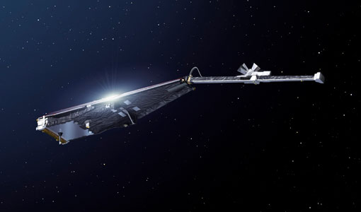
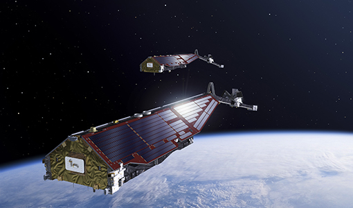
Mission - Earth Explorers
Swarm Product Data Handbook
The Swarm Product Data Handbook provides a detailed description of Level 1b and Level 2 products derived from Swarm data.