- All Categories (39)
- Data (4)
- News (9)
- Missions (1)
- Events (11)
- Tools (3)
- Activities (2)
- Documents (9)
News - Thematic area articles
Tracking the world’s forests from space
As human activities continue to threaten the planet’s forests, data delivered by satellites are boosting global efforts to conserve these crucial natural resources.
Document - General Reference
The-Changing-Earth-New-Scientific-Challenges-for-ESAs-Living-Planet-Programme.pdf
This article is extracted from ESA Bulletin Nr. 129.
Document - Proceedings
The Use and Applications of ERS in Latin America-Uso y Applicaciones de ERS en America Latina
Proceedings of the International Seminar on the use and applications of ERS in Latin America, held on 25-29 November 1996 in Vina del Mar, Chile. In English and Spanish.
Document - General Reference
The Science and Research Elements of ESA Living Planet Programme
This document presents the plans for the Earth Explorer element of the European Space Agency's 'Living Planet' Programme for Earth Observation.
Document - General Reference
Taking-natures-pulse-Europes-ERS-satellites.pdf
This brochure presents an overview of the ERS mission and its applications and benefits.
News - Data Release news
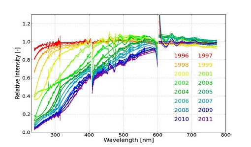
New ERS-2 GOME Level 1 v5.1 dataset available online
A new GOME Level 1b dataset has been generated for the 16-year mission period bringing relevant quality improvements for the revised calibration approach, compensating aging and instrument degradation, and provide enhanced accessibility.
Event - Conference
Living Planet Symposium 2019
ESA's Living Planet Symposia are amongst the biggest Earth observation conferences in the world. Scientists present their latest findings on Earth's environment and climate.
News - Spotlight on EO community
Introducing Mirko Albani
In this short introduction, ESA's Heritage Missions Programme Manager describes what he likes most about ESA's long term archive of satellite mission data and his role in the programme.
Document - Proceedings
Image Processing Techniques-Tecnicas de Procesamiento de Imagenes
Proceedings of the first Latino-American Seminar on Radar Remote Sensing, held on 2-4 December 1996 in Buenos Aires, Argentina. In English and Spanish.
Document - Proceedings
Image Processing Techniques
Proceedings of the second Latino-American Seminar on Radar Remote Sensing held on 11-12 September 1998 in Santos, San Paulo, Brazil.
Event - Conference
IGARSS 2019
World-class scientists, engineers and educators in geoscience and remote sensing gathered in Yokohama, Japan, for the 39th annual IGARSS symposium.
News - Thematic area articles
How satellite data help to shape society
Data from ESA’s Earth observation archives are improving understanding of the interactions between human activities and the environment, helping to power green economic development and boosting prosperity in Europe and beyond.
Tools - Apps
Heritage Missions app for iOS
Download the Heritage Missions application to discover what the missions were about, how it worked and what the elements of the space and ground segment that make these missions unique.
Tools - Apps
Heritage Missions app for Android
Download the Heritage Missions application to discover what the missions were about, how it worked and what the elements of the space and ground segment that make these missions unique.
News - Success Stories
Heritage data trains neural networks to detect urban sprawl
Using data from non-operational ESA remote sensing missions, researchers have trained a network of artificial neurons to recognise how cities change over decades. They hope this will help city planners reduce the impact that urbanisation has on the environment.
News - Thematic area articles
Global understanding of Earth's land surfaces greatly boosted by satellite data
ESA perform land surface monitoring with a range of instruments onboard satellites acquiring optical and radar data. Collections of data from these missions are freely available for research purposes.
Document - General Reference
Further-Achievements-of-the-ERS-Missions.pdf
This publication shows how with time the various uses of ERS data are developing and consolidating in key areas of science and economic exploitation.
Event - Workshop
Fringe 2003 Workshop
The third ESA International Workshop on ERS SAR Interferometry and its first Workshop on ASAR interferometry: Advances in SAR interferometry from ERS and Envisat missions.
Event - Workshop
Fringe 1996 Workshop
The workshop on ERS SAR Interferometry was open to scientists and students working in the field of Synthetic Aperture Radar (SAR) interferometry and its applications.
Tools - Other
Forestry TEP
The Forestry Thematic Exploitation Platform (TEP) enables users in the forestry sector to access satellite data based processing services and tools for generating value-added forest information products.


