- All Categories (31)
- Data (3)
- News (12)
- Missions (2)
- Tools (7)
- Campaigns (1)
- Documents (6)
Mission - Third Party Missions
SPOT 6
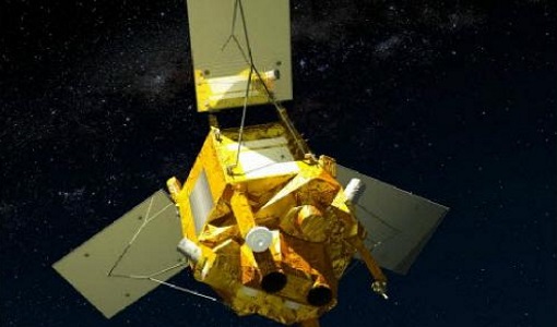
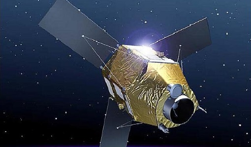
SPOT 6, like all the SPOT missions, is aimed at supplying high-resolution, wide-area optical imagery.
Mission - Heritage Missions
SPOT
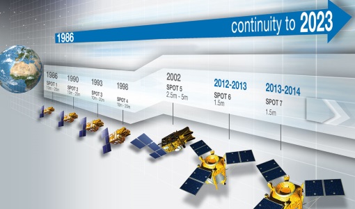
The SPOT (from French "Satellite pour l'Observation de la Terre") series of missions has been supplying high-resolution, wide-area optical imagery since 1986.
Tools - Analysis
SNAP
SNAP is a common architecture for all Sentinel Toolboxes. It is ideal for Earth observation processing and analysis.
Campaign
BACCHUS-DOC
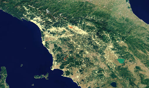
The BACCHUS-DOC Radar and Optical Campaign was an area mapping project of vineyards near Frascati (Italy). ESA required high resolution geo-referenced airborne SAR data of different wavelength and polarisation (preferably polarimetric).
Data - Campaigns (Open)
BACCHUS-DOC
The BACCHUS-DOC Radar and Optical Campaign was an area mapping project of vineyards near Frascati (Italy). ESA required high resolution geo-referenced airborne SAR data of different wavelength and polarisation (preferably polarimetric).
Tools - Analysis
Sentinel-2 Toolbox
The Toolbox consists of a rich set of visualisation, analysis and processing tools for the exploitation of optical high-resolution products including the Sentinel-2 MSI sensor.
Data - Fast Registration with approval (Restrained)
SPOT 6 and 7 ESA archive
The SPOT 6 and 7 ESA archive is a dataset of SPOT 6 and SPOT 7 products that ESA collected over the years. The dataset regularly grows as ESA collects new SPOT 6 and 7 products. SPOT 6 and 7 Primary and Ortho products can be available in the following modes: Panchromatic image at 1.5m resolution Pansharpened colour image at 1.5m resolution Multispectral image in 4 spectral bands at 6m resolution Bundle (1.5m panchromatic image + 6m multispectral image) Spatial coverage: Check the spatial coverage of the collection on a map available on the Third Party Missions Dissemination Service. As per ESA policy, very high-resolution imagery of conflict areas cannot be provided.
Tools - Visualisation
EVDC Orbit Prediction Tool
The EVDC Orbit Prediction and Overpass Tool generates and visualises satellite's overpasses.
Document - User Guide
TPM-L-OADS-dissemination-service-User-Manual.pdf
This guide describes the Third Party Missions Dissemination System.
News - General News
ESA’s Earth Observation Catalogue and its services
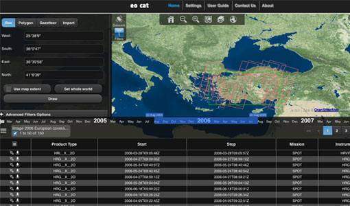
EO-CAT is the EO Catalogue tool allowing users to search ESA and Third Party Mission collections.
News - General News
ESA's new DataCube service is now available
ESA is pleased to announce the deployment of a new service, called ESA PDGS-DataCube, enabling multi-temporal and pixel-based access to a subset of the data available in the European Space Agency dissemination services.
Tools - Analysis
ESA PDGS Jupyter Notebook
A series of Jupyter Notebooks are available, in order to understand how to exploit the API that provides the data access service for different types of datasets included in the ESA PDGS datacube.
Document - Product Document
SPOT-Pleiades-data-terms-of-applicability.pdf
This document describes the terms of applicability for accessing data products from the SPOT and Pleiades missions.
News - General News
OneAtlas Living Library subscription available for SPOT and Pléiades
To complement the traditional and fully customised ordering and download of selected Pléiades and SPOT images in a variety of data formats, users can now also request a subscription for access to the OneAtlas Living Library.
Tools - Other
Geohazards TEP
The Geohazards Thematic Exploitation Platform (TEP) aims to provide Earth observation data for supporting geohazards applications.
Data - Project Proposal (Restrained)
SPOT-6 to 7 full archive and tasking
The SPOT 6 and 7 satellites ensure data continuity with the no longer operational SPOT 5 satellite and provide an archive of very high resolution optical acquisition as well as the possibility to task the satellites for new acquisitions. Following the completion of the SPOT 7 mission in March 2023, new acquisition tasking is only available for the SPOT 6 satellite. The ortho-products are automatically generated by the SPOT 6 and 7 ground segment, based on SRTM database or Reference3D when available. The projection available for SPOT 6 and 7 ortho-products is UTM, datum WGS84. Bands combinations: Pansharpened: colour image at 1.5 m resolution Bundle: 1.5 m panchromatic image and 6 m multispectral image. Geometric processing levels: Primary: The Primary product is the processing level closest to the natural image acquired by the sensor. This product restores perfect collection conditions: the sensor is placed in rectilinear geometry, and the image is clear of all radiometric distortion. Standard Ortho: The Ortho product is a georeferenced image in Earth geometry, corrected from acquisition and terrain off-nadir effects. Tailored ortho: Aside from the Standard Ortho product, when different specifications are needed, a custom orthorectification, with a more precise 3D model provided by the client or acquired for the purpose, can be provided on demand. As per ESA policy, very high-resolution imagery of conflict areas cannot be provided.
News - Infographics
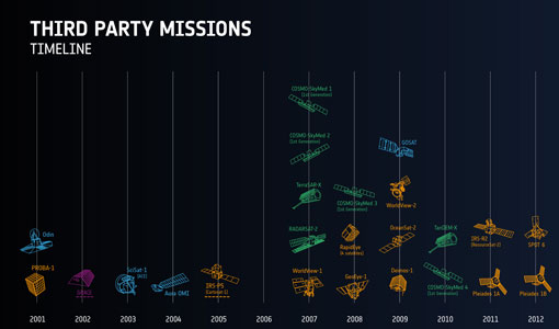
ESA Third Party Missions timeline
We've released a new timeline to illustrate the history of the ESA Third Party Missions.
News - Events and Proceedings
Φ-Week Triumphs
In its fourth edition, Φ-Week presented the scientific community with amazing opportunities and projects—thus running alongside innovation at 360 degrees.
News - Infographics
An overview of ESA's Third Party Missions programme
ESA’s Third Party Missions programme consists of almost 50 satellite missions, which are owned by organisations around the world. ESA has agreements with these organisations to acquire, process, and distribute data from their missions
