- All Categories (4336)
- Data (42)
- News (127)
- Missions (8)
- Events (38)
- Tools (14)
- Activities (12)
- Campaigns (7)
- Documents (4088)
Data - Project Proposal (Restrained)

WorldView-2 European Cities
ESA, in collaboration with European Space Imaging, has collected this WorldView-2 dataset covering the most populated areas in Europe at 40 cm resolution. The products have been acquired between July 2010 and July 2015. Spatial coverage: Check the spatial coverage of the collection on a map available on the Third Party Missions Dissemination Service.
Event - Workshop

Workshop on International Cooperation in Spaceborne Imaging Spectroscopy
The workshop aimed to recommend future international coordination permitting cooperation in the deployment, operation, and exploitation of space-based imaging spectrometers for terrestrial and coastal scientific and operational applications.
Data - EO Sign In Authentication (Open)

VT GOCE Data
This collection contains the VT GOCE software and associated data set needed to run the software that is used for GOCE data visualisation.
Event - Workshop
Volcanic Ash Monitoring - ESA/EUMETSAT Workshop
On 14 April 2010 the Icelandic volcano Eyjafjalla erupted and had been ejecting immense plumes of ash and sulphur into the atmosphere. The workshop was held in response to the emergency.
Data - Project Proposal (Restrained)
Vision-1 full archive and tasking
Vision-1 provides very high resolution optical products, with 87cm resolution in Panchromatic mode and 3.48m in Multispectral Mode. Products are in DIMAP format; the image is in GeoTiff format with 16 bit encoding; the applied geographical projection is WGS84 UTM. Spectral band combination options: Panchromatic (PAN): includes data contained within a single high resolution black and white band, with product pixel size of 0.87m Multispectral (MS4): includes four multispectral (colour) bands: Blue, Green, Red and Near Infrared. The product pixel size is 3.48m Bundle (BUN): provides both the 4-band multispectral, and the panchromatic data from the same acquisition in a single, non-merged product. Data is provided as 16-bit GeoTiffs with pixel sizes of 3.48m and 0.87m for MS and PAN data respectively Pansharpened (PSH): single higher resolution 0.87 colour product obtained by the combination of the visual coloured information of the multispectral data with the details provided in the panchromatic data. Two different geometric processing levels are: Projected (level 2): The product is mapped onto the Earth cartographic system using a standard reference datum and projection system at a constant terrestrial altitude, relative to the reference ellipsoid. By default, the map projection system is WGS84/UTM. The image is georeferenced without the application of a Digital Elevation Model (DEM) and supplied with the RPC model file. Pansharpened are not available as projected product Standard Ortho (level 3): georeferenced image in Earth geometry, including the application of a Airbus World DEM for Ortho and GCPs (using Airbus Intelligence One Atlas BaseMap as reference). The orthorectification procedure eliminates the perspective effect on the ground (excluding buildings) to restore the geometry of a vertical shot. Only the basic radiometric processing is available providing the radiance value. As per ESA policy, very high-resolution imagery of conflict areas cannot be provided.
Tools - Analysis
VirES for Swarm
VirES adds discovery and visual analytics capabilities to the European Space Agency's online data access services established for the Swarm mission.
News - Data Release news
Version 2.0 of GOCE thermosphere reprocessed data released
Version 2.0 of the GOCE thermosphere dataset is now available on the GOCE Online Dissemination Service.
Document - Product Cal/Val Plan/Report

Validation-auroral-electrojet-auroral-boundaries-estimated-from-swarm.pdf
This document provides the validation report for the Swarm Level 2 AEBS products.
Document - Software Verification Plan/Report

User Toolbox Requirements Document - GOCE User Toolbox Specifications (GUTS)
Deliverable: WP2000: This document provides user requirement for the GOCE User Toolbox, designed around the GOCE mission.
News - Data Release news
Updated Swarm EEF dataset released
An improved version of Swarm EEFxTMS_2F products (version 0203) is now available.
News - Data Release news

Updated CryoSat magnetometer data now available
An improved version of the CryoSat magnetic field data (version 0102) is now available in the "#CryoSat-2" folder of the ESA FTP server.
News - Data Release news

Updated CryoSat magnetometer data now available
An improved version of the CryoSat magnetic field data (version 0103) is now available.
News - Operational News

Update on Swarm Field-Aligned Current Dual (FAC_AC) data missing from 7 November 2021
As a follow-up of the news published on 23 November 2021, we want to update Swarm users about the missing Field-Aligned Current Dual (FAC_TMS_2F) data since 7 November 2021.
News - Operational News
Update in Swarm Orbit Counter product
Starting from 17 January 2024, a modification has been introduced in the processing of Swarm Orbit Counter product AUXxORBCNT, which extends the file coverage to 2 days ahead.
Document - General Reference

Understanding our Planet - the Earth Observation Envelope Program
This brochure describes the Earth Observation Envelope Programme.
Document - Software Verification Plan/Report
Toolbox Functionality and Algorithm Specification Document - GOCE User Toolbox Specifications (GUTS)
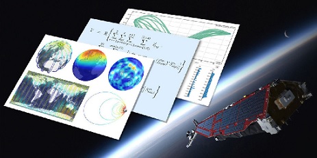
Deliverable: WP3000: This report is the output from WP3000 of the GOCE User Toolbox Specification. The study will select the best (in terms of accuracy and computational demands) algorithms to compute the variables listed in the user requirement document [1]. This document will form the basis for the system specification work performed in WP4000 and the prototype and tutorials to be generated in WP5000, all available in this library.
Document - General Reference
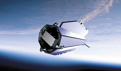
The Nine Candidate Earth Explorer Missions - Gravity Field and Steady-State Ocean Circulation Mission
This report for assessment addresses the Earth Explorer Gravity Field and Steady-State Ocean Circulation (GOCE) mission at the time when it was selected with other 9 Earth Explorer missions as potential candidate for Phase A study.
News - Infographics

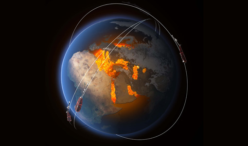
The International Charter - Providing satellite data to support disaster response worldwide
Learn about the International Charter Space and Major Disasters in this new infographic.
Document - General Reference
The Four Candidate Earth Explorer Core Missions - GOCE
The Living Planet Programme document (ESA SP-1227, available to be ordered on this Library in the General Information section) describes the plans for the Agency's new strategy for Earth Observation in the post-2000 time frame. Out of the nine Earth Explorer Core Missions identified in 1996, four Core Missions were selected for Phase-A studies, which began in 1998. In particular this is volume 1 describing in detail the Gravity Field and Steady-State Ocean Circulation Mission.
News - Operational News

Temporary interruption to Envisat AATSR dissemination service
A planned downtime will affect the access to the ftp dissemination server for the Envisat AATSR data during the period 13-15 February 2024.