- All Categories (123)
- Data (13)
- News (20)
- Missions (4)
- Events (14)
- Tools (4)
- Activities (2)
- Campaigns (2)
- Documents (64)
Document - Proceedings
2004 Envisat and ERS Symposium
The 2004 Envisat and ERS Symposium was held in Salzburg - Austria from 6 to 10 September 2004. The 2004 Envisat and ERS Symposium provided a forum for investigators to present results of ongoing research project activities and assess the development of applications and services.
Document - Proceedings
2nd ERS Applications Workshop
Proceedings of the second ERS Applications Workshop held on 6-8 December 1995 in London, United Kingdom.
Document - Proceedings
2nd International Workshop on Retrieval of Bio and Geo-physical Parameters from SAR Data for Land Applications
Proceedings of the workshop held on 21-23 October 1998 at ESA-ESTEC (Noordwijk, The Netherlands). For further information please refer to the article appeared on the Earth Observation Quarterly Nr 62 available for consultation at http://esapub.esrin.esa.it/eoq/eoq62.htm
Event - Training
3rd Advanced Training Course on Land Remote Sensing 2011
This 2011 advanced ESA training course focused on land remote sensing theory and applications.
Event - Conference
3rd ERS Symposium
The ESA Directorate for Observation of the Earth and its Environment held the 3rd ERS Symposium, in 1997, where many of the results from the ERS-1 and ERS-2 missions were presented and discussed by the scientific community.
Document - Proceedings
3rd International Symposium on Retrieval of Bio and Geophysical Parameters from SAR Data for Land Applications
Proceedings of the symposium held on 11-14 September 2001 at the University of Sheffield, UK. This Symposium provided a snapshot of where we currently stand in exploiting SAR data to understand geophysical and biophysical processes. It identified important areas for future research, in terms of specific problems and general trends: in total, 80 papers were presented on Forestry, Agriculture and Land Cover, Hazards and DTM, Soils and Hydrology, Snow and Ice, Process Modelling.
Event - Training
Advanced Training Course in Land Remote Sensing 2012
The 2012 advanced training course focused on land remote sensing theory and applications.
Event - Training
Advanced Training Course on Ocean Remote Sensing 2006
The objective of the course was to provide first-hand information on a broad range of ocean research topics including key principles of SAR, Radar Altimetry, Ocean Colour and Sea Surface Temperature measurements, processing algorithms, data products and their use in oceanographic applications.
Document - Product Document
ANNEX-A-ERS-1-ALT-RAW-Products-CCT-Format-Specification.pdf
Historical Document.This document deals with the product specification of the Altimeter Raw Data Product which provides the user with annotated, uncorrected altimeter measures, sensor parameters and sensor characteristics.
Document - Product Document
ANNEX-B-ERS-1-ALT-FDC-Products-CCT-Format-Specifications.pdf
This document deals with the product specification of the Altimeter Fast Delivery Copy. Valid for data processed up until July '95 when there was a switch from CEOS to CCSDS.
Document - Product Document
Annex-D-ERS-1-ALT-OPR-Product-CCT-Format.pdf
This product aims at providing the users with geophysically corrected altimeter measures over ocean, including all the engineering corrections and all the geophysical corrections due to the troposphere, the ionosphere and the electromagnetic bias. In addition, the surface altitude over the ellipsoid is calculated, correcting for the surface elevation due to tides and geoid.
Document - Product Document
Annex-E-ERS-1-ALT-WDR-Products-CCT-Format-Specifications.pdf
This product consists of the altimeter transcribed raw data with associated immediately available calibrations, corrections, geolocation and characterisation. This product is routinely generated on receipt of altimeter data at UK-PAF.
Data - Announcement of Opportunity (Restrained)
Announcement of Opportunity for NovaSAR-1
ESA is launching an Announcement of Opportunity for the international scientific community to access data from the NovaSAR-1 mission for science and EO-based applications development.
News - Announcement of Opportunity updates
Announcement of Opportunity for SAOCOM – deadline extended
The submission deadline for the ESA/CONAE Announcement of Opportunity for SAOCOM mission data has been extended until 31 December 2024.
Campaign
BioSAR 2008
The main objective of BioSAR-2 (BioSAR 2008) campaign was to record SAR data over boreal forests with topographic effects to investigate the effect on biomass retrieval.
Data - Campaigns (Open)
BioSAR 2008
The main objective of BioSAR-2 (BioSAR 2008) campaign was to record SAR data over boreal forests with topographic effects to investigate the effect on biomass retrieval.
Campaign
BioSAR 2010
The BioSAR-3 (BioSAR 2010) campaign was specifically planned and implemented to investigate possibilities for a future spaceborne P-band polarimetric and interferometric SAR with a life-time of multiple years.
Event - Workshop
Coastal and Marine Applications of SAR Workshop 2003
The second in the Coastal and Marine Applications of SAR Workshop series covered a range of topics on applications of synthetic aperture radar (SAR) in coastal and marine environments.
Document - Product Specifications
COSMO-SkyMed-Second-Generation-Mission-Products-Description.pdf
This document provides an overview of the COSMO-SkyMed Second Generation mission and describes its data products.
News - Success Stories
Decades of satellite data reveal the risks of climate tipping points
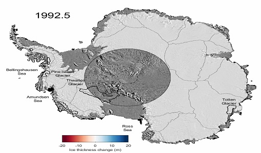
Decades-long time series that draw on ESA’s Earth observation archives are enabling scientists to uncover the threat of sudden and potentially irreversible changes to the icy parts of the planet.

