- All Categories (42)
- Data (11)
- News (11)
- Missions (2)
- Events (13)
- Tools (3)
- Documents (2)
Event - Conference
15 Years of Progress in Radar Altimetry Symposium
A Symposium on "15 Years of Progress in Radar Altimetry" and the annual meeting of the Ocean Surface Topography Science Team, the International Doris Service Workshop and the ARGO Workshop.
Event - Training
2nd Advanced Training Course on Ocean Remote Sensing 2009
This advanced training course focused on ocean remote sensing theory and applications.
Event - Conference
3rd ERS Symposium
The ESA Directorate for Observation of the Earth and its Environment held the 3rd ERS Symposium, in 1997, where many of the results from the ERS-1 and ERS-2 missions were presented and discussed by the scientific community.
Event - Training
Advanced Training Course in Ocean Remote Sensing 2011
Within the framework of the Dragon Programme, a joint collaboration between the European Space Agency (ESA) and the Chinese Ministry of Science and Technology (MOST), ESA and NRSCC are providing a series of advanced thematic training courses on remote sensing applications hosted by university and research institutions in P.R. China.
Event - Training
Advanced Training Course on Ocean Remote Sensing 2006
The objective of the course was to provide first-hand information on a broad range of ocean research topics including key principles of SAR, Radar Altimetry, Ocean Colour and Sea Surface Temperature measurements, processing algorithms, data products and their use in oceanographic applications.
News - Success Stories
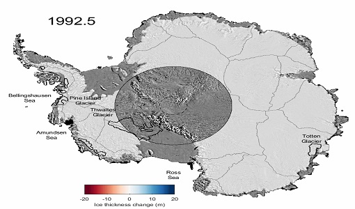
Decades of satellite data reveal the risks of climate tipping points
Decades-long time series that draw on ESA’s Earth observation archives are enabling scientists to uncover the threat of sudden and potentially irreversible changes to the icy parts of the planet.
Mission - Heritage Missions
Envisat
Envisat was ESA's successor to ERS. Envisat carried ten instruments aboard for a wide range of Earth observing fields. The mission was operational from 2002 to 2012.
Data - EO Sign In Authentication (Open)
Envisat ASAR Global Monitoring L1 [ASA_GM1_1P]
This product has been generated from Level 0 data collected when the instrument was in Global Monitoring Mode. One product covers a full orbit. The product includes slant range to ground range corrections. This strip-line product is the standard for ASAR Global Monitoring Mode. It is processed to approximately 1 km resolution using the SPECAN algorithm. The swath width is approximately 400 km. The ASAR GM L0 full mission data archive has been bulk processed to Level 1 (ASA_GM1_1P) in Envisat format with the IPF-ASAR processor Version 6.03. Spatial Resolution: 1 km ground range x 1 km azimuth.
Data - EO Sign In Authentication (Open)
Envisat ASAR IM Medium Resolution L1 [ASA_IMM_1P]
This ASAR Medium Resolution strip-line product has been generated from Level 0 data collected when the instrument was in Image Mode. This product has lower resolution but higher radiometric resolution than the ASA_IMP. It is intended to perform applications-oriented analysis on large scale phenomena and multi-temporal imaging. This product provides a continuation of the ERS-SAR Image Mode data. The ASAR IM L0 full mission data archive has been bulk processed to Level 1 (ASA_IMM_1P) in Envisat format with the IPF-ASAR processor Version 6.03. Spatial Resolution: 150 m ground range x 150 m azimuth.
Data - EO Sign In Authentication (Open)
Envisat ASAR IM Precision L1 [ASA_IMP_1P]
This is a multi-look, ground range, digital Precision Image generated from Level 0 data collected when the instrument was in Image Mode (7 possible swaths HH or VV polarisation). The product includes slant range to ground range correction. It is for users wishing to perform applications-oriented analysis and applies to multi-temporal imaging and to derive backscattering coefficients. The stand-alone image is generated using the Range/Doppler algorithm. The processing uses up to date (at time of processing) auxiliary parameters corrected for antenna elevation gain, and range spreading loss. Engineering corrections and relative calibration are applied to compensate for well-understood sources of system variability. Absolute calibration parameters, when available (depending on external calibration activities) are provided in the product annotations. This product provides a continuation of the ERS-SAR_PRI product. Spatial Resolution: 30 m ground range x 30 m azimuth.
Data - EO Sign In Authentication (Open)
Envisat ASAR IM Single Look Complex L1 [ASA_IMS_1P]
This data product represents a single-look, complex, slant-range, digital image generated from Level 0 ASAR data collected when the instrument is in Image Mode. Seven possible swaths in HH or VV polarisation are available. The product is primarily intended for use in SAR quality assessment and calibration or applications requiring complex SAR images such as interferometry, and can be used to derive higher level products. The spatial coverage is about 100 km along track per 56 - 100 km across track, and the radiometric resolution is 1 look in azimuth, 1 look in range. The file size is 741 Mbytes. It is worth highlighting that Azimuth pixel spacing depends on Earth-Satellite relative velocity and actual PRF and slant range pixel spacing is given by ASAR sampling frequency (19.208 Mhz). Auxiliary data include: Orbit state vector, Time correlation parameters, Main Processing parameters ADS, Doppler Centroid ADS, Chirp ADS, Antenna Elevation Pattern ADS, Geolocation Grid ADS, SQ ADS. Spatial Resolution: Approximately 8m slant range x approximately 4m azimuth.
Data - EO Sign In Authentication (Open)
Envisat ASAR WS Medium Resolution L1 [ASA_WSM_1P]
The strip-line product has been generated from Level 0 data collected when the instrument was in Wide Swath Mode. The product includes slant range to ground range corrections and covers a continuous area along the imaging swath. It is intended to perform application oriented analysis on large scale phenomena over a wide region and for multi-temporal imaging. This is the standard product for ASAR Wide Swath Mode. The ASAR WS L0 full mission data archive has been bulk processed to Level 1 (ASA_WSM_1P) in Envisat format with the IPF-ASAR processor Version 6.03. Spatial Resolution: 150 m slant range x 150 m azimuth.
Document - General Reference
Envisat-ASAR-science-and-applications.pdf
This document describes the technical specifications of the Envisat ASAR instrument and its operations and objectives.
Event - Training
EO Summer School 3
ESA's series of summer schools, on Monitoring of the Earth System, aims to promote the exploitation of Earth observation data.
Mission - Heritage Missions
ERS
The ERS programme was composed of two missions, ERS-1 and ERS-2, which together observed the Earth for 20 years, from 1991 to 2011.
News - Data Release news
ERS-1 Scatterometer L2 dataset processed with ASPS v10.04 is available online
The reprocessed dataset together with corresponding ERS-2 data is now available.
Data - Data Service Request (Restrained)
ERS-1/2 SAR IM L0 [SAR_IM__0P]
This SAR Level 0 product is acquired in Image Mode. The products consist of the SAR telemetry data and are supplied as standard scenes. It also contains all the required auxiliary data necessary for data processing. The product serves two main purposes: For testing ERS SAR processors independently from the HDDR system For users interested in full SAR data processing. Product characteristics: Scene area: 100 km (range - across track) x full segment length (azimuth - along track) Scene size: 5616 samples (range) x full segment length (azimuth) Pixel depth: 10 bits signed integer (5 bits I, 5 bits Q) Projection: Slant range.
Data - EO Sign In Authentication (Open)
ERS-1/2 SAR IM Medium Resolution L1 [SAR_IMM_1P]
This ERS Medium Resolution stripline product is generated from the Image Mode Level 0 Product. Stripline image products contain image data for an entire segment, up to a maximum size of 10 minutes per product for IM mode. The processor concatenates together several sub-images called "slices" that were processed separately on a dataset-by-dataset basis in order to form the entire stripline image. The product is processed to an approximately 150 m x 150 m resolution and has a radiometric resolution that is good enough for ice applications. This product has a lower spatial resolution than the SAR_IMP_1P and SAR_IMS_1P products. Product Characteristics: Pixel size: 5 m (ground range – across track) x 75 m (azimuth – along track) Scene area: 100 km (range) x at least 102.5 km Scene Size: 1300 pixels (range) x at least 1350 lines (azimuth) Pixel depth: 16 bits unsigned integer- Total product volume: at least 3.5 MB Projection: Ground-range Number of looks: 8 (azimuth) x 7 (range).
Data - EO Sign In Authentication (Open)
ERS-1/2 SAR IM Precision L1 [SAR_IMP_1P]
The SAR Precision product is a multi-look (speckle-reduced), ground range image acquired in Image Mode. This product type is most applicable to users interested in remote sensing applications, but is also suitable for calibration purposes. The products are calibrated and corrected for the SAR antenna pattern and range-spreading loss. Radar backscatter can be derived from the products for geophysical modelling, but no correction is applied for terrain-induced radiometric effects. The images are not geocoded, and terrain distortion (foreshortening and layover) has not been removed. The numbering sequence relates to the satellite position and therefore differs between Ascending and Descending scenes. Product characteristics: Pixel size: 12.5 m (range - across track) x 12.5 m (azimuth - along track) Scene area: 100 km (range) x at least 102.5 km (azimuth) Scene size: 8000 pixels range x at least 8200 lines (azimuth) Pixel depth: 16 bits unsigned integer Total product volume: 125 MB Projection: Ground-range Number of looks: 3.
Data - EO Sign In Authentication (Open)
ERS-1/2 SAR IM Single Look Complex L1 [SAR_IMS_1P]
The SAR SLC product is a single look complex acquired in Image Mode. It is a digital image, with slant range and phase preserved, generated from raw SAR data using up-to-date auxiliary parameters. The products are intended for use in SAR quality assessment, calibration and interferometric applications. A minimum number of corrections and interpolations are performed on the data. Absolute calibration parameters (when available) are provided in the product annotation. Product characteristics: Pixel size: 8 m (range - across track) x 4 m (azimuth - along track – varying slightly depending on acquisition Pulse Repetition Frequency) Scene area: 100 km (range) x at least 102.5 km (azimuth) Scene size: 5000 samples (range) x at least 30000 lines (azimuth) Pixel depth: 32 bits signed integer (16 bits I, 16 bits Q) Total product volume: 575 MB Projection: Slant range- Number of looks: 1.


