- All Categories (99)
- Data (34)
- News (27)
- Missions (9)
- Events (20)
- Tools (1)
- Activities (2)
- Campaigns (6)
News - Data Release news
FDR4ALT - ESA unveils new cutting-edge ERS/Envisat Altimeter and Microwave Radiometer Datasets
The European Space Agency (ESA) has developed a comprehensive suite of innovative Earth system data records as part of the Fundamental Data Records for Altimetry project - FDR4ALT.
Data - Sample Data (Open)
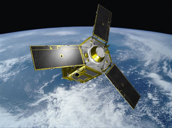
GEOSAT-1 sample data
Download free GEOSAT-1 sample datasets to preview products available for this mission.
News - Events and Proceedings
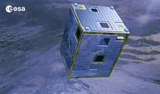
Celebrating ESA’s first small satellite with science success
Scientists and data users gathered at a special workshop to celebrate the end of PROBA-1’s CHRIS sensor and discuss the results of this overachieving mission.
News - Operational News
Temporary interruption to Envisat AATSR dissemination service
A planned downtime will affect the access to the ftp dissemination server for the Envisat AATSR data during the period 13-15 February 2024.
News - Thematic area articles
Space data support Earth’s ecosystems
ESA’s Earth observation (EO) missions are making a critical contribution to monitoring transformations in our planet’s ecosystems, helping track changes in the vegetation, soil, and ocean that affect these systems.
News - Events and Proceedings
Setting the standard for drone-based validation of satellite data
The ESA-supported Surface Reflectance Intercomparison eXercise for Vegetation (SRIX4Veg) – which began in 2022 – is working to put forward good-practice procedures agreed through a series of workshops and a dedicated UAV campaign.
Data - Fast Registration with approval (Restrained)
GEOSAT-2 Spain Coverage
The GEOSAT-2 Spain Coverage collection consists of two separate coverages of Spain, including the Balearic and Canary islands, acquired by GEOSAT-2 between March and November of 2021 and 2022, respectively. The available imagery have a geolocation accuracy of < 4 m RMSE, a cloud cover percentage of < 10 %, and were acquired at an off-nadir angle from -30° to 30°. Spatial coverage of the 2021 collection. The following product types are available: Pan-sharpened: A four-band image, resulting from adding the information of each multispectral band to the panchromatic band. The fusion does not preserves all spectral features of the multispectral bands, so it should not be used for radiometric purposes. Resolution 1 m; Bands: All. Bundle: Panchromatic (1 m resolution) + Multispectral bands (4 m resolution): five-band image containing the panchromatic and multispectral products packaged together, with band co-registration. The available processing level is L1C orthorectified: a calibrated and radiometrically corrected product, manually orthorectified and resampled to a map grid. Property Spatial Resolution Pan-sharpened 1.0 m Bundle (PAN + MS) 1.0 m (PAN), 4.0 m (MS)
Event - Workshop
PROBA-1 CHRIS End of Mission Workshop
The PROBA-1 CHRIS End of Mission Workshop will take place from 18-19 January 2024 in Ghent, Belgium.
News - Thematic area articles
Tracking the world’s forests from space
As human activities continue to threaten the planet’s forests, data delivered by satellites are boosting global efforts to conserve these crucial natural resources.
News - Success Stories
Commercial and international data for fire monitoring
As climate change sparks a surge in the frequency and intensity of wildfires, satellite data disseminated through ESA’s Third Party Missions (TPM) programme are helping scientists to track and investigate these potentially damaging natural events.
News - Infographics
Focusing on Envisat MERIS Full Resolution Level-2 data
ESA's Envisat mission continued and expanded upon the legacy of its predecessors, the ERS (European Remote Sensing) satellites. Operating between 2002 and 2012, the satellite's 10 instruments acquired a decade of data for many applications.
News - Spotlight on EO community
Introducing the Biomass and SMOS Mission Manager
In this video, Klaus Scipal describes his role as Mission Manager of Biomass and SMOS, and what he enjoys about his involvement with these dedicated science missions.
News - Thematic area articles
Remote sensing data map impacts of natural hazards
As climate change increases the frequency and severity of natural disasters, remote sensing data can warn about extreme events and help tackle emergency situations.
Data - Fast Registration with immediate access (Open)
FSSCat products
The FSSCat collection provides hyperspectral data coverage over a number of locations around the world, as measured by the HyperScout 2 sensor. The FSSCat hyperspectral data products are comprised of 50 spectral bands, covering a spectral range of 450 – 950 nm with a spectral resolution of 18 nm (at FWHM). Imagery is available with an along-track ground sampling distance (GSD) of 75 m. To ensure a high degree of radiometric accuracy, HyperScout 2 data are validated through comparison with Sentinel-2 data products. The processing level of the data is L1C – calibrated top-of-atmosphere radiance, reflectance or brightness temperature. The raster type of the L1C data product is a GRID – a 2D or 3D raster where the (geo)location of the data is uniquely defined by the upper left pixel location of the raster and the pixel size of the raster, and the projection parameters of the raster (if georeferenced). The third dimension can e.g. be a spectral or third spatial dimension. The L-1C VNIR data product includes a hyperspectral cube of TOA reflectance in the VNIR range, as well as relevant meta-data that adheres to EDAP's best practice guidelines. This product consists of georeferenced and ortho-rectified image tiles that contain spectral reflectance data at the top-of-the-atmosphere. Each image tile contains radiometrically corrected and ortho-rectified band images that are projected onto a map, as well as geolocation information and the coordinate system used. Additionally, each image pixel provides TOA spectral reflectance data in scaled integers, conversion coefficients for spectral radiance units, viewing and solar zenith and azimuth angles, and quality flags.
News - Data Release news
New data available: GEOSAT-2 Portugal Coverage 2021
A new collection is available to the public through ESA’s Earthnet Third Party Missions Programme: the GEOSAT-2 Portugal Coverage 2021.
News - Data Release news
New BorealScat campaign dataset released
A new dataset has been released for the BorealScat campaign, which took place between 2017 and 2021 in Sweden.
News - Success Stories
Pléiades unlocks information about rock glaciers in central Himalaya
As climate change accelerates the melting of glacial ice, remote sensing scientists are tapping into the potential of Pléiades data to help vulnerable mountainous communities.
News - Thematic area articles
Global understanding of Earth's land surfaces greatly boosted by satellite data
ESA perform land surface monitoring with a range of instruments onboard satellites acquiring optical and radar data. Collections of data from these missions are freely available for research purposes.
News - Success Stories
New worldwide dataset captures the planet in fine detail
Scientists have developed an open source planetwide dataset of high-resolution Earth observation imagery, thanks to commercial data delivered by ESA’s Third Party Missions (TPM) programme.
Event - Training
EO Summer School 5
ESA's series of summer schools, on Monitoring of the Earth System, aims to promote the exploitation of Earth observation data.


