- All Categories (704)
- Data (5)
- News (10)
- Missions (7)
- Events (7)
- Tools (7)
- Activities (6)
- Campaigns (3)
- Documents (659)
Mission - Third Party Missions
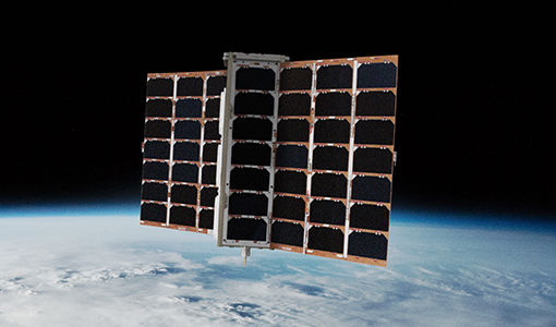
FSSCat
The FSSCat mission was an innovative concept that consisted of two federated 6-Unit Cubesats, called ³Cat-5/A and ³Cat-5/B, which operated in support of the Copernicus Land and Marine Environment services.
Activity - General activities
EO Summer Schools
ESA's series of summer schools, on Monitoring of the Earth System, aims to promote the exploitation of Earth observation (EO) data.
News - Thematic area articles

Transforming space data into climate action
ESA’s Earth observation activities are playing a key role in the revitalised global drive to combat climate change.
News - Data Release news

SMOS L2 Sea Surface Salinity products documentation updates
SMOS L2 Sea Surface Salinity product validation report is now available.
News - General News

Updated SMOS documentation available
Updated versions of several SMOS data documents are now available.
Event - Training

2nd Advanced Training Course on Ocean Remote Sensing 2009
This advanced training course focused on ocean remote sensing theory and applications.
News - Data Release news

New reprocessing of datasets celebrates 30 years of ERS
The ERS programme celebrated its 30th anniversary on 17 July. Today, we are still exploiting ERS data and experts continue to work on improving the altimeter, radiometer and SAR data the programme acquired.
Tools - Apps

Heritage Missions app for iOS
Download the Heritage Missions application to discover what the missions were about, how it worked and what the elements of the space and ground segment that make these missions unique.
Tools - Apps

Heritage Missions app for Android
Download the Heritage Missions application to discover what the missions were about, how it worked and what the elements of the space and ground segment that make these missions unique.
News - Data Release news

New ERS-2 GOME Level 1 v5.1 dataset available online
A new GOME Level 1b dataset has been generated for the 16-year mission period bringing relevant quality improvements for the revised calibration approach, compensating aging and instrument degradation, and provide enhanced accessibility.
Document - Product Document

ENVISAT_AATSR_consolidated_Level-0_dataset_completeness.pdf
This document reports on the completeness of the AATSR consolidated Level 0 dataset. The analysis was performed by IDEAS and includes recommendations for building a clean and complete consolidated Level 0 dataset for reprocessing campaigns
News - Data Release news
Spire data now open to users
Following the submission of a project proposal, data from the Spire mission are now available.
Data - Data Service Request (Restrained)
ERS-1/2 SAR IM L0 [SAR_IM__0P]
This SAR Level 0 product is acquired in Image Mode. The products consist of the SAR telemetry data and are supplied as standard scenes. It also contains all the required auxiliary data necessary for data processing. The product serves two main purposes: For testing ERS SAR processors independently from the HDDR system For users interested in full SAR data processing. Product characteristics: Scene area: 100 km (range - across track) x full segment length (azimuth - along track) Scene size: 5616 samples (range) x full segment length (azimuth) Pixel depth: 10 bits signed integer (5 bits I, 5 bits Q) Projection: Slant range.
Data - EO Sign In Authentication (Open)
ERS-1/2 SAR IM Medium Resolution L1 [SAR_IMM_1P]
This ERS Medium Resolution stripline product is generated from the Image Mode Level 0 Product. Stripline image products contain image data for an entire segment, up to a maximum size of 10 minutes per product for IM mode. The processor concatenates together several sub-images called "slices" that were processed separately on a dataset-by-dataset basis in order to form the entire stripline image. The product is processed to an approximately 150 m x 150 m resolution and has a radiometric resolution that is good enough for ice applications. This product has a lower spatial resolution than the SAR_IMP_1P and SAR_IMS_1P products. Product Characteristics: Pixel size: 5 m (ground range – across track) x 75 m (azimuth – along track) Scene area: 100 km (range) x at least 102.5 km Scene Size: 1300 pixels (range) x at least 1350 lines (azimuth) Pixel depth: 16 bits unsigned integer- Total product volume: at least 3.5 MB Projection: Ground-range Number of looks: 8 (azimuth) x 7 (range).
Data - EO Sign In Authentication (Open)
ERS-1/2 SAR IM Single Look Complex L1 [SAR_IMS_1P]
The SAR SLC product is a single look complex acquired in Image Mode. It is a digital image, with slant range and phase preserved, generated from raw SAR data using up-to-date auxiliary parameters. The products are intended for use in SAR quality assessment, calibration and interferometric applications. A minimum number of corrections and interpolations are performed on the data. Absolute calibration parameters (when available) are provided in the product annotation. Product characteristics: Pixel size: 8 m (range - across track) x 4 m (azimuth - along track – varying slightly depending on acquisition Pulse Repetition Frequency) Scene area: 100 km (range) x at least 102.5 km (azimuth) Scene size: 5000 samples (range) x at least 30000 lines (azimuth) Pixel depth: 32 bits signed integer (16 bits I, 16 bits Q) Total product volume: 575 MB Projection: Slant range- Number of looks: 1.
Data - EO Sign In Authentication (Open)
ERS-1/2 SAR IM Precision L1 [SAR_IMP_1P]
The SAR Precision product is a multi-look (speckle-reduced), ground range image acquired in Image Mode. This product type is most applicable to users interested in remote sensing applications, but is also suitable for calibration purposes. The products are calibrated and corrected for the SAR antenna pattern and range-spreading loss. Radar backscatter can be derived from the products for geophysical modelling, but no correction is applied for terrain-induced radiometric effects. The images are not geocoded, and terrain distortion (foreshortening and layover) has not been removed. The numbering sequence relates to the satellite position and therefore differs between Ascending and Descending scenes. Product characteristics: Pixel size: 12.5 m (range - across track) x 12.5 m (azimuth - along track) Scene area: 100 km (range) x at least 102.5 km (azimuth) Scene size: 8000 pixels range x at least 8200 lines (azimuth) Pixel depth: 16 bits unsigned integer Total product volume: 125 MB Projection: Ground-range Number of looks: 3.
Mission - Earth Explorers

SMOS
The Soil Moisture and Ocean Salinity (SMOS) mission is dedicated to making global observations of soil moisture over land and salinity over oceans.
Mission - Third Party Missions

PROBA-1
PROBA-1 is a technology demonstration satellite that later became an operational Earth observation mission.
Mission - Heritage Missions

Envisat
Envisat was ESA's successor to ERS. Envisat carried ten instruments aboard for a wide range of Earth observing fields. The mission was operational from 2002 to 2012.