- All Categories (14)
- News (4)
- Missions (1)
- Events (4)
- Tools (2)
- Activities (2)
- Documents (1)
Event - Conference
3rd ERS Symposium
The ESA Directorate for Observation of the Earth and its Environment held the 3rd ERS Symposium, in 1997, where many of the results from the ERS-1 and ERS-2 missions were presented and discussed by the scientific community.
Event - Training
Advanced Training Course in Land Remote Sensing 2012
The 2012 advanced training course focused on land remote sensing theory and applications.
Event - Workshop
CEOS-IVOS Workshop on Inter-comparison of Large Scale Optical and Infrared Sensors
The 2004 workshop was an opportunity to present and exchange experiences and knowledge from work on inter-comparing large scale optical sensors at different product levels.
Activity - Projects
Dragon 2 Cooperation Programme
The Dragon 2 Programme focussed on the exploitation of ESA, ESA's Third Party Missions and Chinese Earth observation data for science and applications development in land, ocean and atmospheric applications.
News - Infographics
ERS - ESA’s first Earth observation satellites
To mark the 30th anniversary of ERS, we've released a new infographic summarising the mission.
Document - Product Document
ERS-1-WSC-FDC-Product-CCT-Format.pdf
This document deals with the Product Specifications for the WSC Fast delivery copy. Valid for data processed up until end of July '95 when there was a switch in format from CEOS to CCSDS.
Tools - Other
Forestry TEP
The Forestry Thematic Exploitation Platform (TEP) enables users in the forestry sector to access satellite data based processing services and tools for generating value-added forest information products.
Event - Workshop
Fringe 2003 Workshop
The third ESA International Workshop on ERS SAR Interferometry and its first Workshop on ASAR interferometry: Advances in SAR interferometry from ERS and Envisat missions.
News - Data Release news
Full European Landsat data collection now available under the same catalogue
The Full European Landsat data collection, from Landsat-1 to Landsat-8, is now available under the same catalogue
Tools - Apps
Heritage Missions app for Android
Download the Heritage Missions application to discover what the missions were about, how it worked and what the elements of the space and ground segment that make these missions unique.
News - Spotlight on EO community
Interviewing Mirko Albani
ESA’s Heritage Space Programme Manager describes the goals of the programme, some of the challenges involved in preserving and improving 40 years of historical Earth observation data, and his passion for curating this long-term archive.
Mission - Heritage Missions
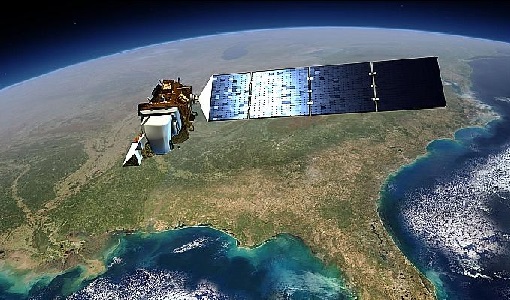
Landsat Series
The Landsat Series is the world's longest running system of satellites for moderate-resolution optical remote sensing for land, coastal areas and shallow waters.
News - Data Release news
New reprocessed Landsat data on a new dissemination server
The full ESA Landsat archive has been reprocessed with the latest version of the processor to provide a homogenous dataset covering MSS, TM and ETM+ data.
Activity - Quality
SLAP
The SLAP (Systematic Landsat Archive Processing) project covers the MSS, TM and ETM+ products from Landsat missions 1 – 7, and is the first systematic reprocessing of the ESA Landsat archive.


