- All Categories (15)
- News (7)
- Missions (1)
- Events (6)
- Tools (1)
News - Success Stories
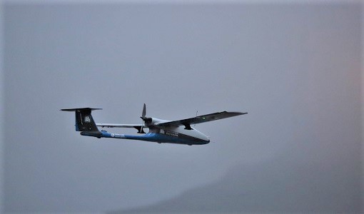
Drones join the campaign to validate Aeolus data
In June and September 2022, the Askos component of the Joint Aeolus Tropical Atlantic Campaign (JATAC), organised by ESA and its international partners, was expanded with new ground-based, drone and radiosonde measurements. The main objective of this campaign was to calibrate and validate Aeolus satellite observations.
Event - Training
EO Summer School 3
ESA's series of summer schools, on Monitoring of the Earth System, aims to promote the exploitation of Earth observation data.
News - Thematic area articles
Space data help to unravel the complexities of Earth’s atmosphere
As the impacts of the climate crisis intensify, scientists are using ESA’s Earth observation archives to investigate atmospheric processes and their influences on the planet’s changing environment.
News - Events and Proceedings
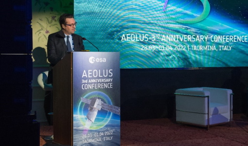
Exploring the prevailing achievements and future directions of Aeolus
A tight-knit community of European remote sensing experts converged on the Italian island of Sicily last month to discuss how the strong success of ESA’s Aeolus mission is shaping scientists’ understanding of the winds that sweep across the planet.
News - Thematic area articles
Satellite data central to ocean monitoring
Over 95% of Earth’s water is found in our oceans, and yet sadly, oceans are under stress from climate change and pollution. Monitoring our oceans is vital for Earth’s survival and satellites are the primary means of long-term and independent observation of our vast ocean bodies and their associated coastal zones.
Tools - Processing
Aeolus VRE
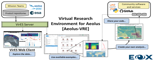
The Aeolus Virtual Research Environment (VRE) is the latest extension to the VirES for Aeolus service, which offers more direct and in-depth data exploitation of the Aeolus mission. The VRE is a cloud service that provides a web-based development environment in the form of a JupyterLab workspace.
News - General News
Launch of Aeolus VRE
The Aeolus Virtual Research Environment (VRE) is a cloud service, which provides users with a web-based development environment in the form of a JupyterLab workspace.
News - Success Stories
Dust aerosol campaign validates Aeolus data
Prepared, implemented and executed by a consortium of French universities and research institutions, under the umbrella of the French Space Agency (CNES) and the French National Centre for Scientific Research (CNRS), the Clouds-Atmospheric Dynamics–Dust Interactions in West Africa (CADDIWA) campaign took place on Sal Island in Cape Verde, from 6 to 25 September 2021.
Event - Workshop
SEASAR 2008
The "Advances in SAR Oceanography from Envisat and ERS missions" was a thematic workshop on SAR remote sensing techniques for oceanography.
Event - Training
2nd Advanced Training Course on Ocean Remote Sensing 2009
This advanced training course focused on ocean remote sensing theory and applications.
News - Success Stories
COVID-19: Aeolus and weather forecasts
The drop in commercial flights has led to fewer measurements for weather forecasts, but fortunately, ESA’s Aeolus satellite mission is helping to fill the gap.
Mission - Earth Explorers
Aeolus
The Aeolus mission which was launched into space on 22 August 2018 and was retired on 30 April 2023, provided global observations of wind profiles from space to improve the quality of weather forecasts, and to advance our understanding of atmospheric dynamics and climate processes.
Event - Conference
15 Years of Progress in Radar Altimetry Symposium
A Symposium on "15 Years of Progress in Radar Altimetry" and the annual meeting of the Ocean Surface Topography Science Team, the International Doris Service Workshop and the ARGO Workshop.
Event - Workshop
Applications of the ERS Along Track Scanning Radiometer Workshop 1999
The workshop on ERS mission's Along Track Scanning Radiometer (ATSR) instrument gathered researchers and specialists working on different applications of the mission.
Event - Conference
3rd ERS Symposium
The ESA Directorate for Observation of the Earth and its Environment held the 3rd ERS Symposium, in 1997, where many of the results from the ERS-1 and ERS-2 missions were presented and discussed by the scientific community.


