- All Categories (396)
- Data (1)
- News (7)
- Missions (1)
- Events (5)
- Tools (2)
- Activities (2)
- Documents (378)
Document - Proceedings
2004 Envisat and ERS Symposium
The 2004 Envisat and ERS Symposium was held in Salzburg - Austria from 6 to 10 September 2004. The 2004 Envisat and ERS Symposium provided a forum for investigators to present results of ongoing research project activities and assess the development of applications and services.
Document - General Reference
2007 Dragon Symposium - Abstract book
The Dragon Programme concerns the exploitation of BSA and Chinese BO data particularly from the ERS and Envisat satellites for monitoring and mapping applications in 16 thematic application areas in the P.R. China. The abstracts presented herein detail the results achieved since the Lijiang Symposium that was held in July 2006 in P.R. China.
Document - General Reference
2013 Dragon 3 Brochure
The 2013 Dragon 3 cooperation brochure presents the activities undertaken since the formal start of programme in June 2012.
Event - Training
2nd Advanced Training Course on Ocean Remote Sensing 2009
This advanced training course focused on ocean remote sensing theory and applications.
Document - Proceedings
2nd-Conference-on-Academic-and-Industrial-Cooperation-in-Space-Research.pdf
This document describes the proceedings of the second conference on academic and industrial cooperation in space research, held in Graz, Austria, 15-17 November 2000.
Event - Training
Advanced Training Course in Ocean Remote Sensing 2011
Within the framework of the Dragon Programme, a joint collaboration between the European Space Agency (ESA) and the Chinese Ministry of Science and Technology (MOST), ESA and NRSCC are providing a series of advanced thematic training courses on remote sensing applications hosted by university and research institutions in P.R. China.
Event - Workshop
CEOS-IVOS Workshop on Inter-comparison of Large Scale Optical and Infrared Sensors
The 2004 workshop was an opportunity to present and exchange experiences and knowledge from work on inter-comparing large scale optical sensors at different product levels.
News - Events and Proceedings
Data preservation takes centre stage at Living Planet Symposium
Against the backdrop of the famed Rhine River, world-class scientists and Earth observation data-users are gathered this week in the historical city of Bonn, at the Living Planet Symposium (LPS).
Activity - Projects
Dragon 2 Cooperation Programme
The Dragon 2 Programme focussed on the exploitation of ESA, ESA's Third Party Missions and Chinese Earth observation data for science and applications development in land, ocean and atmospheric applications.
Document - General Reference
Dragon Programme - Brochure 2006
The Dragon Programme focuses on science and applications development in P.R. China exploiting mainly data from ESA ERS and Envisat missions. This brochure describes the programme, projects and partners.
Document - General Reference
Earth-from-Space-Middle-East.pdf
This brochure is a collection of ENVISAT ASAR and MERIS, PROBA, ERS-2, Landsat mosaics.
Document - General Reference
Earth-from-Space-North-America.pdf
This brochure is a collection of Envisat MERIS, Envisat ASAR, Envisat AATSR, ERS, Proba and SPOT mosaics of North America.
Document - General Reference
Earth-from-Space-Oceans-and-Coastal-Zone.pdf
This brochure is a collection of ERS-2 SAR; ENVISAT ASAR, MERIS, AATSR; Landsat TM and Proba CHRIS mosaics.
Event - Training
EO Summer School 3
ESA's series of summer schools, on Monitoring of the Earth System, aims to promote the exploitation of Earth observation data.
Event - Training
EO Summer School 5
ESA's series of summer schools, on Monitoring of the Earth System, aims to promote the exploitation of Earth observation data.
Mission - Heritage Missions
ERS
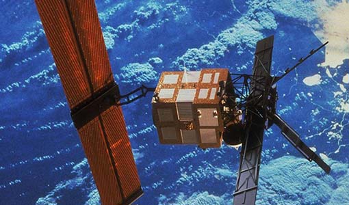
The ERS programme was composed of two missions, ERS-1 and ERS-2, which together observed the Earth for 20 years, from 1991 to 2011.
News - Data Release news
ERS-1 Scatterometer L2 dataset processed with ASPS v10.04 is available online
The reprocessed dataset together with corresponding ERS-2 data is now available.
Data - Fast Registration with immediate access (Open)
ERS-1/2 SCATTEROMETER Ocean Wind field and Sea Ice probability [ASPS20.H/ASPS20.N]
The ASPS Level 2 products contain, for each node: the radar backscattering sigma nought for the three beams of the instrument, the four aliased wind solutions (Rank 1-4 wind vector) and the de-aliased wind vector flag, the sea-ice probability and sea-ice flag, the YAW quality flag. The wind retrieval is performed with the CMOD5N geophysical model function derived by ECMWF to compute the neutral winds rather than 10 m winds. ASPS L2.0 High resolution products are provided with a spatial resolution of 25x25 km and a grid spacing of 12.5 km. ASPS L2.0 Nominal resolution products are provided with a spatial resolution of 50x50 km and a grid spacing of 25 km. One product covers one orbit from ascending node crossing. Please consult the Product Quality Readme file before using the ERS ASPS data.
Document - Quality Report
ERS-2 AMI-SAR/AMI-Scatterometer Weekly Report 01 Aug 2003
ERS-2 AMI-SAR/AMI-Scatterometer Weekly Report
Document - Quality Report
ERS-2 AMI-SAR/AMI-Scatterometer Weekly Report 01 Aug 2004
ERS-2 AMI-SAR/AMI-Scatterometer Weekly Report


