- All Categories (95)
- Data (7)
- News (24)
- Missions (2)
- Events (16)
- Tools (5)
- Activities (1)
- Campaigns (1)
- Documents (39)
Data - Sample Data (Open)
TerraSAR-X Sample Data
Download free TerraSAR-X sample datasets to preview products available for this mission.
Document - Newsletter
Earth Online Newsletter - 22 March 2024
This issue of the Earth Online Newsletter covers a selection of the latest news and events from ESA.
News - Infographics
Explore sample data products from Third Party Missions
ESA’s Third Party Missions programme consists of over 50 satellite missions from commercial and public organisations worldwide.
Data - Sample Data (Open)
IRS-P5 (Cartosat-1) Sample Data
Download free IRS-P5 (Cartosat-1) sample datasets to preview products available for this mission.
News - Data Release news
Sample data products from ESA’s Third Party Missions
Samples of data products from a range of Third Party Missions are now available to download, offering a preview of what these missions provide.
News - Thematic area articles
How to use space data to probe humankind’s ancient past
Data disseminated by ESA’s Third Party Missions (TPM) programme are enabling archaeological investigations that could help to unravel the mysteries of past societies and cultures.
News - Success Stories
Commercial and international data for fire monitoring
As climate change sparks a surge in the frequency and intensity of wildfires, satellite data disseminated through ESA’s Third Party Missions (TPM) programme are helping scientists to track and investigate these potentially damaging natural events.
News - Data Release news
European Cities: Cartosat-1 Euro-Maps 3D DSMs and Ortho Images
ESA is pleased to announce that the Cartosat-1 Euro-Maps 3D Digital Surface Model (DSM) and ortho image products collection on European cities has been opened to users in the framework of Earthnet’s Third Party Mission Programme.
News - Infographics
Twin satellites - TerraSAR-X and TanDEM-X
DLR's TerraSAR-X and TanDEM-X are twin satellites flying in close formation to acquire SAR data of unique geometric accuracy. Operating together, the missions deliver data that are used to generate Digital Elevation Models of Earth.
News - Thematic area articles
How scientists use space data to help advance the energy transition
Scientists are using remote sensing data disseminated by ESA to support the green transformation of world’s power generation infrastructure.
News - General News
International collaboration: Summarising ESA’s Third Party Missions
ESA’s Third Party Missions programme consists of more than 50 missions from around the world. Learn more about the Third Party Missions in this video.
Data - Fast Registration with approval (Restrained)
European Cities: Cartosat-1 Euro-Maps 3D
A large number of European cities are covered by this dataset; for each city you can find one or more Cartosat-1 ortho image products and one or more Euro-Maps 3D DSM tiles clipped to the extent of the ortho coverage. The Euro-Maps 3D DSM is a homogeneous, 5 m spaced Digital Surface Model semi-automatically derived from 2.5 m Cartosat-1 in-flight stereo data with a vertical accuracy of 10 m. The very detailed and accurate representation of the surface is achieved by using a sophisticated and well adapted algorithm implemented on the basis of the Semi-Global Matching approach. The final product includes several pixel-based quality and traceability layers: The dsm layer (*_dsm.tif) contains the elevation heights as a geocoded raster file The source layer (*_src.tif) contains information about the data source for each height value/pixel The number layer (*_num.tif) contains for each height value/pixel the number of IRS-P5 Cartosat-1 stereo pairs used for the generation of the DEM The quality layer (*_qc.tif) is set to 1 for each height/pixel value derived from IRS-P5 Cartosat-1 data and which meets or exceeds the product specifications The accuracy vertical layer (*_acv.tif) contains the absolute vertical accuracy for each quality controlled height value/pixel. The ortho image is a Panchromatic image at 2.5 m resolution. The following table defines the offered product types. EO-SIP product type Description PAN_PAM_3O IRS-P5 Cartosat-1 ortho image DSM_DEM_3D IRS-P5 Cartosat-1 DSM
News - Success Stories
Showcasing success stories from ESA's Third Party Missions
ESA’s Third Party Missions programme consists of more than 50 missions from around the world.
News - Thematic area articles
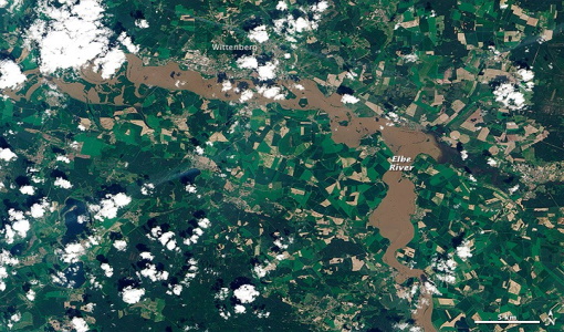
Global understanding of Earth's land surfaces greatly boosted by satellite data
ESA perform land surface monitoring with a range of instruments onboard satellites acquiring optical and radar data. Collections of data from these missions are freely available for research purposes.
News - Success Stories
Long-term satellite data show wind farms can affect local air currents
Decades of satellite data have allowed for the first long-term study of the impact of offshore wind farms on downstream wind flow in coastal areas.
Document - Data Access Information
ESA-archive-third-party-mission-collections.pdf
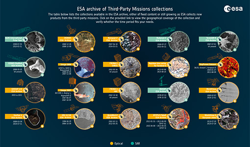
Discover the ESA archive data collections offered for the Third Party Missions programme.
News - Infographics
A summary of ESA Third Party Mission collections
A new summary is available, showcasing the ESA archives for Third Party Mission collections.
News - Events and Proceedings
National missions in the spotlight at the Living Planet Symposium
In the framework of ESA’s Third Party Missions (TPM) programme, the agency offers access to the full data archives of almost 50 satellite missions, which are owned by organisations around the world.
Document - General Reference
Third Party Missions Brochure
This brochure summarises ESA's Third Party Missions programme, providing a timeline and examples of content related to some of the missions.
News - Thematic area articles
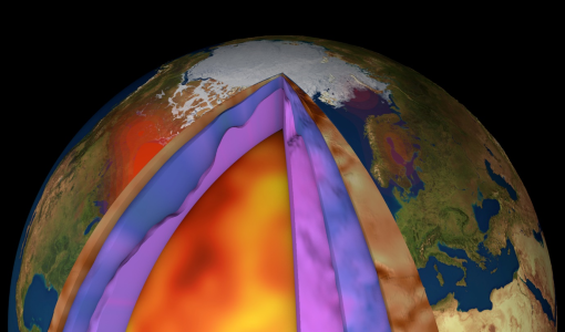
How ESA uses space data to explore deep Earth
As anthropogenic activities continue to unbalance our environment, scientists strive to fully understand the intricate interactions within Earth’s system.


