- News & Events
- European Cities: Cartosat-1 Eu...
European Cities: Cartosat-1 Euro-Maps 3D DSMs and Ortho Images
23 Feb 2023
ESA is pleased to announce that the Cartosat-1 Euro-Maps 3D Digital Surface Model (DSM) and ortho image products collection on European cities has been opened to users in the framework of Earthnet’s Third Party Mission Programme.
IRS-P5 (also known as Cartosat-1) was an Indian Earth-imaging satellite that was launched on 5 May 2005 and ended operations on 5 May 2019, with the primary objective of providing high-resolution panchromatic imagery and stereoscopic imagery with high pointing accuracies for geo-engineering (mapping) applications.
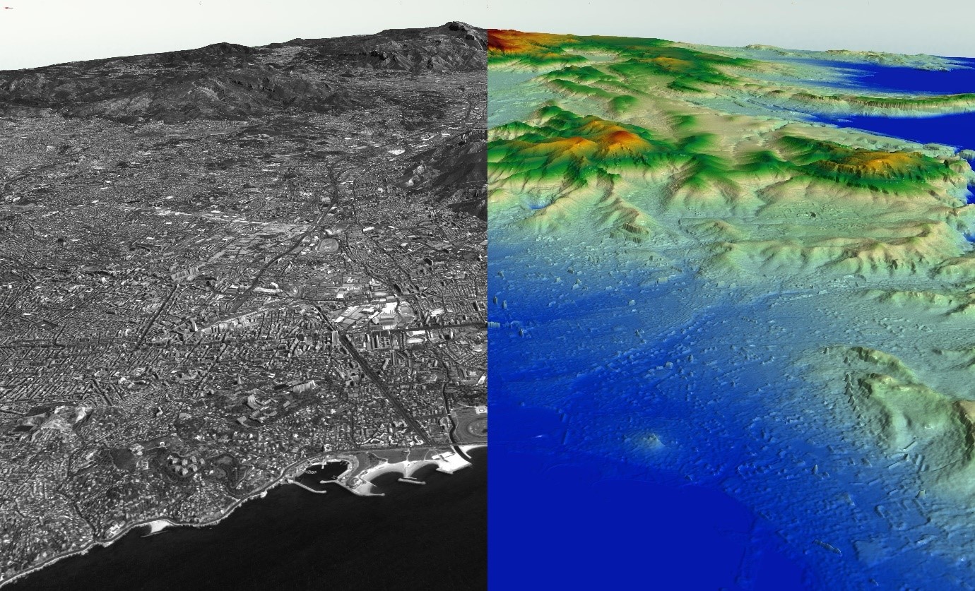
This dataset covers many European cities; for each city, you can find one or more Cartosat-1 ortho image products and one or more Euro-Maps 3D DSM tiles clipped to the extent of the ortho coverage.
The Euro-Maps 3D DSM is a homogeneous, 5 m spaced Digital Surface Model semi-automatically derived from 2.5 m Cartosat-1 in-flight stereo data with a vertical accuracy of 10 m. The surface’s very detailed and accurate representation is achieved by using a sophisticated and well-adapted algorithm based on the Semi-Global Matching approach.
You can find more details on the data available and how to access it on the dedicated collection page.