- All Categories (1324)
- Data (2)
- News (5)
- Missions (3)
- Events (1)
- Tools (3)
- Documents (1310)
Data - Announcement of Opportunity (Restrained)

Announcement of Opportunity for S3VT (Sentinel-3 Validation Team)
In the framework of a Copernicus collaborative agreement ESA and EUMETSAT invite interested groups and individuals to support the Sentinel-3 Validation Team (S3VT).
News - Thematic area articles

Transforming space data into climate action
ESA’s Earth observation activities are playing a key role in the revitalised global drive to combat climate change.
News - Data Release news

New reprocessing of datasets celebrates 30 years of ERS
The ERS programme celebrated its 30th anniversary on 17 July. Today, we are still exploiting ERS data and experts continue to work on improving the altimeter, radiometer and SAR data the programme acquired.
News - Success Stories

ERS Heritage Data allow for 30 years of science
At their time of launch thirty years ago, the two ERS satellites were the most sophisticated Earth observation spacecraft ever developed and launched by Europe.
Tools - Apps

Heritage Missions app for iOS
Download the Heritage Missions application to discover what the missions were about, how it worked and what the elements of the space and ground segment that make these missions unique.
Tools - Apps

Heritage Missions app for Android
Download the Heritage Missions application to discover what the missions were about, how it worked and what the elements of the space and ground segment that make these missions unique.
Document - Technical Note

CryoSat-Characterisation-for-FBR-users-ARESYS-ESA.zip
This document contains the CryoSat system and SIRAL instrument characterization parameters that can be useful to CryoSat users to processBaselineCFBR data.The information provided in this document does not apply to FBR products from the previous Baselines.
Document - Technical Note
CryoSat-2-Guidelines-for-reverting-Waveform-Power-Sigma-Nought-in-SAR-mode.pdf
The scope of thisTechnical Note is tofeatureknow-howand recipes in ordertoextract the sigma nought information from CryoSat-2 data productsin SAR mode.
Mission - Copernicus Sentinels

Copernicus Sentinel-3
Copernicus Sentinel-3 is an European Earth Observation satellite mission developed to support Copernicus ocean, land, atmospheric, emergency, security and cryospheric applications.
Data - Fast Registration with immediate access (Open)
ERS-1/2 SCATTEROMETER Ocean Wind field and Sea Ice probability [ASPS20.H/ASPS20.N]
The ASPS Level 2 products contain, for each node: the radar backscattering sigma nought for the three beams of the instrument, the four aliased wind solutions (Rank 1-4 wind vector) and the de-aliased wind vector flag, the sea-ice probability and sea-ice flag, the YAW quality flag. The wind retrieval is performed with the CMOD5N geophysical model function derived by ECMWF to compute the neutral winds rather than 10 m winds. ASPS L2.0 High resolution products are provided with a spatial resolution of 25x25 km and a grid spacing of 12.5 km. ASPS L2.0 Nominal resolution products are provided with a spatial resolution of 50x50 km and a grid spacing of 25 km. One product covers one orbit from ascending node crossing. Please consult the Product Quality Readme file before using the ERS ASPS data.
Mission - Heritage Missions

Envisat
Envisat was ESA's successor to ERS. Envisat carried ten instruments aboard for a wide range of Earth observing fields. The mission was operational from 2002 to 2012.
Mission - Heritage Missions

ERS
The ERS programme was composed of two missions, ERS-1 and ERS-2, which together observed the Earth for 20 years, from 1991 to 2011.
Tools - Analysis
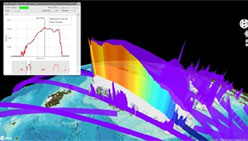
VtCryoSat
VtCryoSat is a tool for easily browsing and downloading CryoSat products through an interactive and graphical web interface.
News - Data Release news

Updated Precise Orbit data (POD) for the full ERS-1 and ERS-2 mission available
The Precise Orbit files (ERS.ORB.POD) for the entire ERS-1 and ERS-2 mission periods have been reprocessed with up-to-date standards.
News - Data Release news

ERS-1 Scatterometer L2 dataset processed with ASPS v10.04 is available online
The reprocessed dataset together with corresponding ERS-2 data is now available.
Event - Training

Advanced Training Course in Ocean Remote Sensing 2011
Within the framework of the Dragon Programme, a joint collaboration between the European Space Agency (ESA) and the Chinese Ministry of Science and Technology (MOST), ESA and NRSCC are providing a series of advanced thematic training courses on remote sensing applications hosted by university and research institutions in P.R. China.
Document - General Reference

The Nine Candidate Earth Explorer Missions - Topography Mission
This report for assessment addresses the Topography mission when it was selected with other nine Earth Explorer missions as a potential candidate for Phase A study.
Document - General Reference
The Science and Research Elements of ESA Living Planet Programme
This document presents the plans for the Earth Explorer element of the European Space Agency's 'Living Planet' Programme for Earth Observation.
Document - General Reference
CryoSat-Science-Report.pdf
This Science Report presents the latest progress in the cryospheric research related to the CryoSat mission, a three-year radar altimetry mission scheduled for launch in 2004, to determine variations in the thickness of the Earth's continental ice sheets and marine ice cover. Its primary objective is to test the prediction of thinning arctic ice due to global warming.
Document - General Reference
CryoSat-L2-Geophysical-Corrections.pdf
This document provides information on the geophysical corrections and ancillary information used in the processing of the Level 2 CryoSat data products. It complements and expands on the information provided in the CryoSat Product Handbook [RD.1] and the CryoSat Level 2 Product Format Specification document [RD.3].