- All Categories (67)
- Data (11)
- News (32)
- Missions (5)
- Events (1)
- Tools (6)
- Documents (12)
Document - Product Document

Urban-Atlas-Data-Coverage-WorldView-2.pdf
14EUSI-1961 Urban Atlas Data Coverage with WorldView-2 Data
Mission - Heritage Missions
GEOSAT-1
GEOSAT-1 is part of a group of satellites collectively known as the Disaster Monitoring Constellation (DMC).
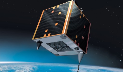
Mission - Heritage Missions
GEOSAT-2
GEOSAT-2 is the second satellite of the Deimos Earth Observation system, following GEOSAT-1.
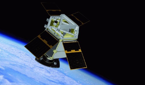
Mission - Third Party Missions

WorldView-2
WorldView-2 is an environment-monitoring satellite from Maxar which presents images as the human eye can perceive them, creating a more realistic 'true colour' view of the world.
Event - Meeting

VH-RODA and CEOS SAR workshop
The workshop provided an open forum for the presentation and discussion of current status and future developments related to the calibration and validation of space borne very high-resolution SAR and optical sensors and data products.
Tools - Analysis

SNAP
SNAP is a common architecture for all Sentinel Toolboxes. It is ideal for Earth observation processing and analysis.
Mission - Heritage Missions
GEOSAT
The GEOSAT series consists of GEOSAT-1 and GEOSAT-2 missions. They are Earth imaging satellites. GEOSAT-2, a high resolution satellite, became the first European fully-private satellite capable of providing sub-metric multi-spectral imagery.
Mission - Third Party Missions

WorldView Series
The WorldView constellation are environment-monitoring satellites that have been supplying imagery since 2007.
Tools - Analysis

Sentinel-2 Toolbox
The Toolbox consists of a rich set of visualisation, analysis and processing tools for the exploitation of optical high-resolution products including the Sentinel-2 MSI sensor.
Tools - Analysis

Sentinel-3 Toolbox
The Toolbox consists of a set of visualisation, analysis and processing tools for the exploitation of OLCI and SLSTR data.
Data - Project Proposal (Restrained)

WorldView-2 European Cities
ESA, in collaboration with European Space Imaging, has collected this WorldView-2 dataset covering the most populated areas in Europe at 40 cm resolution. The products have been acquired between July 2010 and July 2015. Spatial coverage: Check the spatial coverage of the collection on a map available on the Third Party Missions Dissemination Service.
Data - Project Proposal (Restrained)
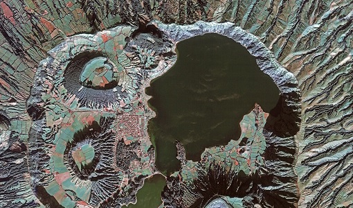
WorldView-2 full archive and tasking
WorldView-2 high resolution optical products are available as part of the Maxar Standard Satellite Imagery products from the QuickBird, WorldView-1/-2/-3/-4, and GeoEye-1 satellites. All details about the data provision, data access conditions and quota assignment procedure are described into the Terms of Applicability available in Resources section. In particular, WorldView-2 offers archive and tasking panchromatic products up to 0.46 m GSD resolution, and 4-Bands/8-Bands Multispectral products up to 1.84 m GSD resolution. Band Combination Data Processing Level Resolution Panchromatic and 4-bands Standard (2A)/View Ready Standard (OR2A) 15 cm HD, 30 cm HD, 30 cm, 40 cm, 50/60 cm View Ready Stereo 30 cm, 40 cm, 50/60 cm Map-Ready (Ortho) 1:12.000 Orthorectified 15 cm HD, 30 cm HD, 30 cm, 40 cm, 50/60 cm 8-bands Standard(2A)/View Ready Standard (OR2A) 30 cm, 40 cm, 50/60 cm View Ready Stereo 30 cm, 40 cm, 50/60 cm Map-Ready (Ortho) 1:12.000 Orthorectified 30 cm, 40 cm, 50/60 cm 4-Bands being an optional from: 4-Band Multispectral (BLUE, GREEN, RED, NIR1) 4-Band Pan-sharpened (BLUE, GREEN, RED, NIR1) 4-Band Bundle (PAN, BLUE, GREEN, RED, NIR1) 3-Bands Natural Colour (pan-sharpened BLUE, GREEN, RED) 3-Band Colored Infrared (pan-sharpened GREEN, RED, NIR1). 8-Bands being an optional from: 8-Band Multispectral (COASTAL, BLUE, GREEN, YELLOW, RED, RED EDGE, NIR1, NIR2) 8-Band Bundle (PAN, COASTAL, BLUE, GREEN, YELLOW, RED, RED EDGE, NIR1, NIR2). Native 30 cm and 50/60 cm resolution products are processed with MAXAR HD Technology to generate respectively the 15 cm HD and 30 cm HD products: the initial special resolution (GSD) is unchanged but the HD technique increases the number of pixels, improves the visual clarity and allows to obtain an aesthetically refined imagery with precise edges and well reconstructed details. As per ESA policy, very high-resolution imagery of conflict areas cannot be provided.
Data - Data Description
TropForest - ALOS, GEOSAT-1 & KOMPSAT-2 optical coverages over tropical forests
The objective of the ESA TropForest project was to create a harmonised geo-database of ready-to-use satellite imagery to support 2010 global forest assessment performed by the Joint Research Centre (JRC) of the European Commission and by the Food and Agriculture Organization (FAO). Assessments for year 2010 were essential for building realistic deforestation benchmark rates at global to regional levels. To reach this objective, the project aimed to create a harmonised ortho-rectified/pre-processed imagery geo-database based on satellite data acquisitions (ALOS AVNIR-2, GEOSAT-1 SLIM6, KOMPSAT-2 MSC) performed during year 2009 and 2010, for the Tropical Latin America (excluding Mexico) and for the Tropical South and Southeast Asia (excluding China), resulting in 1971 sites located at 1° x 1° geographical lat/long intersections. The project finally delivered 1866 sites (94.7% of target) due to cloud coverages too high for missing sites. Spatial coverage: Check the spatial coverage of the collection on a map available on the Third Party Missions Dissemination Service.
News - Data Release news

ESA TPM collection ‘Worldview-2 European Cities’ expanded
The WorldView-2 European Cities ESA dataset has been enriched with 3,149 additional products.
Document - User Guide

TPM-L-OADS-dissemination-service-User-Manual.pdf
This guide describes the Third Party Missions Dissemination System.
News - General News

ESA’s Earth Observation Catalogue and its services
EO-CAT is the EO Catalogue tool allowing users to search ESA and Third Party Mission collections.
News - General News

ESA's new DataCube service is now available
ESA is pleased to announce the deployment of a new service, called ESA PDGS-DataCube, enabling multi-temporal and pixel-based access to a subset of the data available in the European Space Agency dissemination services.
Tools - Analysis

ESA PDGS Jupyter Notebook
A series of Jupyter Notebooks are available, in order to understand how to exploit the API that provides the data access service for different types of datasets included in the ESA PDGS datacube.
Document - User Guide
GEOSAT-1-Imagery-User-Guide.pdf
The GEOSAT-1 Imagery User Guide provides the essential information about GEOSAT-1 products and services to its users.
Document - User Guide
GEOSAT-2-Imagery-User-Guide.pdf
This GEOSAT-2 Imagery User Guide provides the essential information about GEOSAT-2 products and services to its users.