- All Categories (2309)
- Data (33)
- News (67)
- Missions (25)
- Events (37)
- Tools (3)
- Activities (2)
- Campaigns (15)
- Documents (2127)
DATA
Discover and download the Earth observation data you need from the broad catalogue of missions the European Space Agency operate and support.
Data - Project Proposal (Restrained)

WorldView-4 Full Archive
WorldView-4 high resolution optical products are available as part of the Maxar Standard Satellite Imagery products from the QuickBird, WorldView-1/-2/-3/4, and GeoEye-1 satellites. All details about the data provision, data access conditions and quota assignment procedure are described into the Terms of Applicability available in Resources section. In particular, WorldView-4 offers archive panchromatic products up to 0.31 m GSD resolution, and 4-Bands Multispectral products up to 1.24 m GSD resolution. Band Combination Data Processing Level Resolution Panchromatic and 4-bands Standard (2A) / View Ready Standard (OR2A) 15 cm HD, 30 cm HD, 30 cm, 40 cm, 50/60 cm View Ready stereo 30 cm, 40 cm, 50/60 cm Map Ready (Ortho) 1:12.000 Orthorectified 15 cm HD, 30 cm HD, 30 cm, 40 cm, 50/60 cm The options for 4-Bands are the following: 4-Band Multispectral (BLUE, GREEN, RED, NIR1) 4-Band Pan-sharpened (BLUE, GREEN, RED, NIR1) 4-Band Bundle (PAN, BLUE, GREEN, RED, NIR1) 3-Bands Natural Colour (pan-sharpened BLUE, GREEN, RED) 3-Band Colored Infrared (pan-sharpened GREEN, RED, NIR1) Native 30 cm and 50/60 cm resolution products are processed with MAXAR HD Technology to generate respectively the 15 cm HD and 30 cm HD products: the initial special resolution (GSD) is unchanged but the HD technique increases the number of pixels and improves the visual clarity achieving aesthetically refined imagery with precise edges and well-reconstructed details.
Data - Project Proposal (Restrained)

WorldView-3 full archive and tasking
WorldView-3 high resolution optical products are available as part of the Maxar Standard Satellite Imagery products from the QuickBird, WorldView-1/-2/-3/-4, and GeoEye-1 satellites. All details about the data provision, data access conditions and quota assignment procedure are described into the Terms of Applicability available in Resources section. In particular, WorldView-3 offers archive and tasking panchromatic products up to 0.31m GSD resolution, 4-Bands/8-Bands products up to 1.24 m GSD resolution, and SWIR products up to 3.70 m GSD resolution. Band Combination Data Processing Level Resolution High Res Optical: Panchromatic and 4-bands Standard(2A)/View Ready Standard (OR2A) 15 cm HD, 30 cm HD, 30 cm, 40 cm, 50/60 cm View Ready Stereo 30 cm, 40 cm, 50/60 cm Map Ready (Ortho) 1:12.000 Orthorectified 15 cm HD, 30 cm HD, 30 cm, 40 cm, 50/60 cm High Res Optical: 8-bands Standard(2A)/View Ready Standard (OR2A) 30 cm, 40 cm, 50/60 cm View Ready Stereo 30 cm, 40 cm, 50/60 cm Map Ready (Ortho) 1:12.000 Orthorectified 30 cm, 40 cm, 50/60 cm High Res Optical: SWIR Standard(2A)/View Ready Standard (OR2A) 3.7 m or 7.5 m (depending on the collection date) Map Ready (Ortho) 1:12.000 Orthorectified 4-Bands being an optional from: 4-Band Multispectral (BLUE, GREEN, RED, NIR1) 4-Band Pan-sharpened (BLUE, GREEN, RED, NIR1) 4-Band Bundle (PAN, BLUE, GREEN, RED, NIR1) 3-Bands Natural Colour (pan-sharpened BLUE, GREEN, RED) 3-Band Colored Infrared (pan-sharpened GREEN, RED, NIR1) 8-Bands being an optional from: 8-Band Multispectral (COASTAL, BLUE, GREEN, YELLOW, RED, RED EDGE, NIR1, NIR2) 8-Band Bundle (PAN, COASTAL, BLUE, GREEN, YELLOW, RED, RED EDGE, NIR1, NIR2) Native 30 cm and 50/60 cm resolution products are processed with MAXAR HD Technology to generate respectively the 15 cm HD and 30 cm HD products: the initial special resolution (GSD) is unchanged but the HD technique increases the number of pixels and improves the visual clarity achieving aesthetically refined imagery with precise edges and well reconstructed details. As per ESA policy, very high-resolution imagery of conflict areas cannot be provided.
Data - Project Proposal (Restrained)

WorldView-2 full archive and tasking
WorldView-2 high resolution optical products are available as part of the Maxar Standard Satellite Imagery products from the QuickBird, WorldView-1/-2/-3/-4, and GeoEye-1 satellites. All details about the data provision, data access conditions and quota assignment procedure are described into the Terms of Applicability available in Resources section. In particular, WorldView-2 offers archive and tasking panchromatic products up to 0.46 m GSD resolution, and 4-Bands/8-Bands Multispectral products up to 1.84 m GSD resolution. Band Combination Data Processing Level Resolution Panchromatic and 4-bands Standard (2A)/View Ready Standard (OR2A) 15 cm HD, 30 cm HD, 30 cm, 40 cm, 50/60 cm View Ready Stereo 30 cm, 40 cm, 50/60 cm Map-Ready (Ortho) 1:12.000 Orthorectified 15 cm HD, 30 cm HD, 30 cm, 40 cm, 50/60 cm 8-bands Standard(2A)/View Ready Standard (OR2A) 30 cm, 40 cm, 50/60 cm View Ready Stereo 30 cm, 40 cm, 50/60 cm Map-Ready (Ortho) 1:12.000 Orthorectified 30 cm, 40 cm, 50/60 cm 4-Bands being an optional from: 4-Band Multispectral (BLUE, GREEN, RED, NIR1) 4-Band Pan-sharpened (BLUE, GREEN, RED, NIR1) 4-Band Bundle (PAN, BLUE, GREEN, RED, NIR1) 3-Bands Natural Colour (pan-sharpened BLUE, GREEN, RED) 3-Band Colored Infrared (pan-sharpened GREEN, RED, NIR1). 8-Bands being an optional from: 8-Band Multispectral (COASTAL, BLUE, GREEN, YELLOW, RED, RED EDGE, NIR1, NIR2) 8-Band Bundle (PAN, COASTAL, BLUE, GREEN, YELLOW, RED, RED EDGE, NIR1, NIR2). Native 30 cm and 50/60 cm resolution products are processed with MAXAR HD Technology to generate respectively the 15 cm HD and 30 cm HD products: the initial special resolution (GSD) is unchanged but the HD technique increases the number of pixels, improves the visual clarity and allows to obtain an aesthetically refined imagery with precise edges and well reconstructed details. As per ESA policy, very high-resolution imagery of conflict areas cannot be provided.
Data - Fast Registration with approval (Restrained)

WorldView-1 full archive and tasking
WorldView-1 high resolution optical products are available as part of the Maxar Standard Satellite Imagery products from the QuickBird, WorldView-1/-2/-3/-4, and GeoEye-1 satellites. All details about the data provision, data access conditions and quota assignment procedure are described into the Terms of Applicability available in Resources section. In particular, WorldView-1 offers archive and tasking panchromatic products up to 0.50 m GSD resolution. Band Combination Data Processing Level Resolution Panchromatic Standard(2A)/View Ready STANDARD (OR2A) 50 cm, 30 cm HD View Ready Stereo 50 cm Map-Ready (Ortho) 1:12.000 Orthorectified 50 cm, 30 cm HD Native 50 cm resolution products are processed with MAXAR HD Technology to generate the 30 cm HD products: the initial special resolution (GSD) is unchanged but the HD technique increases the number of pixels and improves the visual clarity achieving aesthetically refined imagery with precise edges and well reconstructed details. As per ESA policy, very high-resolution imagery of conflict areas cannot be provided.
Data - Fast Registration with approval (Restrained)
WorldView ESA archive
The WorldView ESA archive is composed of products acquired by WorldView-1, -2, -3 and -4 satellites and requested by ESA supported projects over their areas of interest around the world Panchromatic, 4-Bands, 8-Bands and SWIR products are part of the offer, with the resolution at Nadir depicted in the table. Band Combination Mission GSD Resolution at Nadir GSD Resolution (20° off nadir) Panchromatic WV-1 50 cm 55 cm WV-2 46 cm 52 cm WV-3 31 cm 34 cm WV-4 31 cm 34 cm 4-Bands WV-2 1.84 m 2.4 m WV-3 1.24 m 1.38 m WV-4 1.24 m 1.38 m 8-Bands WV-2 1.84 m 2.4 m WV-3 1.24 m 1.38 m SWIR WV-3 3.70 m 4.10 m The 4-Bands includes various options such as Multispectral (separate channel for Blue, Green, Red, NIR1), Pan-sharpened (Blue, Green, Red, NIR1), Bundle (separate bands for PAN, Blue, Green, Red, NIR1), Natural Colour (pan-sharpened Blue, Green, Red), Coloured Infrared (pan-sharpened Green, Red, NIR). The 8-Bands being an option from Multispectral (COASTAL, Blue, Green, Yellow, Red, Red EDGE, NIR1, NIR2) and Bundle (PAN, COASTAL, Blue, Green, Yellow, Red, Red EDGE, NIR1, NIR2). The processing levels are: Standard (2A): normalised for topographic relief View Ready Standard: ready for orthorectification (RPB files embedded) View Ready Stereo: collected in-track for stereo viewing and manipulation (not available for SWIR) Map Scale (Ortho) 1:12,000 Orthorectified: additional processing unnecessary Spatial coverage: Check the spatial coverage of the collection on a map available on the Third Party Missions Dissemination Service. The following table summarises the offered product types EO-SIP Product Type Band Combination Processing Level Missions WV6_PAN_2A Panchromatic (PAN) Standard/View Ready Standard WorldView-1 and 4 WV6_PAN_OR Panchromatic (PAN) View Ready Stereo WorldView-1 and 4 WV6_PAN_MP Panchromatic (PAN) Map Scale Ortho WorldView-1 and 4 WV1_PAN__2A Panchromatic (PAN) Standard/View Ready Standard WorldView-2 and 3 WV1_PAN__OR Panchromatic (PAN) View Ready Stereo WorldView-2 and 3 WV1_PAN__MP Panchromatic (PAN) Map Scale Ortho WorldView-2 and 3 WV1_4B__2A 4-Band (4B) Standard/View Ready Standard WorldView-2, 3 and 4 WV1_4B__OR 4-Band (4B) View Ready Stereo WorldView-2, 3 and 4 WV1_4B__MP 4-Band (4B) Map Scale Ortho WorldView-2, 3 and 4 WV1_8B_2A 8-Band (8B) Standard/View Ready Standard WorldView-2 and 3 WV1_8B_OR 8-Band (8B) View Ready Stereo WorldView-2 and 3 WV1_8B_MP 8-Band (8B) Map Scale Ortho WorldView-2 and 3 WV1_S8B__2A SWIR Standard/View Ready Standard WorldView-3 WV1_S8B__MP SWIR Map Scale Ortho WorldView-3 As per ESA policy, very high-resolution imagery of conflict areas cannot be provided.
Data - Campaigns (Open)

WISE
The objective of WInd and Salinity Experiment 2001 (WISE 2001) was to get more data points and better wind speed (WS) measurements so as to reduce the sensitivity to WS uncertainty.
Data - Project Proposal (Restrained)
Vision-1 full archive and tasking
Vision-1 provides very high resolution optical products, with 87cm resolution in Panchromatic mode and 3.48m in Multispectral Mode. Products are in DIMAP format; the image is in GeoTiff format with 16 bit encoding; the applied geographical projection is WGS84 UTM. Spectral band combination options: Panchromatic (PAN): includes data contained within a single high resolution black and white band, with product pixel size of 0.87m Multispectral (MS4): includes four multispectral (colour) bands: Blue, Green, Red and Near Infrared. The product pixel size is 3.48m Bundle (BUN): provides both the 4-band multispectral, and the panchromatic data from the same acquisition in a single, non-merged product. Data is provided as 16-bit GeoTiffs with pixel sizes of 3.48m and 0.87m for MS and PAN data respectively Pansharpened (PSH): single higher resolution 0.87 colour product obtained by the combination of the visual coloured information of the multispectral data with the details provided in the panchromatic data. Two different geometric processing levels are: Projected (level 2): The product is mapped onto the Earth cartographic system using a standard reference datum and projection system at a constant terrestrial altitude, relative to the reference ellipsoid. By default, the map projection system is WGS84/UTM. The image is georeferenced without the application of a Digital Elevation Model (DEM) and supplied with the RPC model file. Pansharpened are not available as projected product Standard Ortho (level 3): georeferenced image in Earth geometry, including the application of a Airbus World DEM for Ortho and GCPs (using Airbus Intelligence One Atlas BaseMap as reference). The orthorectification procedure eliminates the perspective effect on the ground (excluding buildings) to restore the geometry of a vertical shot. Only the basic radiometric processing is available providing the radiance value. As per ESA policy, very high-resolution imagery of conflict areas cannot be provided.
Data - Campaigns (Open)

SMOSice
The ESA SMOSice study has demonstrated for the first time the potential to retrieve sea ice thickness from SMOS data.
Data - EO Sign In Authentication (Open)
SMOS NRT Data Products
The SMOS Near Real Time products include Level 1 geo-located brightness temperature and Level 2 geo-located soil moisture estimation. The SMOS NRT L1 Light BUFR product contains brightness temperature geo-located on a reduced Gaussian grid (T511/N256), only for "land" pixels but keeping the full angular resolution. The pixels are consolidated in a full orbit dump segment (i.e. around 100 minutes of sensing time) with a maximum size of about 30MB per orbit. Spatial resolution is in the range of 30-50 km. This product is distributed in BUFR format. The SMOS NRT L2 Soil Moisture Neural Network (NN) product provides NRT soil moisture data based on the statistical coefficients estimated by a neural network. It is provided in the SMOS DGG grid and only at the satellite track. It also provides an estimation of the uncertainty of the estimated soil moisture product, and the probability that a soil moisture value is contaminated by Radio Frequency Interference (RFI). This product is distributed in NetCDF format. The L2 data product is also distributed via the EUMETCast Europe Service (DVB), upon registration on the EUMETSAT Earth Observation Portal. The Ku-band DVB reception station must be situated within the service coverage in Europe. SMOS NRT data is also regularly delivered to the UK Met-Office, then made available to operational agencies and research and development institutes via the WMO GTS Network. For an optimal exploitation of the SMOS NRT products please consult the read-me-first notes available in the Resources section below.
Data - EO Sign In Authentication (Open)
SMOS L1 and L2 Science data
SMOS Level 1 data products are designed for scientific and operational users who need to work with calibrated MIRAS instrument measurements, while SMOS Level 2 data products are designed for scientific and operational users who need to work with geo-located soil moisture and sea surface salinity estimation as retrieved from the L1 dataset. Products from the SMOS Data Processing Ground Segment (DPGS) located at the European Space Astronomy Centre (ESAC), belonging to the latest processing baseline, have File Class OPER. Reprocessed SMOS data is tagged as REPR. The Level 1A product comprises all calibrated visibilities between receivers (i.e. the interferometric measurements from the sensor including the redundant visibilities), combined per integration time of 1.2s (snapshot). The snapshots are consolidated in a pole-to-pole product file (50 minutes of sensing time) with a maximum size of about 215MB per half orbit (29 half orbits per day). Access to this products is restricted to SMOS Cal/Val users. The Level 1B product comprises the result of the image reconstruction algorithm applied to the L1A data. As a result, the reconstructed image at L1B is simply the difference between the sensed scene by the sensor and the artificial scene. The brightness temperature image is available in its Fourier component in the antenna polarisation reference frame top of the atmosphere. Images are combined per integration time of 1.2 seconds (snapshot). The removal of foreign sources (Galactic, Direct Sun, Moon) is also included in the reconstruction. Snapshot consolidation is as per L1A, with a maximum product size of about 115MB per half orbit. ESA provides the Artificial Scene Library (ASL) to add the artificial scene in L1B for any user that wants to start from L1B products and derive the sensed scene. The Level 1C product contains multi-angular brightness temperatures in antenna frame (X-pol, Y-pol, T3 and T4) at the top of the atmosphere, geo-located in an equal-area grid system (ISEA 4H9 - Icosahedral Snyder Equal Area projection). The pixels are consolidated in a pole-to-pole product file (50 minutes of sensing time), with a maximum size of about 350MB per half orbit (29 half orbits per day). Spatial resolution is in the range of 30-50 km. For each L1C product there is also a corresponding Browse product containing brightness temperatures interpolated for an incidence angle of 42.5°. Two L1C products are available: Land for soil moisture retrieval and Sea for sea surface salinity retrieval. The Level 2 Soil Moisture (SM) product comprises soil moisture measurements geo-located in an equal-area grid system ISEA 4H9. The product contains not only the retrieved soil moisture, but also a series of ancillary data derived from the processing (nadir optical thickness, surface temperature, roughness parameter, dielectric constant and brightness temperature retrieved at top of atmosphere and on the surface) with the corresponding uncertainties. The pixels are consolidated in a pole-to-pole product file (50 minutes of sensing time), with a maximum size of about 7MB (25MB uncompressed data) per half orbit (29 half orbits per day). This product is available in both Earth Explorer and NetCDF formats. The Level 2 Ocean Salinity (OS) product comprises sea surface salinity measurements geo-located in an equal-area grid system ISEA 4H9. The product contains one single swath-based sea surface salinity retrieved with and without Land-Sea contamination correction, SSS anomaly based on WOA-2009 referred to Land-Sea corrected sea surface salinity, brightness temperature at the top of the atmosphere and at the sea surface with their corresponding uncertainties. The pixels are consolidated in a pole-to-pole product file (50 minutes of sensing time), with a maximum size of about 10MB (25MB uncompressed data) per half orbit (29 half orbits per day). This product is available in both Earth Explorer and NetCDF formats. For an optimal exploitation of the SMOS L1 and L2 datasets, please refer to the Resources section below in order to access Product Specifications, read-me-first notes, etc.
Data - EO Sign In Authentication (Open)
SMOS Auxiliary Data
The Level 2 ECMWF SMOS Auxiliary data product, openly available to all users, contains ECMWF data on the ISEA 4-9 DGG corresponding to SMOS half-orbit. It is used by both the ocean salinity and soil moisture operational processors to store the geophysical parameters from ECMWF forecasts. Access to other SMOS Level 1 and Level 2 "dynamic" and "static" auxiliary datasets is restricted to Cal/Val users. The detailed content of the SMOS Auxiliary Data Files (ADF) is described in the Products Specification documents available in the Resources section below.
Data - External Data (Restrained)
PROBA-V 1 km, 333 m, and 100 m products
The PROBA-V VEGETATION Raw products and Synthesis products provided coverage of all significant landmasses worldwide with, in the case of a 10-day synthesis product, a minimum effect of cloud cover, resulting from selection of cloud-free acquisitions during the 10-day period. It provided a daily coverage between Latitudes 35°N and 75°N, and between 35°S and 56°S, and a full coverage every two days at the equator. The VEGETATION instrument was pre-programmed with an indefinite repeated sequence of acquisitions. This nominal acquisition scenario allowed a continuous series of identical products to be generated, with the goal to map land cover and vegetation growth across the entire planet every two days. Level Synthesis Resolution resolution (m) Reflectance Level-1C n/a TOA Level-2A n/a 100 m TOA 333 m TOA 1 km TOA Level-3 S1 100 m TOA TOC TOC NDVI 333 m TOA TOC 1 km TOA TOC S5 100 m TOA TOC TOC NDVI S10 333 m TOC TOC NDVI 1 km TOC TOC NDVI Raw Products Overview Product Description Level-1C Level-1C segments (P – product): Radiometrically corrected Level-1B data, in raw sensor geometry (unprojected) Contains: - Top Of Atmosphere reflectance in the four spectral bands - Longitude/latitude information for every pixel - Geometric viewing conditions - Information on the status map (indicating missing and interpolated measurements). Format: HDF5 & GeoTiFF Level-2A Level-2A segment: projected Level-1C (P–product) data, radiometrically and geometrically corrected. Contains: - TOA reflectance values in the four spectral bands without atmospheric correction being performed - Information on the status map (containing identification of radiometric quality, snow, ice, shadow, clouds, land/sea for every pixel) - Geometric viewing conditions Plate carrée projection (EPSG:4326) with spatial resolution of 100 m, 333 m and 1 km Format: HDF5 & GeoTiFF Synthesis Products Overview Level-3 S1 = daily, S5 = 5 days, S10 = decade Different spatial resolution: 100 m, 333 m and 1 km Divided into so called granules, each measuring 10 degrees x 10 degrees, each granule being delivered as a single file Plate carrée projection (EPSG:4326) Format: HDF5 & GeoTiFF Products Content TOA - Top Of Atmosphere reflectance in the four spectral bands (no atmospheric correction applied) - Normalized Difference Vegetation Index (NDVI) -Information on the composite status map (containing identification of snow, ice, shadow, clouds, land/sea for every pixel) - Geometric viewing conditions & date and time of selected measurement TOC Level-2A segment: projected Level-1C (P–product) data, radiometrically and geometrically corrected. Contains: - Top Of Canopy (ground surface) reflectance in the four spectral bands, the atmospheric correction being performed using the SMAC (Simplified Method for Atmospheric Corrections) algorithm - Normalized Difference Vegetation Index (NDVI) - Information on the composite status map (containing identification of snow, ice, shadow, clouds, land/sea for every pixel) Normalized Difference Vegetation Index (NDVI) from Top Of Canopy product (SMAC algorithm for atmospheric corrections applied) - Geometric viewing conditions & date and time of selected measurement TOC NDVI Normalized Difference Vegetation Index (NDVI) from Top Of Canopy product (SMAC algorithm for atmospheric corrections applied)
Data - EO Sign In Authentication (Open)
PROBA-1 HRC
The HRC Level 1A product is an image with a pixel resolution of 8m. The data are grey scale images, an image contains 1026 x 1026 pixels and covers an area of 25 km2. HRC data is supplied in BMP format. All PROBA-1 passes are systematically acquired according to the current acquisition plan, HRC data are processed every day to Level 1A and made available to ESA users. Spatial coverage: Check the spatial coverage of the collection on a map available on the Third Party Missions Dissemination Service.
Data - EO Sign In Authentication (Open)
PROBA-1 CHRIS Level 1A
CHRIS acquired a set of up to five images of each target during each acquisition sequence, these images were acquired when PROBA-1 was pointing at distinct angles with respect to the target. CHRIS Level 1A products (supplied in HDF data files, version 4.1r3) include five formal CHRIS imaging modes, classified as modes 1 to 5: Mode Name Swath Spectral Bands/Ground Resolution Mode 1 Aerosols 13 km 62 at 34 m (773 nm / 1036 nm) Mode 2 Water bands 13 km 18 at 18 m Mode 3 Land channels 13 km 18 at 18 m Mode 4 Chlorophyll band set 13 km 18 at 18 m Mode 5 Land channels 6.5 km 37 at 18 m Spatial coverage: Check the spatial coverage of the collection on a map available on the Third Party Missions Dissemination Service.
Data - Campaigns (Open)
POLARIS Proof of Concept 2008
The POLARIS Proof-of-Concept (PoC) 2008 campaign primarily aimed to verify the usefulness of the system for glaciological applications.
Data - Campaigns (Open)
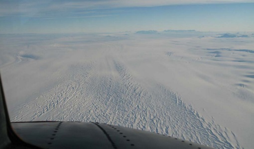
POLARIS 2011
In February 2011, ESA's POLarimetric Airborne Radar Ice Sounder (POLARIS) system was flown for the first time in the Antarctic, as part of the POLARIS IceGrav Antarctic Campaign 2011, ICEGRAV project.
Data - Campaigns (Open)
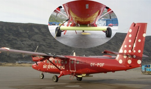
POLARIS - Proof of Concept 2009
POLARIS - Proof of Concept (PoC) 2009 is a follow on campaign from POLARIS - PoC 2008. It focused on an additional POLARIS test with the objective to system test after system upgrade and the acquisition of fully polarimetric data of glaciological interest.
Data - Campaigns (Open)

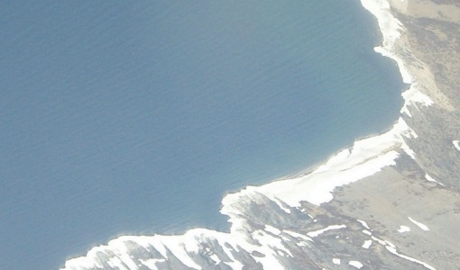
PolarGap
The primary objective of the PolarGap campaign was to carry out an airborne gravity survey covering the southern polar gap of the gravity field mission GOCE, beyond the coverage of the GOCE orbit.
Data - EO Sign In Authentication (Open)
OceanSat-2 data
ESA, in collaboration with GAF AG, acquired and processed every day OceanSat-2 passes over Neutrelitz reception station from January 2016 to November 2021. All passes were systematically processed to levels 1B, 2B and 2C, and available to users in NRT (< 3 hours). Products are available in: Level 1B: Geophysical Data containing Radiance Data for all 8 Bands of OCM-2 Level 2B: Geophysical Data L2B for given Geo physical parameter. Geo physical parameters: Chlorophyll, Aerosol Depth, Different Attenuation, Total Suspended Sediments Level 2C: Georeferenced Radiance Data for given geo physical parameter. Geo physical parameters: Chlorophyll, Aerosol Depth, Different Attenuation, Total Suspended Sediments. Spatial coverage: Check the spatial coverage of the collection on a map available on the Third Party Missions Dissemination Service.
Data - EO Sign In Authentication (Open)
Land Ice Thematic Data Product [ALT_TDP_LI]
This is the Land Ice Thematic Data Product (TDP) V1 resulting from the ESA FDR4ALT project and containing estimates of ice sheet surface elevation and associated uncertainties. The collection covers data for three different missions: ERS-1, ERS-2 and Envisat, and based on Level 1 data coming from previous reprocessing (ERS REAPER and the Envisat V3.0) but taking into account the improvements made at Level 0/Level 1 in the frame of FDR4ALT (ALT FDR). The Land Ice TDP focuses specifically on the ice sheets of Greenland and Antarctica, providing these data in different files. For many aspects, the Land Ice Level 2 and Level 2+ processing is very innovative: Improved relocation approach correcting for topographic effects within the beam footprint to identify the Point of Closest Approach Homogeneous timeseries of surface elevation measurements at regular along-track reference nodes. The FDR4ALT products are available in NetCDF format. Free standard tools for reading NetCDF data can be used. Information for expert altimetry users is also available in a dedicated NetCDF group within the products. Please consult the FDR4ALT Product User Guide before using the data. The FDR4ALT datasets represent the new reference data for the ERS/Envisat altimetry missions, superseding any previous mission data. Users are strongly encouraged to make use of these datasets for optimal results.