- Campaigns
- SMOSice
SMOSice
Overview
What was the purpose of SMOSice?
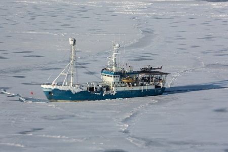
The ESA SMOSice study has demonstrated for the first time the potential to retrieve sea ice thickness from SMOS data. It was therefore the aim of the 2014 SMOSice campaign to improve the SMOS sea-ice thickness retrieval algorithm by assembling a comprehensive data set of high resolution L-Band radiometer data, auxiliary sea ice conditions and sea-ice thickness validation data. The surveys were centred on newly formed thin sea ice regimes in the Barents Sea south-east of the Svalbard in spring 2014.
What was the outcome of SMOSice?
Preliminary analysis of the data acquired from the SMOSice 2014 field campaign proved the worthiness of the region for SMOS cal/val studies and highlighted directions for further investigations. The key findings can be summarised as follows:
- A bias of 15-10 K has been identified between the L-Band brightness temperatures of SMOS and the validation measurements by EMIRAD
- Comparisons of the L-Band brightness temperatures of EMIRAD and collocated sea ice thickness estimates from airborne laser scanner data give strong empirical evidence that brightness temperatures can be used to estimate sea ice thickness on a significant thickness range.
- All data sources, SMOS, EMIRAD, ALS and EM-Bird show the same geographical patterns of sea-ice thickness, however with different magnitudes due to the characteristics of the retrieval methods.
- The comparison of direct sea-ice thickness measurements by the EM-Bird to the aircraft validation data requires a more detailed analysis due to differences in the spatio-temporal scales and sea ice drift between the data acquisitions.
- Not intended, but the freeboard swath data of the laser scanner may be used to study wave propagation into the ice cover.
- The quality of data from the AWI snow radar did not meet the expectations and subsequently a geophysical data product from the snow radar with sufficient quality cannot be provided at the time of project closure.
Download the SMOSice Final Report
| Data Coverage (Year) | 2014 |
| Release Date | November 2019 |
| Geographic Site | Barents Sea, SE Svalbard |
| Field of Application | Airborne L-Band radiometer data, ALS, EM-bird, surface temperature and radiation |
| Data Size | 75.3 GB |
Digital Object Identifier: https://doi.org/10.5270/esa-kjcuzuo - SMOSice: " Final Report: Technical Support for the 2014 SMOSice Campaign in SE Svalbard"
Data
The campaign data is available online via FTPS upon submission of a data access request. An active EO Sign In account is required to submit the request.
The data can be downloaded via an FTP client (e.g., FileZilla or WinSCP) using the option "Implicit FTP over TLS".
For further information about the EO Sign In Service you can visit TellUs
Should you need support please contact EOHelp