earth online
  • Explore Missions
    • Earth Explorers
    • Heritage Missions
    • Third Party Missions
  • Explore Data
    • All Data
    • Open Data
    • Announcement of Opportunity
    • Project Proposal
    • Sample Data
    • Dashboard
  • Explore Tools
    • Analysis Tools
    • Processing Tools
    • Visualisation Tools
    • Catalogues
    • Apps
  • Explore News & Events
    • All News
    • Data Release News
    • Maintenance News
    • Operational News
    • All Events
    • Events Updates
    • Workshop
    • Conference
  • Explore Learn & Discover
    • Data Application Articles
    • Spotlight on EO Community
    • Gallery
    • FAQ
    • Success Stories
    • Infographics
    • Quality Reports Advanced Search
  • SEE ALL
  • EarthCARE
  • EarthCARE
  • Mission
    • EarthCARE Overview
    • EarthCARE Objectives
    • EarthCARE DISC
  • Instruments
    • ATLID
      • ATLID Overview
      • ATLID Design
    • BBR
      • BBR Overview
      • BBR Design
      • BBR Spectral Response
    • CPR
      • CPR Overview
      • CPR Design
    • MSI
      • MSI Overview
      • MSI Design
      • MSI Spectral Response
  • Data
    • EarthCARE Data
    • EarthCARE Product Data Handbook
    • EarthCARE Image of the Month
    • EarthCARE Data Tools
    • Data Quality
    • Calibration/Validation
      • Calibration/Validation overview
      • Exploring EarthCARE Data
      • Validation Activities
      • Validation Needs
        • Validation Needs Overview
        • Geophysical Parameters
      • Validation Workshops
  • Events
  • Publications
    • EarthCARE Publications
    • Post-public Data Release Articles
  • News
    • All News
    • Success Stories
  • EARTHCARE IN 3D
More

    EarthCARE INSTRUMENTS

    Explore instruments used in EarthCARE mission.

    EXPLORE INSTRUMENTS

    EarthCARE DATA

    Discover how to access EarthCARE data.

    ACCESS MISSION DATA

    EarthCARE TOOLS

    A number of tools are available for visualising, processing and analysing EarthCARE data.

    EXPLORE TOOLS

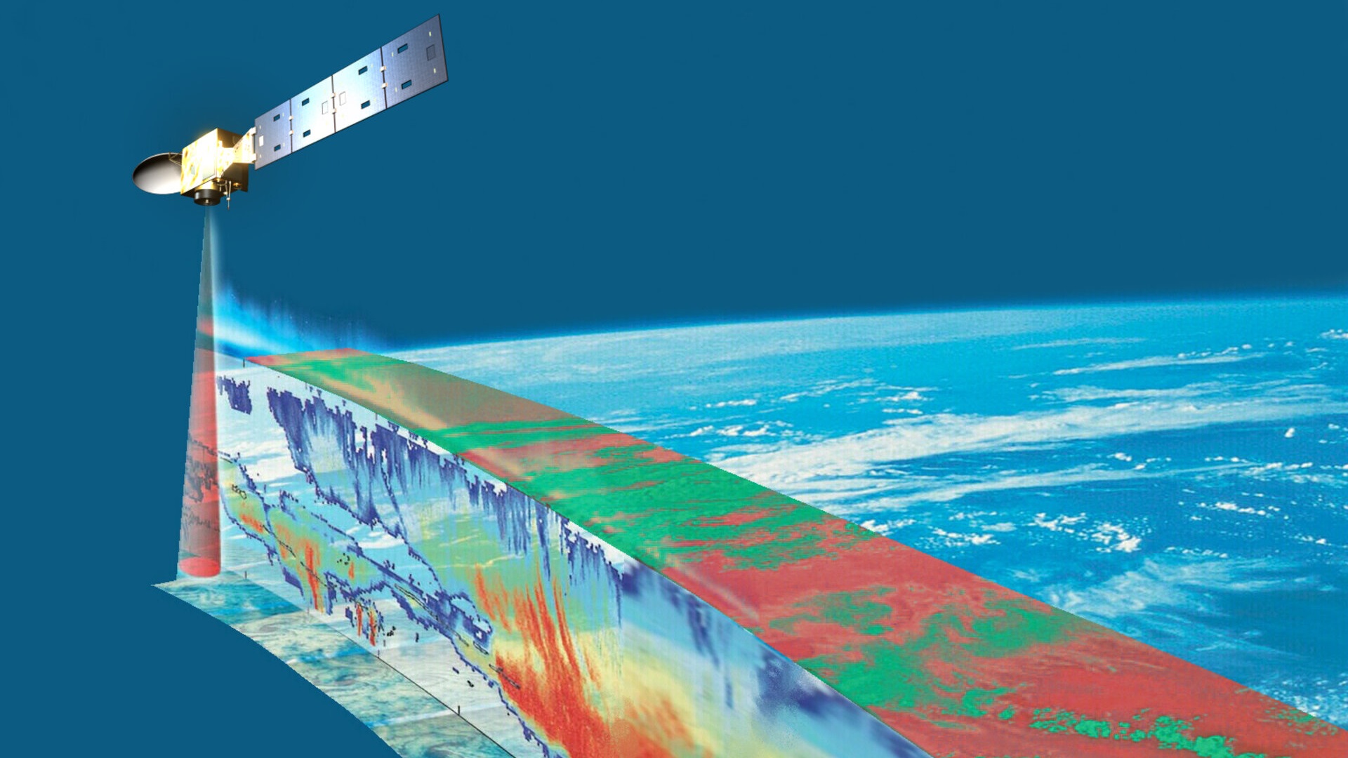
    EarthCARE will examine the role clouds and aerosols play in trapping infrared radiation emitted from Earth's surface.

    Featured

    EarthCARE spots birth of rare fire cloud over Europe

    EarthCARE spots birth of rare fire cloud over Europe

    Climate change means wildfires are becoming a more common threat in Europe. Thanks to EarthCARE’s multispectral imager, we can track their widespread atmospheric effects, including wildfire-induced thunderstorms.

    EarthCARE tracks wildfire-induced storms over Europe

    EarthCARE tracks wildfire-induced storms over Europe

    Summer 2026 was one of the hottest in parts of Europe, setting new records for high temperatures and dry conditions, which lead to extreme wildfires.

    EarthCARE shows how smoke dims the sky

    EarthCARE shows how smoke dims the sky

    Wildfires struck Ontario, Canada, in July 2026. Smoke plumes from the fires spread east and south, affecting major cities including Toronto, Detroit, and Chicago.

    How wildfire smoke dims the sky, seen through the eyes of EarthCARE

    How wildfire smoke dims the sky, seen through the eyes of EarthCARE

    As wildfires raged over Canada this summer, EarthCARE was keeping a keen eye on them from above, with its multispectral imager and atmospheric lidar combining to help us understand the local effects of wildfire smoke.

    New EarthCARE Science seminar in October

    New EarthCARE Science seminar in October

    A series of monthly science seminars are currently taking place, which cover the applications and science of ESA's EarthCARE mission. The seminars are one hour sessions, held online, that feature two guest speakers who present for approximately 20 to 25 minutes each. The remaining time is open for discussion with the participants.

    About EarthCARE

    EarthCARE

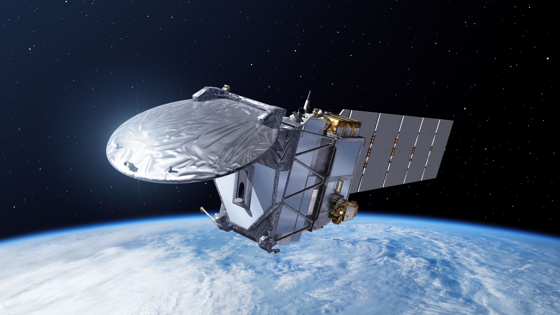
    ESA's EarthCARE (Earth Cloud, Aerosol, and Radiation Explorer) mission launched on 28 May 2024 is the largest and most complex Earth Explorer to date, and will advance our understanding of the role that clouds and aerosols play in reflecting incident solar radiation back into space and trapping infrared radiation emitted from Earth's surface.

    EarthCARE is a joint venture between ESA and JAXA (Japan Aerospace Exploration Agency).


    FIND OUT MORE

    EarthCARE Objectives

    EarthCARE

    EarthCARE employs high-performance lidar and radar technology that has never been flown in space before, with the objective to deliver unprecedented datasets to allow scientists to study the relationship of clouds, aerosols and radiation at accuracy levels that will significantly improve our understanding of these highly variable parameters.


    FIND OUT MORE

    EarthCARE Instruments

    ATLID
    The Atmospheric Lidar (ATLID) provides vertical profiles of aerosols and thin clouds. It operates at a wavelength of 355 nm and has a high-spectral resolution receiver and depolarisation channel.

    find out more
    BBR
    The Broad-Band Radiometer (BBR) provides measurements of top-of-the-atmosphere radiances and fluxes. It has one short-wave and one long-wave channel with three fixed viewing directions pointing in nadir and aft-directions.
    find out more
    CPR
    The Cloud Profiling Radar (CPR) provides vertical profiles measurements of clouds and observes vertical velocities of cloud particles through Doppler measurements. It operates at 94GHz.

    find out more
    MSI
    The Multi-Spectral Imager (MSI) hosted by EarthCARE provides across-track information on clouds and aerosols with channels in the visible, near infrared, shortwave and thermal infrared.
    find out more
    Tweet
    Share

    People also search for

    DataNewsMissionsEventsTools and toolboxesActivitiesCampaignsLearn & Discover
    European Space Agency
    Terms and conditionsCookie NoticePrivacy NoticeContact UsFAQComplaintsLeave feedback