Vatnajökull - Iceland, October/November 1996
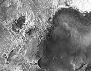
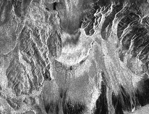
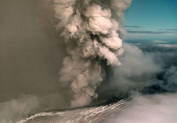 Late on the evening of 30 September 1996, an eruption started beneath the Vatnajökull glacier in central Iceland. A fissure 4km long under the ice heated the glacier, and caused part of it to melt. 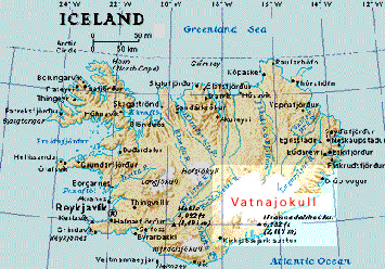 By 14 October, the eruption was effectively over, but the trapped meltwater had raised the level of the Grímsvötn lake by some 100 m by the time it eventually broke out to the south, causing devastating floods in the Skei?arársandur region before draining into the Atlantic Ocean. 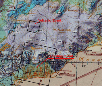 This map shows the affected regions. The map was scanned from aeronautical maps of the area and shows elevations in feet - divide by three to get a rough equivalent in metres. The Vatnajökull glacier is the largest glacier in Iceland, covering more than 10,000 square km. The smaller rectangle marked on the map shows the approximate location of the volcanic event, and measures about 20 x 20 km.
|
||||||