Georges formed in the far eastern Atlantic on September 15th and reached hurricane status on the 17th. The hurricane moved on a general west-northwesterly course over the next few days reaching maximum wind speeds of 250 km/h. Georges made "landfall" in the Dominican Republic on the afternoon of the 22nd with estimated maximum wind speeds of 190 km/h and reached in eastern Cuba on the afternoon of the 23rd (120 km/h). The hurricane continued along the northern coast of Cuba for most of the 24th. Georges moved into the Florida straits early on the 25th and re-intensified making "landfall" near the West "Florida Keys" islands on mid-morning of the 25th with estimated maximum wind speeds of 170 km/h. Georges continued on a general west-northwest to northwest track on the 26th and 27th, turning to a north-northwest heading and gradually slowing down as it approached the coast of the central Gulf of Mexico. Georges made its final landfall near Biloxi Mississippi on the 28th. By the 29th Georges was located in Alabama and over the next few days near the Georgia coast. (Source: National Hurricane Center)
Georges is one of the worst hurricanes to strike the Caribbean islands in decades. In Hispaniola (home of two of the poorest nations in the Western hemisphere, Haiti and Dominican Republic), entire communities were literally erased from the landscape. It is estimated that 206 Dominicans were killed by Georges and an additional 2,000 are missing. In Haiti the official death toll from Hurricane Georges stands at approximately 150. As in the Dominican Republic, the Haitian death toll may never be known because many rural residents never received warning of the hurricane's approach. As a result, they were caught by surprise away from shelter and often adjacent to the rivers and streams near to which they lived.
Six people are confirmed dead in Cuba, where it is estimated that 20,000 people were forced from their homes by extensive flooding. The total damages has yet to be determined, although the Puerto Rican government initially estimated damages at $1 billion for Puerto Rico alone. (Source and more information at Disaster Relief)
For reference: 1 Kt = 0.533m/s = 1.92km/h
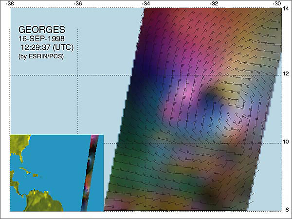
ERS Wind Scatterometer image, acquired 16 September. Maximum wind speed: 57 kts (110 km/h). Centre: 10.9N 30.5W
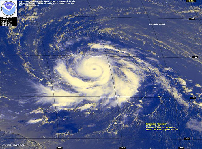
GOES-8 image acquired 14:15 on 18 September.
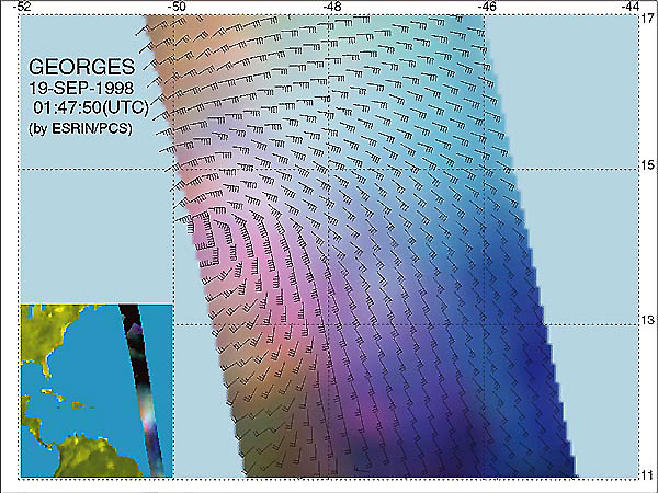
ERS Wind Scatterometer image, acquired at 01:47 UTC on 19 September. Maximum wind speed: 80kts 155km/h. Centre: 14.1N 49.7W
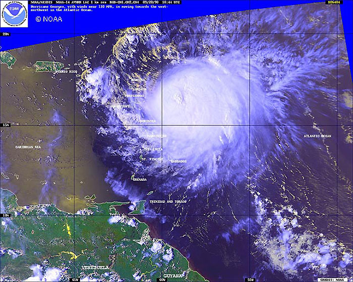
NOAA-14 AVHRR image, acquired at 18:44 on 20 September.
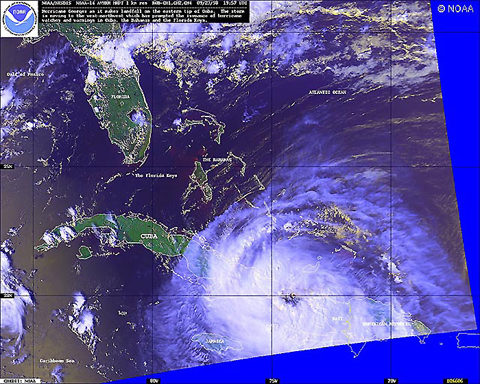
NOAA-14 AVHRR image, acquired at 19:57 on 23 September.
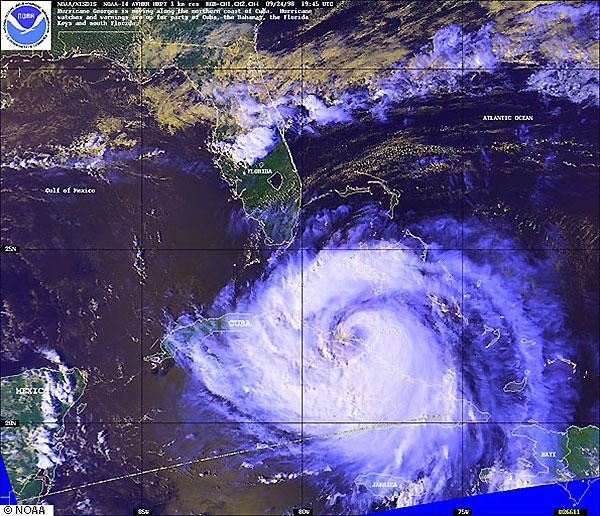
NOAA-14 AVHRR image, acquired at 19:45 on 24 September.
ERS Wind Scatterometer image, acquired at 03:43 on 25 September. Maximum wind speed: 80 kts (155 km/h) Centre: 27.8N 78.9W
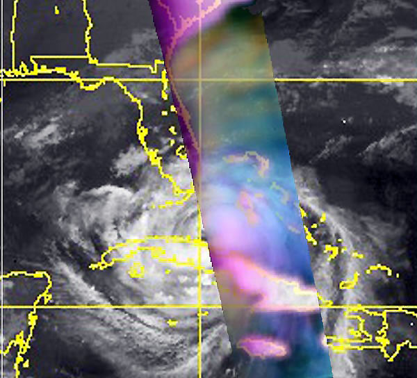
ERS Wind Scatterometer image, acquired at 03:43 on 25 September, superimposed on GOES-8 image acquired at 03:15.
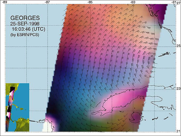
ERS Wind Scatterometer image, acquired at 16:03 on 25 September. Maximum wind speed: 57 kts (110 km/h) Centre: 24.5N 82.0W
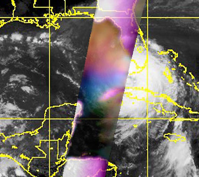
ERS Wind Scatterometer image, acquired at 16:03 on 25 September, superimposed on GOES-8 image acquired at 16:15.
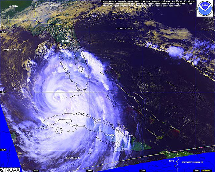
NOAA-14 AVHRR image acquired at 19:35 on 25 September.
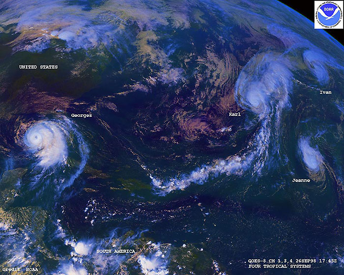
GOES-8 view of four Hurricanes, visible from left to right: Georges, Karl, Jeanne and Ivan acquired at 17:45 on 26 September.
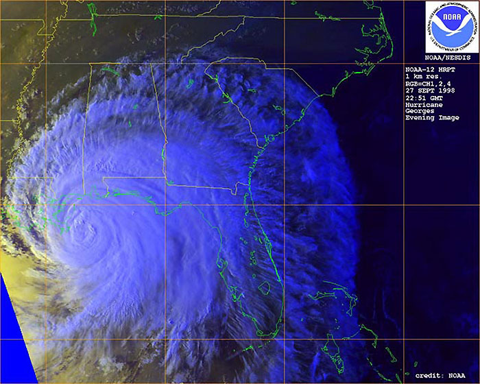
NOAA-12 AVHRR image acquired at 22:51 on 27 September.
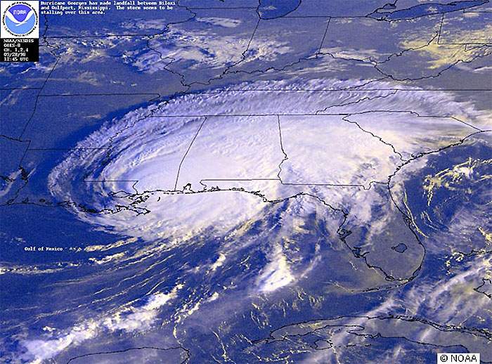
GOES-8 image acquired at 12:45 on 28 September.
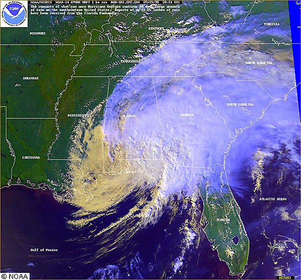
NOAA-14 AVHRR image acquired at 20:24 on 29 September.
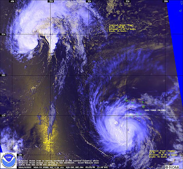
Hurricane Jeanne (South) and Hurricane Ivan (North) near the Cape Verde Islands, as seen by NOAA-14 AVHRR on 22 September.
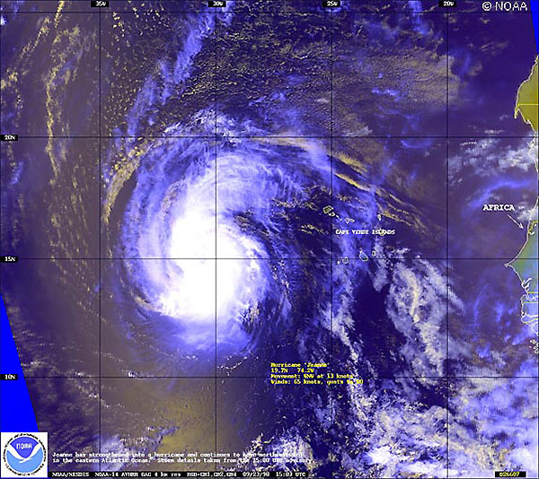
NOAA-14 AVHRR image acquired on 23 September.
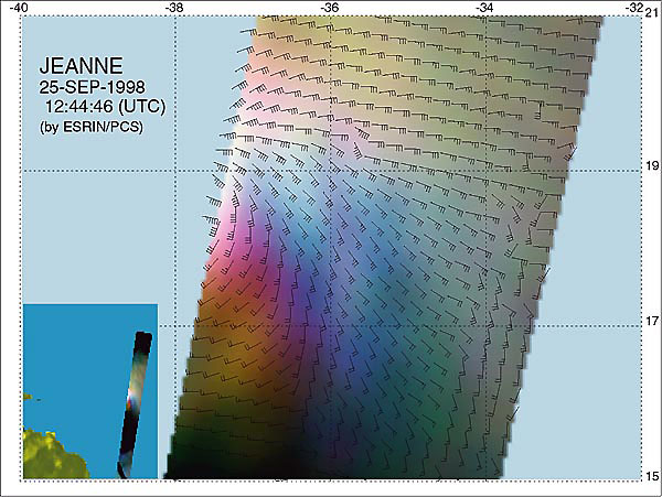
ERS Wind Scatterometer image acquired at 12:44 on 25 September.
NOAA-12 and 14 AVHRR and GOES-8 images are derived from NOAA's website.
 Hurricanes Georges and Jeanne - September 1998