 Hurricane Floyd - September 1999
At least 70 deaths are attributed to Hurricane Floyd and its aftermath, which prompted the largest peacetime evacuation in U.S. history. In the Bahamas, three days after the deadly storm ripped across the Abacos, Eleuthera and Grand Bahama, power was still out and stocks of food and fresh water were running low in outlying islands. International and Bahamian relief workers joined forces to reach still isolated islands and to deliver food and water to hurricane victims. An entire village was swept out to sea, homes were smashed to pieces, half of an island's cemetery was washed away. The storm devastated New Providence's vulnerable population of Haitian immigrants, who live in shanties off back roads throughout the island. Floyd obliterated their fragile homes of cast-off wood, windows and doors and flooded their farms. The flood-related casualties and problems in North Carolina included at least 42 people dead, 10,000 in shelters, 30,000 flooded homes and damages for $6 billion. Agricultural damage was devastating. Estimated losses exceed $1 billion, primarily to cotton and soybean crops. Many of the dead were found still strapped in their automobiles, victims of rising water that washed their vehicles into flood-swollen creeks and streams. Floodwaters had virtually shut down the eastern third of North Carolina, an area of 2.1 million people. Disease has become a growing threat because of the hundreds of thousands of dead hogs, chickens and turkeys. Flooding swept at least 1,000 containers of explosive and toxic materials into waterways throughout New Jersey: gasoline, cleaning solvents, propane gas, etc. Officials with the U.S. Environmental Protection Agency said more than a million gallons of wastewater, possibly containing chromium, spilled at the Occidental Chemical plant in Castle Hayne. EPA investigators were also assessing a potential threat of mercury contamination from a containment pond at the HoltraChem plant in Riegelwood.
This ERS Wind Scatterometer image with computed wind field was acquired on 10 September. 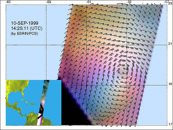
ERS Wind Scatterometer data acquired on 10 September superimposed on a GOES-8 image. 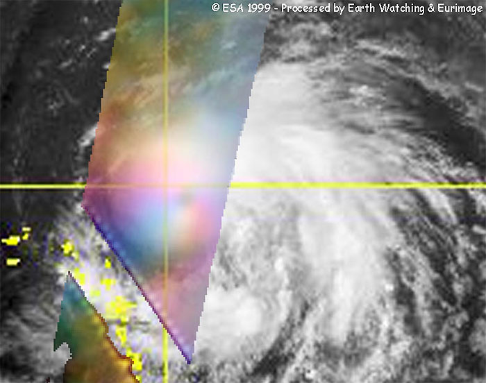
This ERS Wind Scatterometer image with computed wind field was acquired on 12 September. The Hurricane is now category three, with a maximum wind speed (Km/h) of 144.0 in the image. 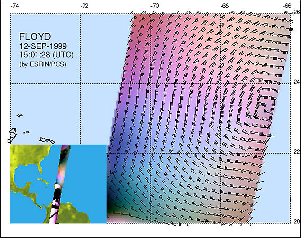
ERS Wind Scatterometer data acquired on 12 September superimposed on a GOES-8 image. 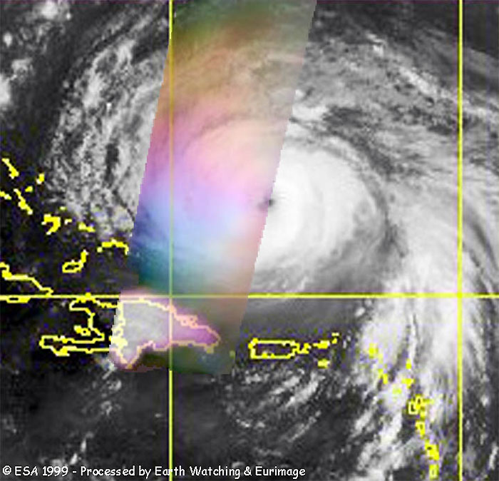
ERS Wind Scatterometer image, acquired 14 September, with computed wind field. The Hurricane is now category four, with a maximum wind speed (Km/h) of 250.2 in the image. 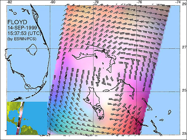
ERS Wind Scatterometer data acquired on 14 September superimposed on a GOES-8 image. 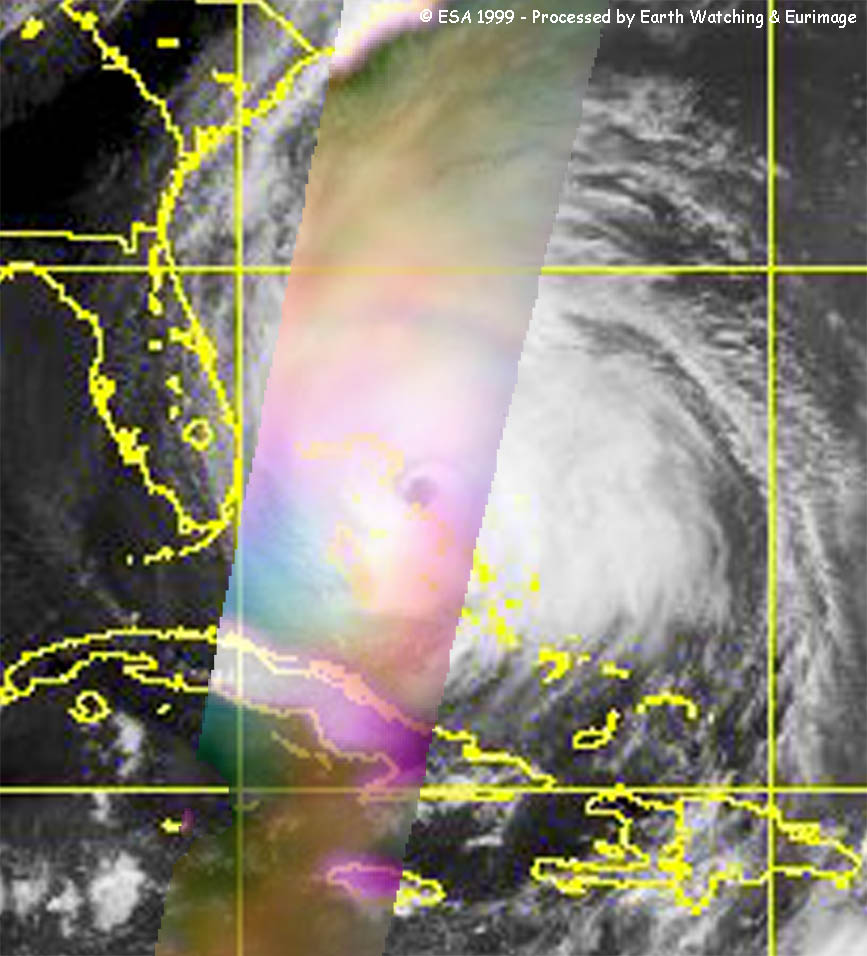
ERS Wind Scatterometer data acquired on 14 September. 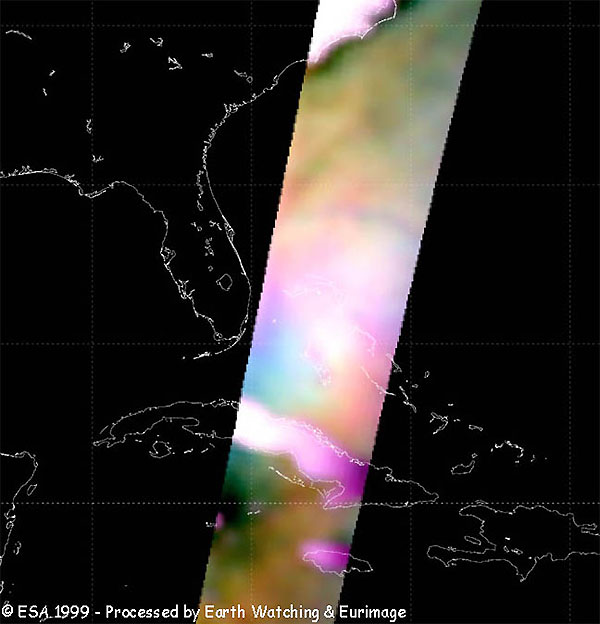
Floyd formed from a tropical wave over the central tropical Atlantic Ocean on 07 September (14.6N 46.2W at 21Z). Until 09 September the system (with the status of Tropical Storm) moved towards West to West-Northwest, increasing its wind speeds up to a maximum of 1-minute sustained surface winds of 110 km/h. Floyd was upgraded to a Hurricane category on 10 September, with maximum surface winds of 130 km/h, and turned to a West-Northwest track over the eastern Caribbean Sea. On 12 September it was upgraded to category three on the Saffir-Simpson hurricane scale, with surface winds of 195 km/h and a speed of 22 km/h. The cyclone turned its track to West to West-Northwest. On 13 September, the hurricane's minimum central pressure was 923 millibars, which represented a drop of 44 millibars in about 27 hours. During this day, Floyd reached its maximum surface winds (250 km/h) and its minimum central pressure (921 millibars), and it was upgraded to category four on the hurricane scale. On 14 September Floyd passed over the Bahamas with winds of 220 km/h. During this day and the 15th the system turned to North to Northwestward and after to Northeastward due to an anticyclone over the extreme Western Atlantic, this prevented the hurricane from making landfall in Florida. On 16 September Floyd moved inland over eastern North Carolina, near Cape Fear, as a category two hurricane, with maximum surface winds of 175 km/h, weakening as it made progress over the land. It was downgraded to a category one hurricane, with winds of 150 km/h (36.0N 76.6W at 13Z) and after to a tropical storm (39.3N 74.6W at 21z, on the New Jersey coast about 10 miles at the south of Atlantic City), with winds of 90 km/h.
The following images are from GOES-8 and NOAA-14/15 satellites. Courtesy of NOAA. 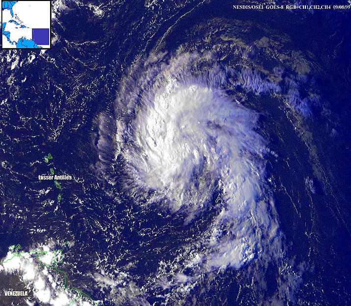 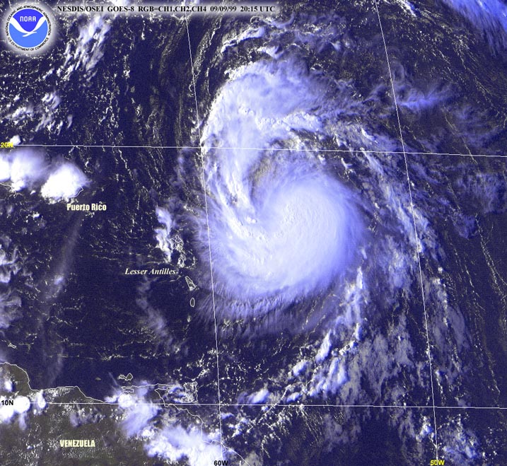 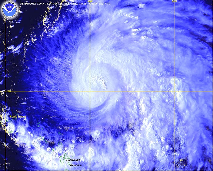 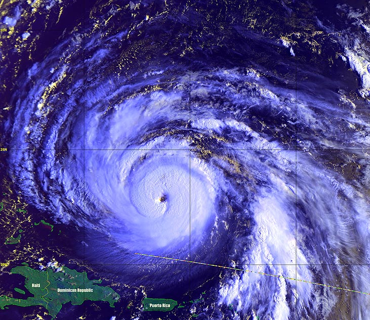 8 Sep 99 - GOES 8 9 Sep 99 - GOES 8 10 Sep 99 - NOAA 14 12 Sep 99 - NOAA 15 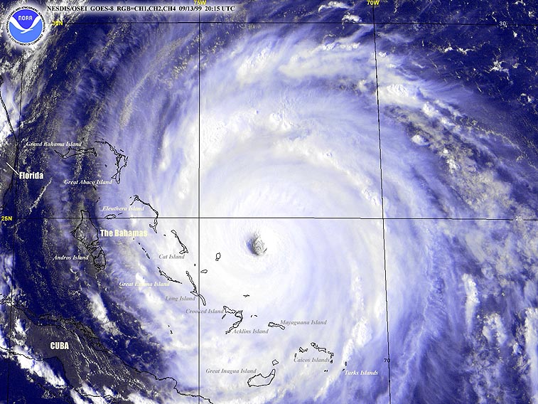 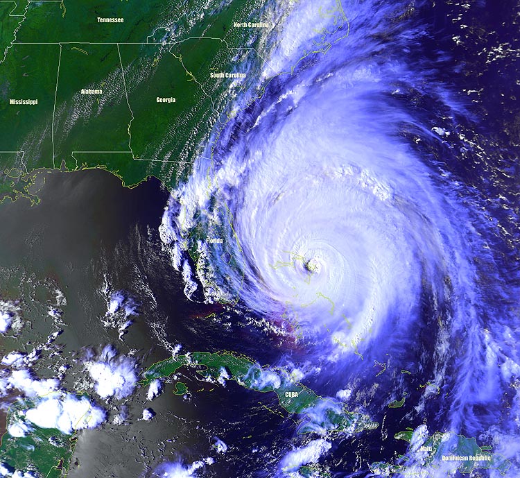 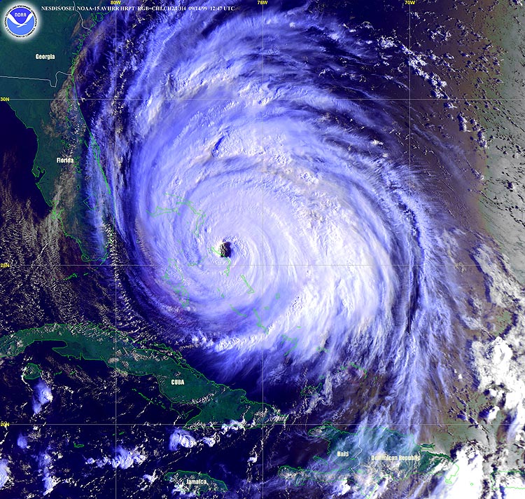 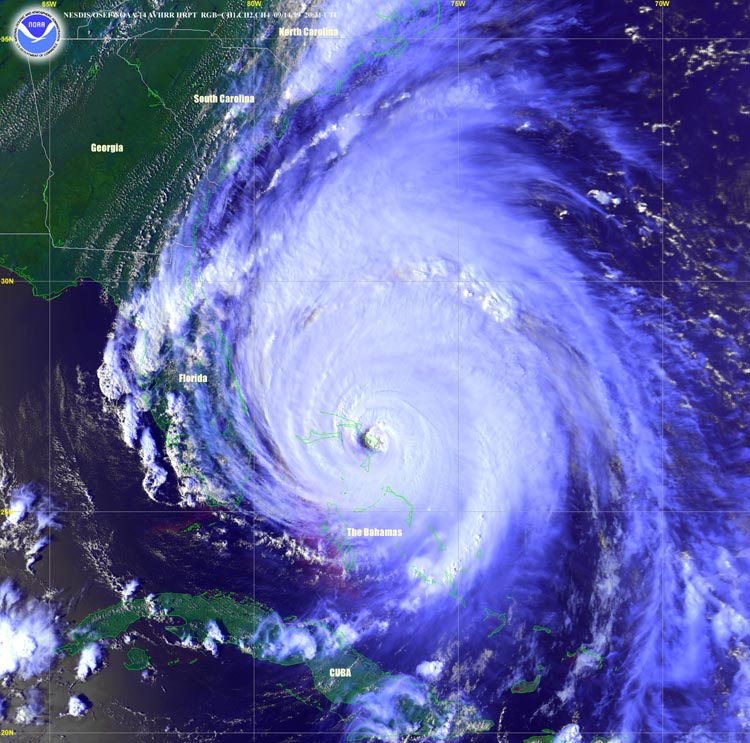 13 Sep 99 - GOES 8 14 Sep 99 - NOAA 14 14 Sep 99 - NOAA 14 14 Sep 99 - NOAA 14 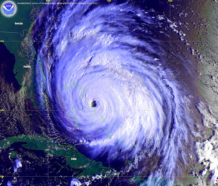 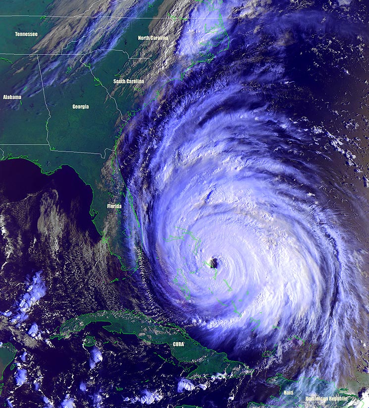 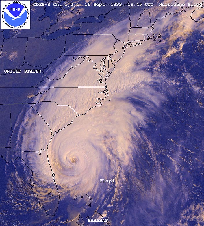 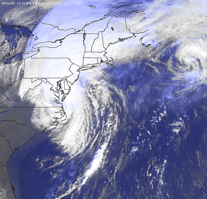 14 Sep 99 - NOAA 15 14 Sep 99 - NOAA 15 15 Sep 99 - GOES 8 16 Sep 99 - GOES 8
These animations are from the GOES-8 satellite and are in .avi format.
|
Related Links
|
||||||||||||||||||||||||