During the lifetime of Hurricane Danielle, wind speeds greater than 100 Kts were recorded. Danielle formed over the central tropical Atlantic ocean on the 24th of August becoming a tropical storm later that afternoon. Danielle reached hurricane status on the 25th and moved on a West-Northwest track for the next 5 days. At the time of thes images, Danielle was near Florida, but in the following days began to move to the North and North-East following the East coast of the United States and Canada and turning to the East until it became extratropical on the 4th of September at latitude 40 North West.
As it can be seen on the images the tropical cyclones are characterised by a thermal circulation containing a spiral convergence of warm air toward the centre of the system at low levels, and a region of ascending air close to the centre surrounded by a descending region. The air diverges at the top. The generation and maintenance of the warm zone close to the centre results from the heating and humidification of the convergent air of the low levels by flows of water vapour, sensible heat coming from the surface of the sea above which it flows, and the release of latent heat associated with the very thick vigorous convection in the convective ring surrounding the eye of the hurricane and in the spiral bands.
|
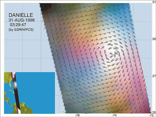
ERS Wind Scatterometer view |
This image shows a representation of Hurricane Danielle on the 31st of August 1998 at 3:29 UTC, based on measurements obtained by the Wind Scatterometer instrument aboard ERS. The maximum wind speed measured in this image is 80 Kts.
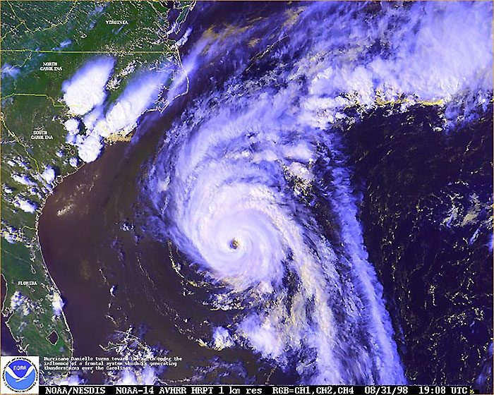
This NOAA 14 AVHRR image was acquired on the 31st of August, 1998 at 19:08 UTC.
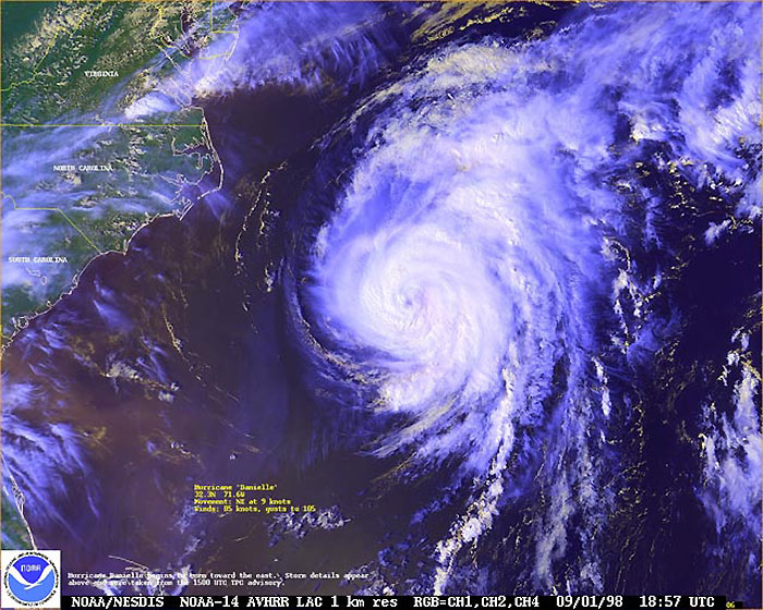
This NOAA 14 AVHRR image was acquired on the 1st of September, 1998 at 18:57 UTC.
See more NOAA AVHRR and GOES-8 images.
 Hurricane Danielle - August 1998