Cyclone Yali spent most of its life in the Fiji area. It moved westwards across the 160 East meridian on the 25th of March to the Australian region for a couple of days before undergoing rapid deepening as an extratropical cyclone and pummelling New Zealand with fast winds, high sea waves and heavy rains.
|
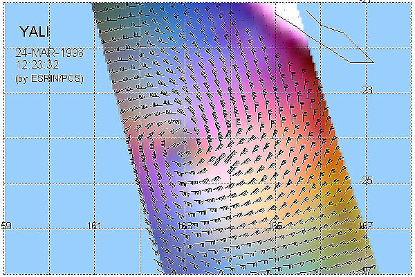
ERS Wind Scatterometer view |
This image shows data from the scatterometer instrument coloured in red, green or blue according to which of the three antennas of the instrument provided the measurements. The image shows a representation of the Tropical Cyclone Yali which was present in the Pacific Ocean from the 17th to the 27th of March 1998 based on measurements of the Wind Scatterometer instrument. The maximum wind speed measured in this image is 55 Kts. This ERS Wind Scatterometer image was acquired on the 24th of March 1998 at 12:23 UTC.
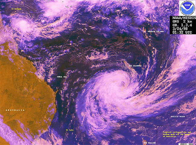
This GMS satellite image was acquired on the 24th of March 1998 at 1:32 UTC
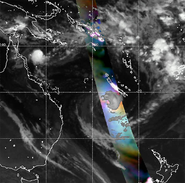
In this image the ERS Wind Scatterometer image has been superimposed on a GMS metereological image of the 24th of March at 11:32 UTC
See more NOAA AVHRR and GMS images.
 Cyclone Yali - March 1998