 Cyclone Rona - February 1999
Tropical cyclone Rona has produced Eastern Australia's worst flooding in more than a century and at least seven deaths. About 2,000 people were evacuated from low-lying areas, and rail and air corridors were shut down. Although heavy rains are usual in Queensland, this year's storms have been unusually heavy and came earlier than normal. For instance, the Cairns area had received 400 mm of rain in two days. Queensland Emergency Services Minister Merri Rose declared the area around Cairns, Port Douglas and Innisfail a disaster zone. Torrential rains since the weekend have sent torrents of water down creeks and swelled the Mary River, which peaked in the town of Gympie on Wednesday at nearly 22 meters (72 feet), the highest level in a century. The state government said first estimates put flood damage at 2 million US$ in the Gympie area but the final bill was likely to be much higher. The storm's greatest impact may be on the sugar cane industry, a US$1 billion cash crop. Rona flattened nearly all of the sugar cane crop in the north Queensland region, which produces about one-third of Australia's supply of the commodity.
This image shows data from the scatterometer instrument coloured in red, green or blue according to which of the three antennas of the instrument provided the measurements. The image shows a representation of the tropical cyclone Rona on the 10th of February 1999 at 12:57 UTC based on measurements of the Wind Scatterometer instrument. 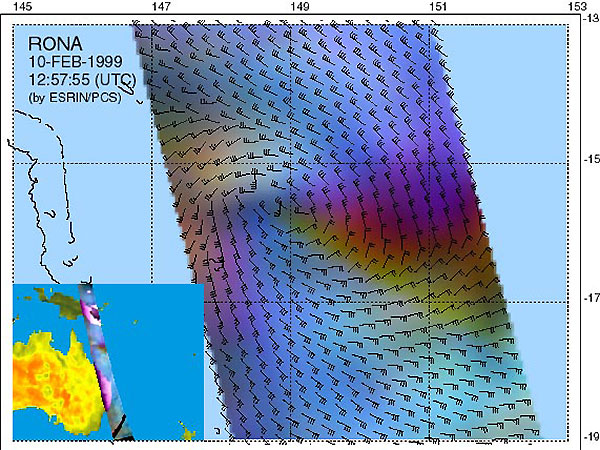
ERS Wind Scatterometer image superimposed on a metereological image of the 10th of February at 13:31 UTC. 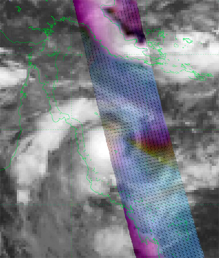
|
Related Links
|
|||||||||