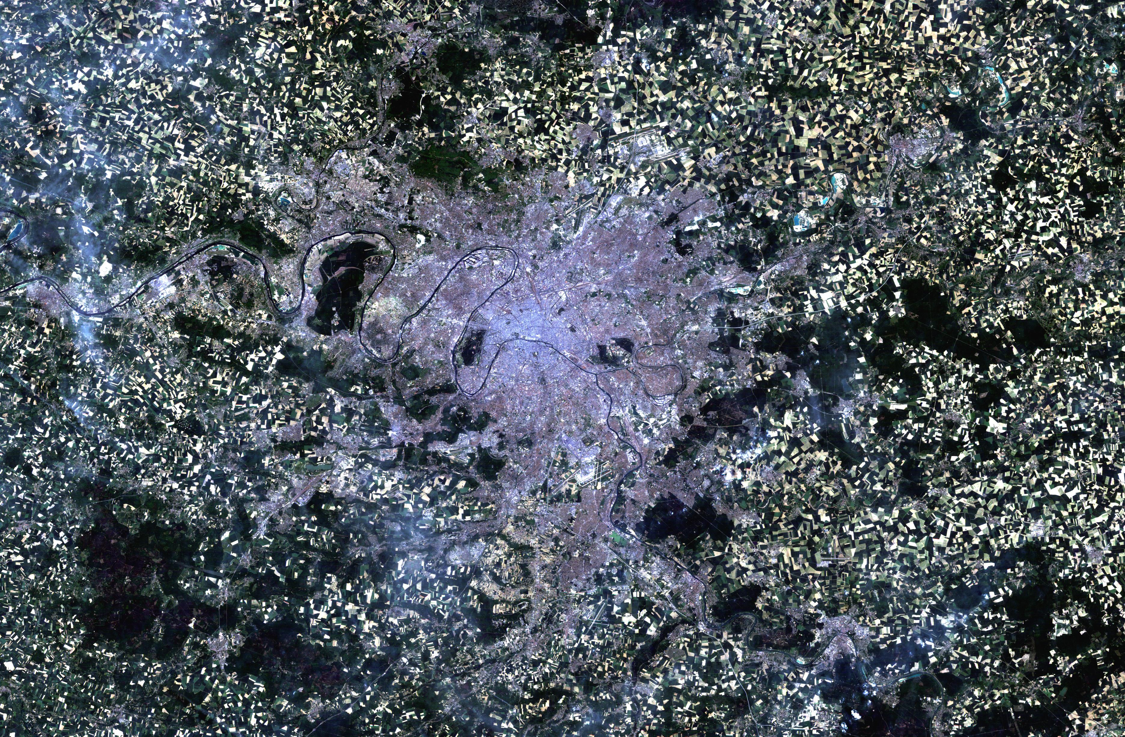
Paris, France (1984-2004)
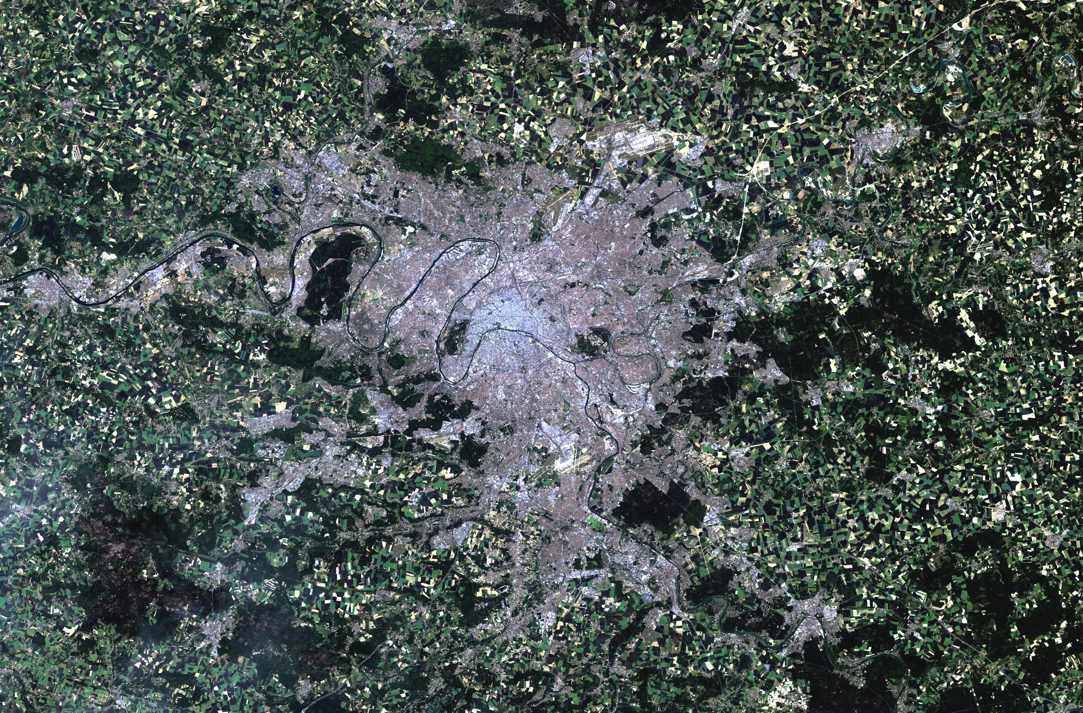
Twenty years separate these two Landsat thematic mapper images of Paris, the capital city of France. Paris, known as the City of Light (la Ville Lumière), is built on an arc of the River Seine and is divided into two parts: the Right Bank to the north and the Left Bank to the south. The comparison between the 1984 image on the left and the 2004 image on the right suggests that Paris has not experienced substantial growth in the last 20 years. The oval shape of the city can be clearly seen in both of the images and they show just how little Paris has grown. Unlike other large European cities, Paris has not extended its administrative limits and there has not been a huge increase in the population. However, the population density in the city of Paris is very high compared to other European cities and it has not seen the same trend of relocation to the suburbs as has been experienced by other western cities. In both of the images, one can see the River Seine winding its way through the centre of the images. The grey and purple pixels denote the urban area. The heart of the city appears greyer than the suburbs. The patchwork of green, brown, tan and yellow surrounding the city is farmland. . The first Landsat-5 image was acquired on 17 July 1984 – Paris, known as the City of Light (la Ville Lumière), is built on an arc of the River Seine and is divided into two parts: the Right Bank to the north and the Left Bank to the south. Paris was occupied by a Gallic tribe until 52 BC. The invaders referred to the former occupants as the Parisii, but called their new city Lutetia, meaning "marshy place". About fifty years later the city had been renamed "Paris". In the image, one can see the River Seine winding its way through the centre of the images. The grey and purple pixels denote the urban area. The heart of the city appears greyer than the suburbs. The patchwork of green, brown, tan and yellow surrounding the city is farmland. The second Landsat-5 image was acquired on 08 June 2004 – Paris is divided into twenty numerically arranged districts called the arrondissements. These districts are numbered in a spiral pattern with the 1er arrondissement at the centre of the city.
|
||||||||||||||||||||||