Bucharest, Romania (1984-2004)
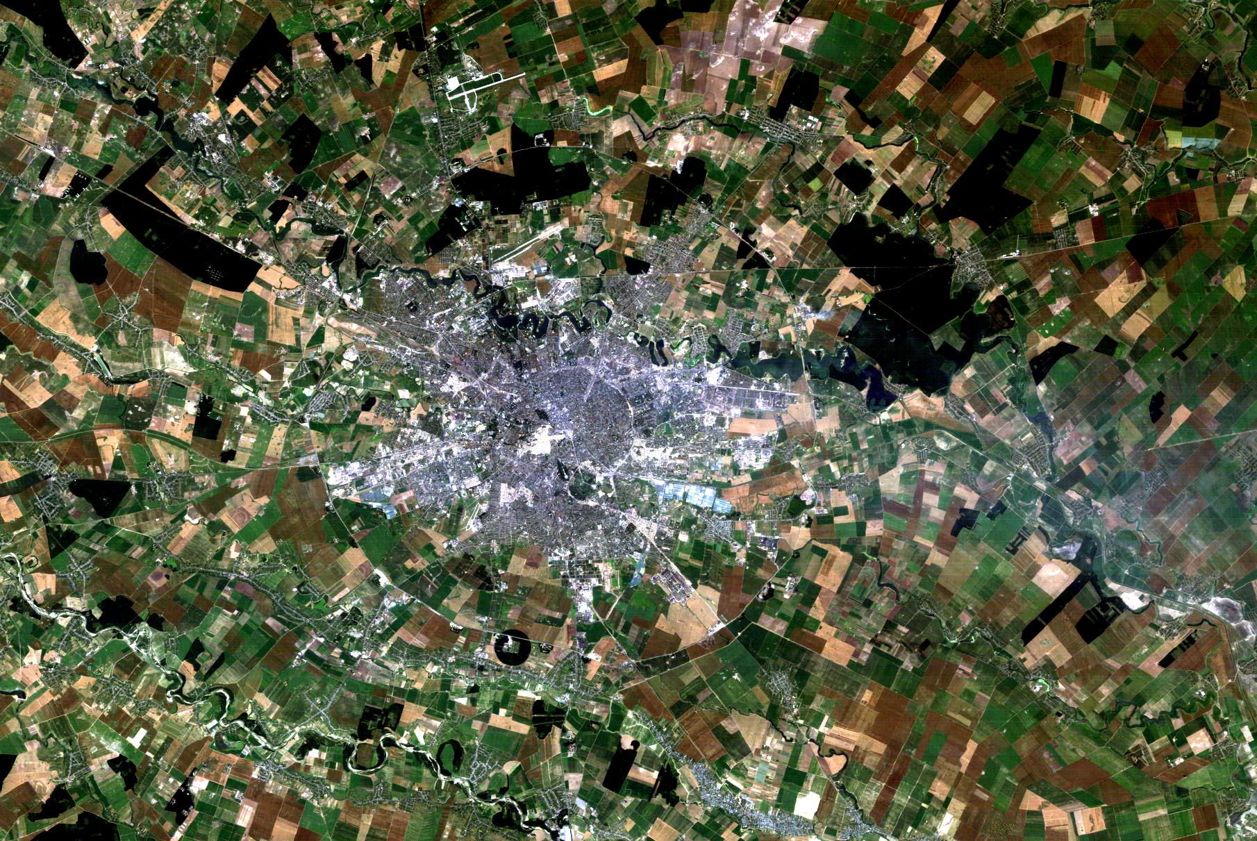
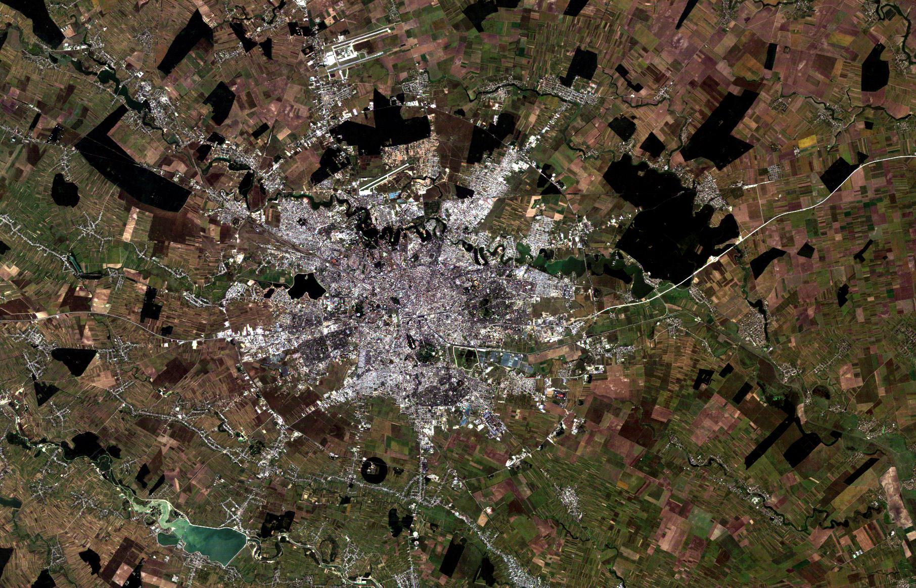
Twenty years separate these two Landsat thematic mapper images of Bucharest, Romania. Bucharest is the capital city and industrial and commercial centre of Romania. It is located in the southeast of the country, on the Dâmboviþa River. The comparison of the two images highlights how the city grew around its centre. Bucharest expanded in all directions during the 20 years covered by the images, and all of its six administrative sectors experienced a considerable growth. Among these, Baneasa, the northern district of the city, was the one which grew the most, almost reaching the lake which bears the same name. The city has a total surface of 226 km2. The altitude varies between 55.8 meters at the Dâmboviþa Bridge in Cãþelu, south-eastern Bucharest, to 91.5 m at the Militari church. Several lakes stretch across it, the most important being Lake Floreasca, Lake Tei and Lake Colentina. In the center of the capital there is also a small artificial lake. Surrounded by gardens and parks, it has a rich history, as it was frequented by famous poets and writers. Until recently, the regions surrounding Bucharest were largely rural, but after 1989, new suburbs started to be built, in an area well renowned for its natural beauty and the fertility of its land. The region where Bucharest lies was in fact once covered by the Vlãsiei forest, which, after it was cleared, gave way to a fertile flatland. Bucharest was founded in the 14th century after a victory won over the Turks (bucurie means joy in Romanian, and for this reason Bucharest is often called "The City of Joy"). However, the Turks took their revenge in 1595, when they burned the whole city Another disaster, this time of natural origin, struck the city in 1977. A Magnitude 7.4 (Richter scale) earthquake hit Bucharest on 4 March 1977, 21:20 local time. The seismic event claimed 1,500 lives and destroyed many old buildings. It was a relatively deep earthquake, with an ipocentre of about 94 kilometres, and this explains why it was clearly felt throughout the Balkans. The quake killed about 1,570 people and wounded more than 11,000. About 35,000 buildings were damaged, and the total damages were estimated to count for more than two billion dollars. Most of the damages were concentrated in Bucharest, where about 33 large buildings collapsed. After the earthquake, the Romanian government imposed tougher standards for the building construction. The first Landsat 5 image was acquired on 03 July 1984 – The population of Bucharest grew rapidly over the last two centuries, partially due to the urbanisation of Romanian’s who were mostly farmers, predominantly living in rural areas. Although it accounts for around 9% of Romania's population, Bucharest produces around 21% of the country's GDP and about a quarter of the industrial production. The city also comprises of the largest transport network in Romania, and one of the largest in Central and Eastern Europe. The second Landsat 5 image was acquired on 12 September 2004 – In the early 2000s, Romania perished after the economic boom. The city is modern and many historical areas have been restored to their former glory.
|
||||||||||||||||||||||