Copenhagen, Denmark (1984 - 2004)
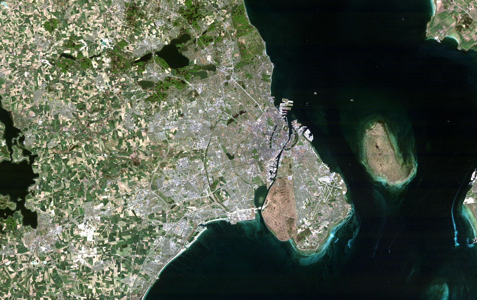
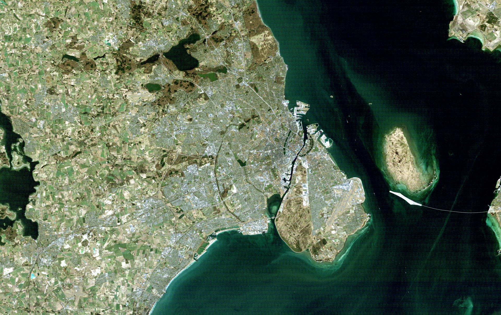
Copenhagen, the capital of Denmark, can be seen in these two Landsat images.
Twenty years separate these two Landsat thematic mapper images of the city of Copenhagen. They clearly highlight the continued stability by allowing a comparison between the 2004 image on the right and the 1984 image on the left. Copenhagen, the capital of Denmark, is a major commercial, fishing and naval port. Denmark is comprised of several islands and a peninsula that borders Germany. Copenhagen is situated on one of several islands (called Sjaelland). Temperatures vary considerably during the year, particularly during the winter period. July is normally the warmest month with an average temperature of just below 20°C. February is generally the coldest with an average of just below 0°C. Copenhagen maintains a statue in honour of the "Little Mermaid", which continues to be the most popular tourist attraction in Denmark and one of the most photographed statues in the world. She sits in Langelinie in Copenhagen. The sculpture was put up in 1913, and has since then been the symbol of Denmark. In 1984, she lost her right arm. The arm was returned the day after by two young men. As can be seen from both images, the population density is and has always been high. Compared with the rest of the country and other Nordic cities, population density is currently at 5,800 people per sq km. Air pollution, principally from vehicle and power plant emissions, is becoming a public safety issue in Copenhagen. Denmark up until the 1980’s was totally dependent on coal and oil imports. Oil was discovered in the North Seas, and in 1984, natural gas distribution via a nationwide pipeline network made Denmark 100 % self-sufficient. This pipeline can be seen as the white line to the extreme right of the image. The first Landsat-5 image was acquired on 13 May 1984 – In the eighties, the density of the population was high in Copenhagen. The then government of Denmark believed in an “open door” policy regarding immigration and as a result of this policy, Copenhagen has a diverse population that primarily comes from Afghanistan, Bosnia, Iraq, Iran, the Yugoslav Republics, Pakistan, Somalia, Sri Lanka and the Middle East. The second Landsat-5 image was acquired on 2 April 2004 - 1.7 million people live in the Greater Copenhagen area, and the Öresund region. The density of the population is high at 5,800 people per sq km.
|
||||||||||||||||||||||