Sharm el-Sheikh, Egypt (1984-2004)
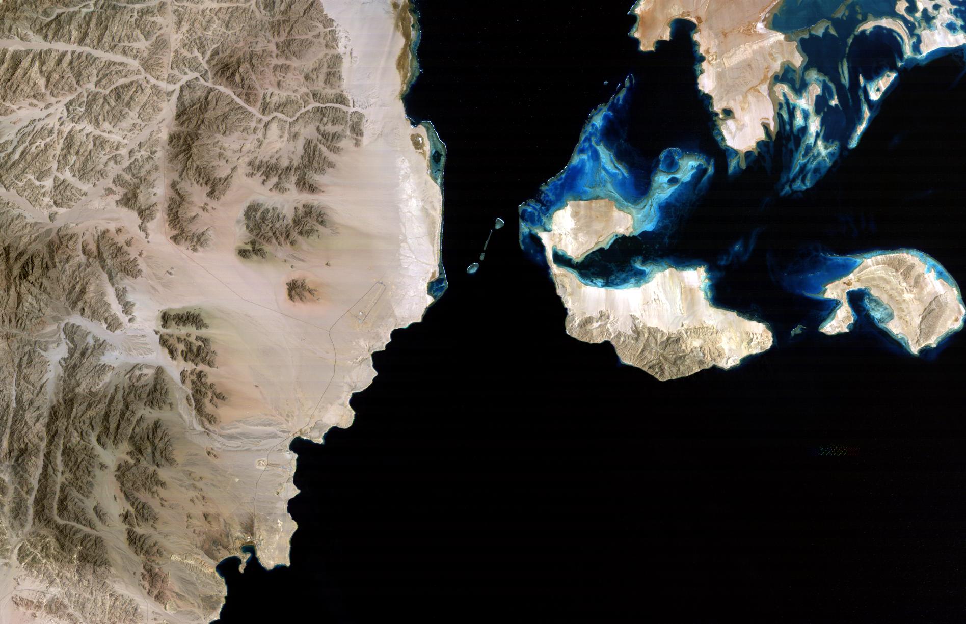
Twenty years separate these two Landsat thematic mapper images of Sharm el-Sheikh,Egypt. They clearly highlight the transition it has undergone from a strategic military port to tourist hot spot by allowing a comparison between the 2004 image on the right and the 1984 image on the left. Located at the southern tip of the Sinai Peninsula on the southern tip, Sharm el-Sheikh overlooks the very important shipping route of the Sraits of Tiran. Its geographical location made it a strategic naval choke point that was the cause of much military conflict. Its closure prevented Israeli shipping from entering and leaving the Red Sea. In 1979, after thirty years of bloody conflict and five all-out wars, Egypt signed a peace treaty with Israel. Since the mid-1980's, Sharm el-Sheikh has made the transition from stark military outpost to tourist hot spot. The Ras Mohammed was declared a National Park in 1983. It is the very thin strip of land at the southern tip of the Sinai peninsula. In itself a peninsula, it is bordered to the west by the relatively shallow waters of the Gulf of Suez, and to the east by the deep waters of the Gulf of Aqaba. Here the water reaches depths of up to 2000 meters as this is the beginning of an enormous cleavage in the earth's crust that separates the, African and Eurasian continental plates. Since the mid-1980s, the Sharm el-Sheikh area has come into its own as a world-class resort destination, with the construction of almost forty hotels and resorts. Many of these can be seen especially to the top right of the 2004 image. Sharm el-Sheikh which gave the Red Sea an international reputation as one of the world's most extraordinary diving destinations. And the coral reefs of Ras Mohammed, Tiran, and the Aqaba coast, on which Sharm built its legendary reputation, are as dazzling as ever. Today, however, diving is only part of the attraction here, as many visitors arrive simply to enjoy the sun, to parasail and windsurf and bicycle, or to explore the magical desert landscape of the southern Sinai. The grey rectangles visible on both the images is the Sharm el-Sheikh airport which has undergone a notable expansion. The passenger traffic in Sharm El-Sheikh is currently 3.4 million passengers per year and is expected to reach 9.5 million by year 2020. A plan to build a new terminal building is being prepared to increase the capacity of airport to 3200 passengers per hour instead of 1200 passengers per hour. The town's large southwestern inlet, Sharm el-Sheikh bay, remains a military harbour.
|
||||||||||||||||||||||