 Vercelli rice field in Italy
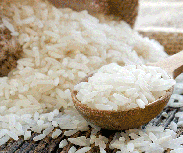
A paddy field is a flooded parcel of arable land used for growing semiaquatic rice. Paddy cultivation should not be confused with cultivation of deep water rice, which is grown in flooded conditions with water more than 50 cm (20 in) deep for at least a month. Genetic evidence shows that all forms of paddy rice, both indica and japonica, spring from a domestication of the wild rice Oryza rufipogon that first occurred 8,200-13,500 years ago South of the Yangtze River in present-day China. However, the domesticated indica subspecies currently appears to be a product of the introgression of favorable alleles from japonica at a later date, so that there are possibly several events of cultivation and domestication. Paddy fields are the typical feature of rice farming in east, south and southeast Asia. Fields can be built into steep hillsides as terraces and adjacent to depressed or steeply sloped features such as rivers or marshes. They can require a great deal of labor and materials to create, and need large quantities of water for irrigation. Oxen and water buffalo, adapted for life in wetlands, are important working animals used extensively in paddy field farming. More information on the subject is available on Wikipedia In Italy, rice cultivation is mainly concentrated in the lower Padana and in the narrow strip until the pre-Alps between Lombardy and Piedmont; in particular the Lomellina and the low province of Milan in Lombardy and Novarese and Vercellese in Piedmont. Still, in Lombardy, rice cultivation takes place in Mantua. Veneto and Emilia-Romagna, particularly in the province of Verona and in the Polesine region, and in the province of Ferrara, are also areas where cultivation occurs. Sardinia also offers cultivation areas in the Campidanese plain near Oristano. For the eighteenth century and until the mid-nineteenth century rice was cultivated in almost all of Sicily's flatland plains and production centres such as Lentini, the Piana di Catania, the territories of Simeto between Centuripe, Adrano and Paternò, Calatabiano, Vittoria and Bivona. Other extinct production areas were located in the low plains of Bologna and in the lower Ferrara, where the most important areas were between Molinella and Argenta and the Valle dei Mezzano. The rice field area from the natural point of view was very important because it housed a large part of the European heron population, concentrated in nesting areas called gauze. In recent years, due changes in water cycle management techniques and the diffusion of dry rice paddies, the natural value of paddy fields has decreased considerably due to ecological malaise, including abnormal mosquito proliferation.
This week we feature Vercelli, which is located on the right bank of Sesia River in Italy. Vercelli and the surrounding plains are an important agricultural and commercial centre for rice cultivation. In fact in this comparision of images acquired by the Copernicus Sentinel-2 satellite we aim to show the fields before and during the phases of rice cultivation. In particular, the image acquired at the end of April uses a combination of bands in false colour (two bands in visible and one in near infrared), and shows the fields are artificially flooded to allow the cultivation of this precious food. 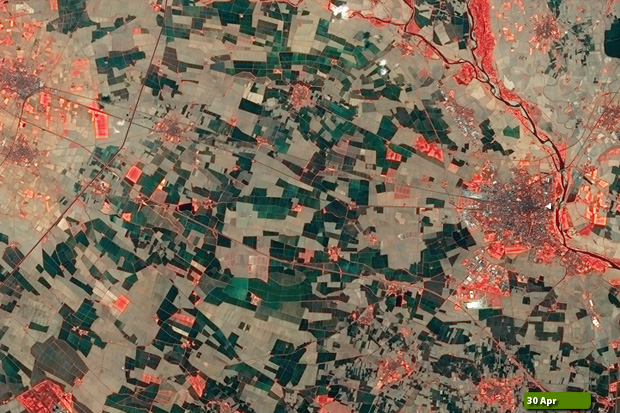  View Sentinel-2 high resolution image (Before) (JPG 11.9 MB) View Sentinel-2 high resolution image (During) (JPG 9.0 MB)
|
|||||||||||||||||||