 Venice, Italy
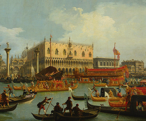
Venice is a city in northeastern Italy and the capital of the Veneto region. It is situated across a group of 118 small islands that are separated by canals and linked by bridges, of which there are 400. The islands are located in the shallow Venetian Lagoon, an enclosed bay that lies between the mouths of the Po and the Piave Rivers. Parts of Venice are renowned for the beauty of their settings, their architecture, and artwork. The lagoon and a part of the city are listed as a World Heritage Site. In 2014, 264,579 people resided in Comune di Venezia, of whom around 55,000 live in the historic city of Venice (Centro storico). Together with Padua and Treviso, the city is included in the Padua-Treviso-Venice Metropolitan Area (PATREVE), with a total population of 2.6 million. PATREVE is only a statistical metropolitan area. The name is derived from the ancient Veneti people who inhabited the region by the 10th century BCE. The city was historically the capital of the Republic of Venice. Venice has been known as the "La Dominante," "Serenissima," "Queen of the Adriatic," "City of Water," "City of Masks," "City of Bridges," "The Floating City," and "City of Canals." The Republic of Venice was a major financial and maritime power during the Middle Ages and Renaissance, and a staging area for the Crusades and the Battle of Lepanto, as well as a very important centre of commerce (especially silk, grain, and spice) and art in the 13th century up to the end of the 17th century. The City State of Venice is considered to have been the first real international financial centre which gradually emerged from the 9th century to its peak in the 14th century. This made Venice a wealthy city throughout most of its history. It is also known for its several important artistic movements, especially the Renaissance period. After the Napoleonic Wars and the Congress of Vienna, the Republic was annexed by the Austrian Empire, until it became part of the Kingdom of Italy in 1866, following a referendum held as a result of the Third Italian War of Independence. Venice has played an important role in the history of symphonic and operatic music, and it is the birthplace of Antonio Vivaldi. Venice has been ranked the most beautiful city in the world as of 2016. The city is facing some major challenges, however, including financial difficulties, erosion, pollution, subsidence, an excessive number of tourists in peak periods and problems caused by oversized cruise ships sailing close to the banks of the historical city. More information is available on Wikipedia
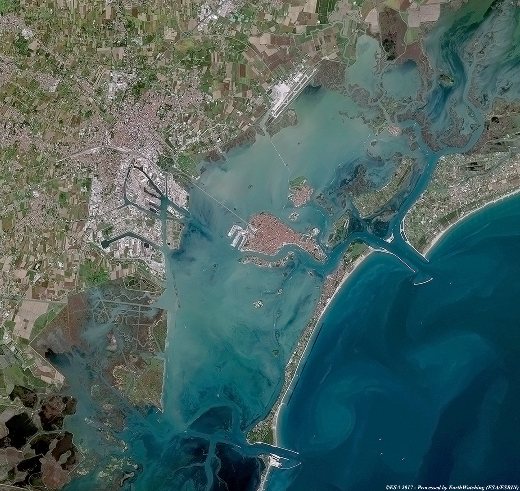
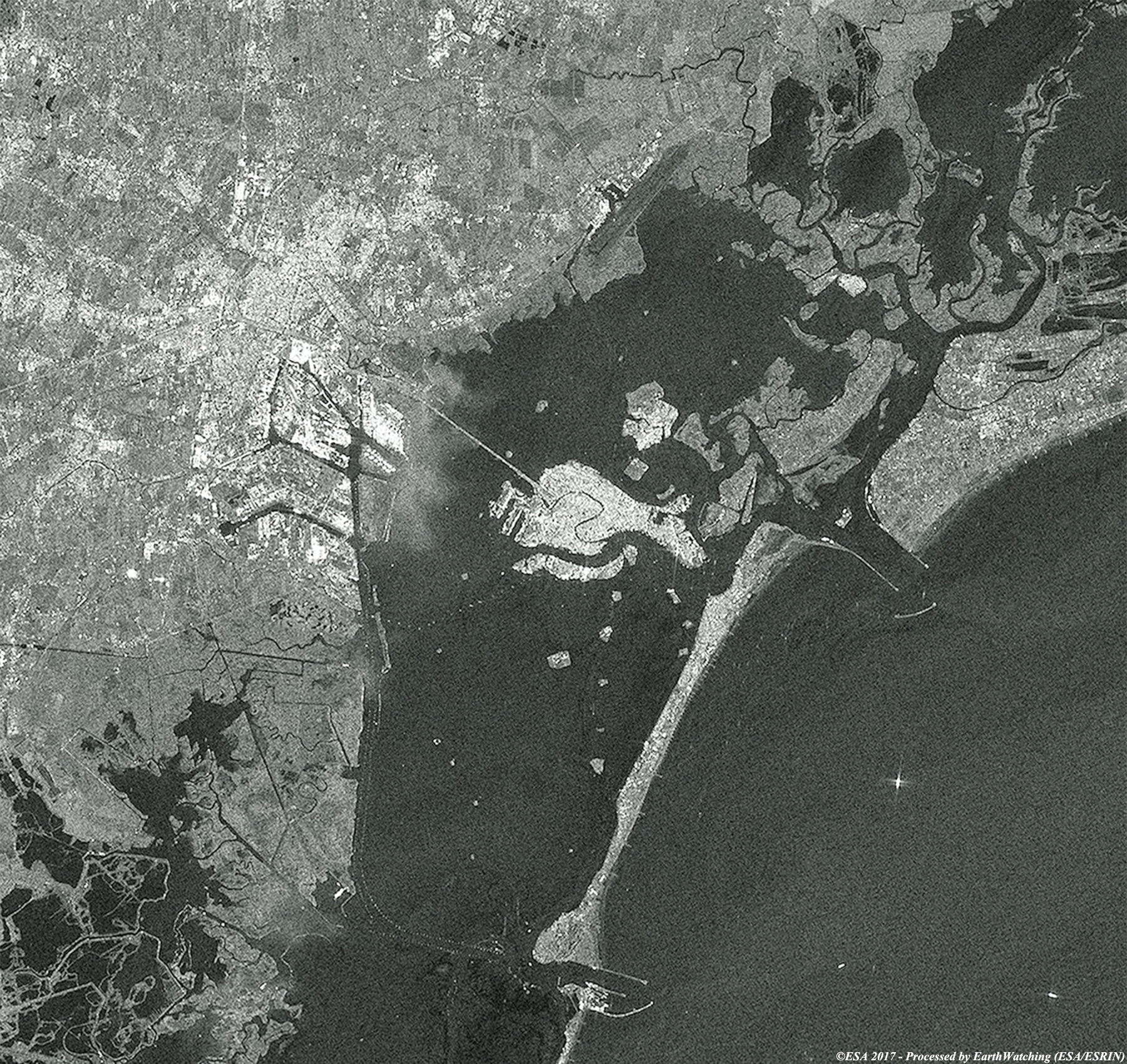
Our last image comparison of 2017 takes us to Venice (in Italian Venezia). Modern Venice has faced many challenges, including loss of population to other areas and physical damage from flooding, subsidence, erosion, air and water pollution, and age. After devastating floods in 1966, an international effort to preserve historic Venice was coordinated by UNESCO, and many structures were renovated and preserved. Flooding has occurred throughout the history of the city; it is caused when high tides combine with storm winds, and has been combated with experiments using mechanical barriers. The sinkage of buildings and other structures, caused by the drainage of underground aquifers, has been addressed by limits on groundwater usage and the construction of an aqueduct from the Alps nearby. However, since the early 20th century, Venice has sunk 23 cm (12 in) deeper into the lagoon and in 2003 work began on a multi-billion dollar anti-flood project to protect the city from further sinkage. The construction of a 1.6 km long mobile defence barrier that will shut off high tides is scheduled for completion by 2018. With this demonstration of images taken by the Sentinel-2 (optical sensor) and Sentinel-1 (radar SAR instrument), we aim to show the large field of application that the Copernicus satellite family can provide for monitoring urban areas. 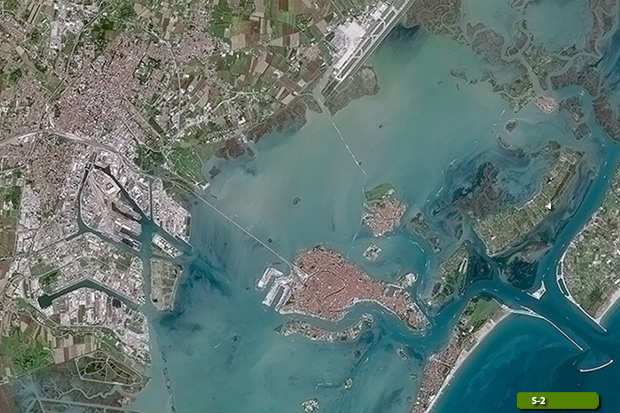 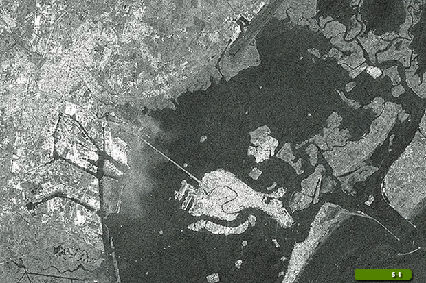 View Sentinel 2 high resolution image (JPG 2.2 MB) View Sentinel 1 high resolution image (JPG 2.1 MB)
|
|||||||||||||||||||