 Valencia, Spain
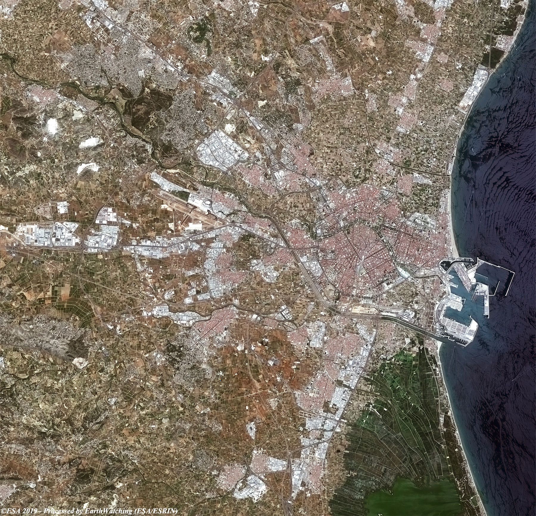
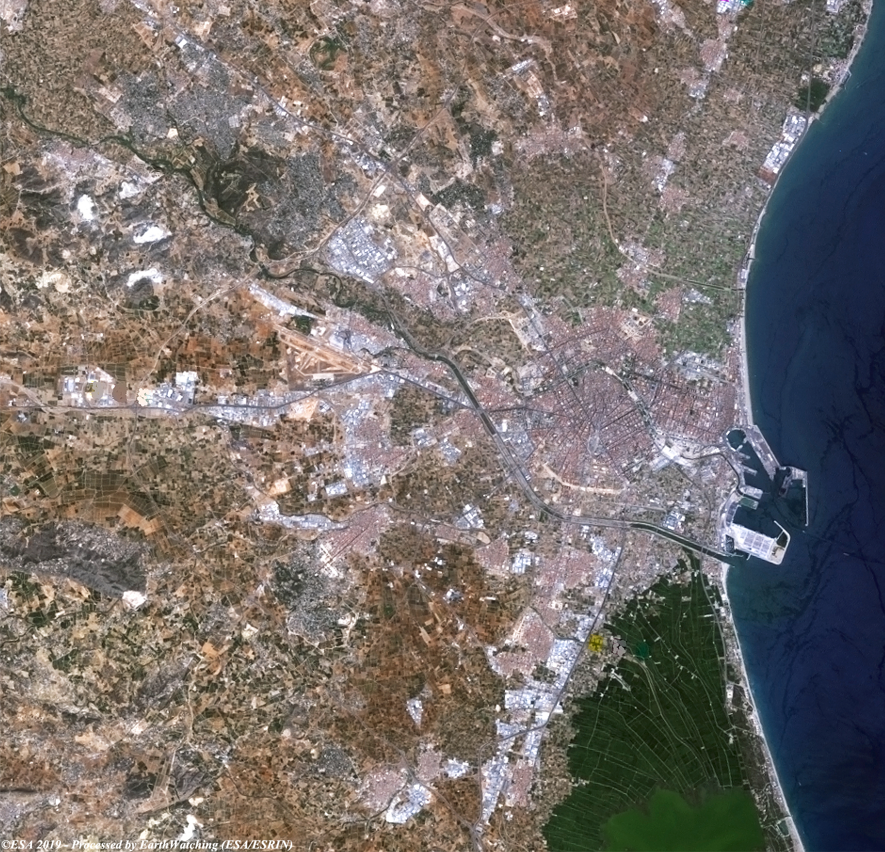
This week, our comparison uses optical images from USGS's Landsat-7 and the Copernicus Sentinel-2 mission to look at Valencia in Spain. The aim of this comparison is to demonstrate how the city has developed to show to the users how the city of Valencia has evolved and developed since 2000, particularly in the metropolitan areas. Valencia is one of the busiest ports in Europe and on the Mediterranean Sea, and the comparison shows that the port area has received major development, with new facilities to accommodate recreational tourism and cruise ships, and for the container ships. The city is the third largest in Spain and it is also the third largest metropolitan area. Valencia is located on the banks of the Turia River, located on the east coast of the Iberian Peninsula and in the western part where the Turia River meets the Mediterranean Sea, facing the Gulf of Valencia. It is known for the City of Arts and Sciences, a complex which includes futuristic structures including a planetarium, an oceanarium and an interactive museum. Not far from the city is the park of Albufera, a reserve of marshes with a lake and paths. Over the years the city has become one of the most popular destinations in Europe, a circumstance that has led tourism becoming the first economic resource of the city. 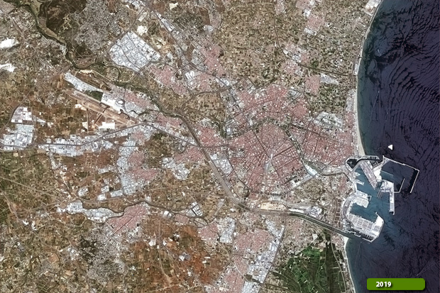 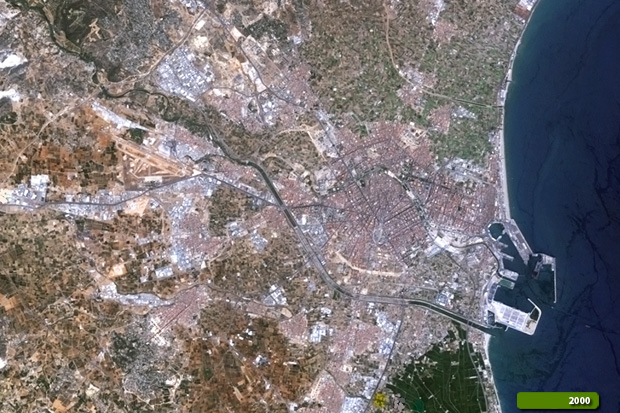 View Sentinel-2 high resolution image (JPG 3.9 MB) View Landsat 7 high resolution image (JPG 3.2 MB)
|
|||||||||||||||