 Tigris-Euphrates River System
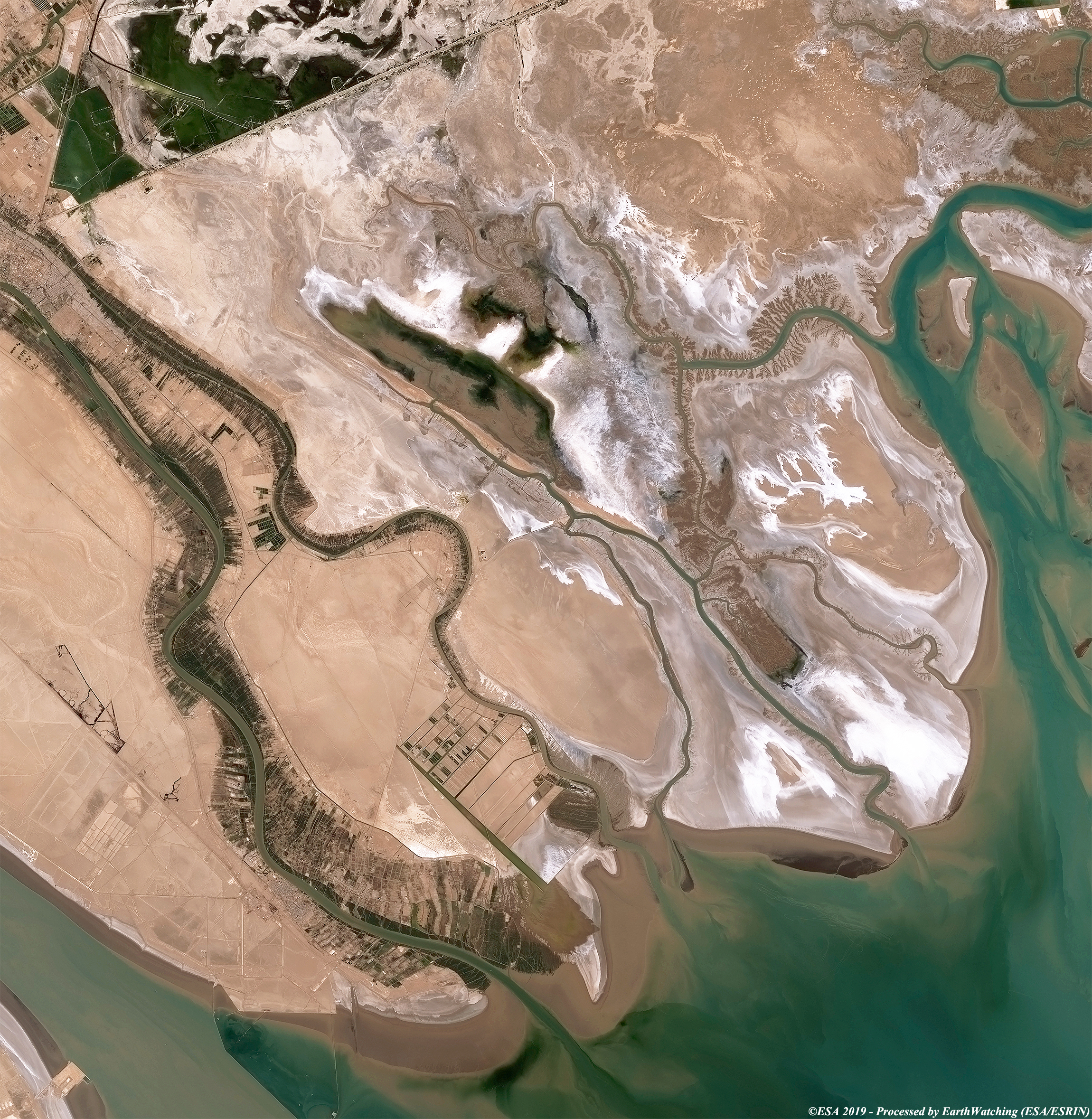
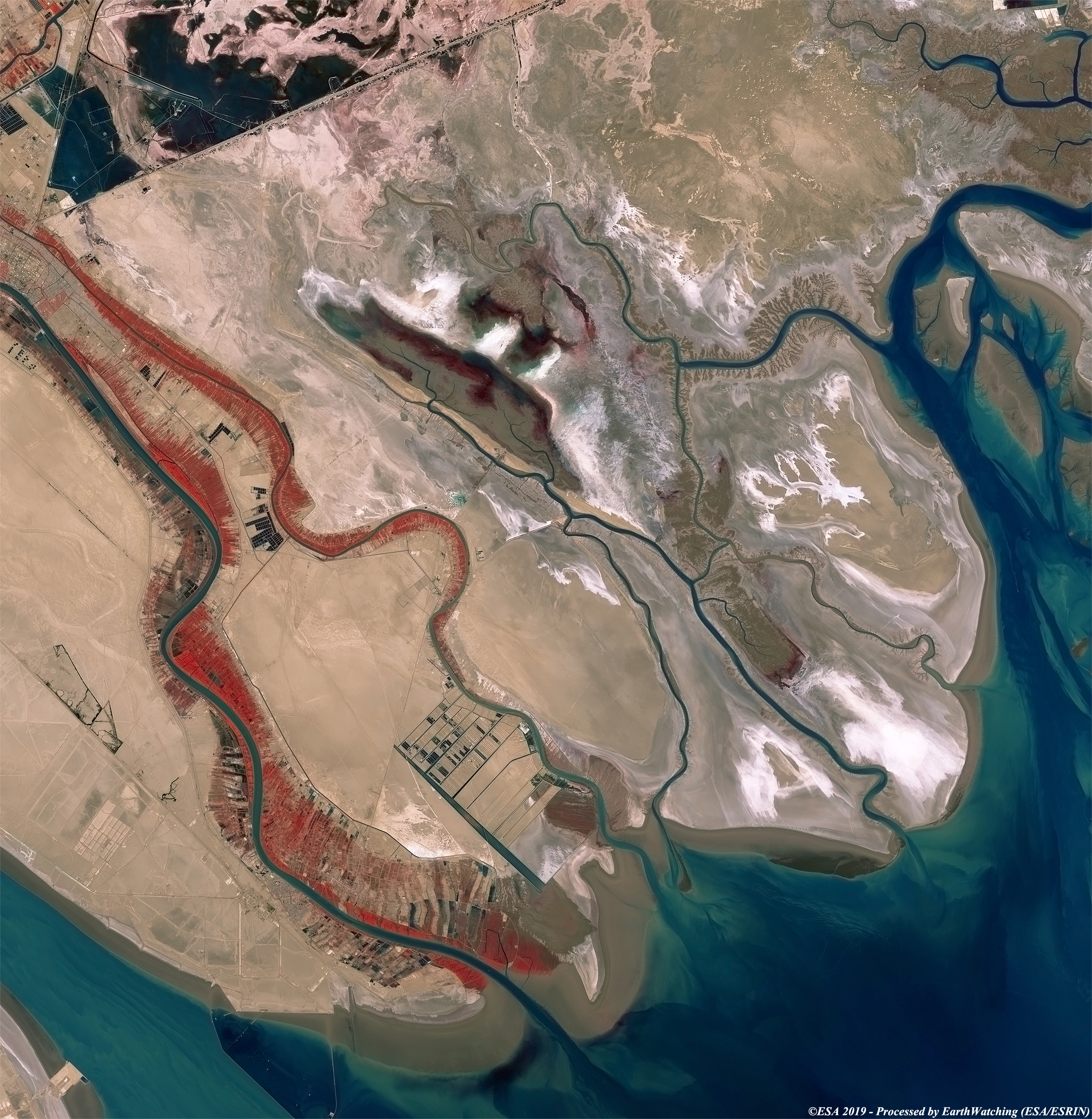
This image acquired by the Copernicus Sentinel–2 satellite in September 2019, shows the waters of the Tigris and Euphrates mix with the salty waters of the sea. The images are processed in two different bands, natural and in infrared false colour. In southern Iraq, the Euphrates joins the Tigris to become the Shatt Al Arab, which then flows into the Persian Gulf. The ancient countries of Assyria, Babylon and Sumer developed in the valley of the Euphrates and Tigris rivers. 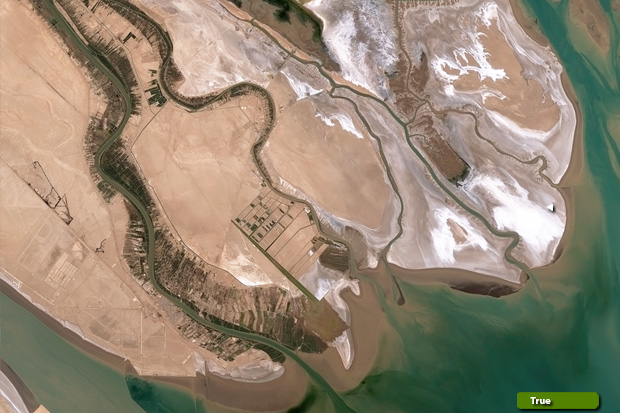 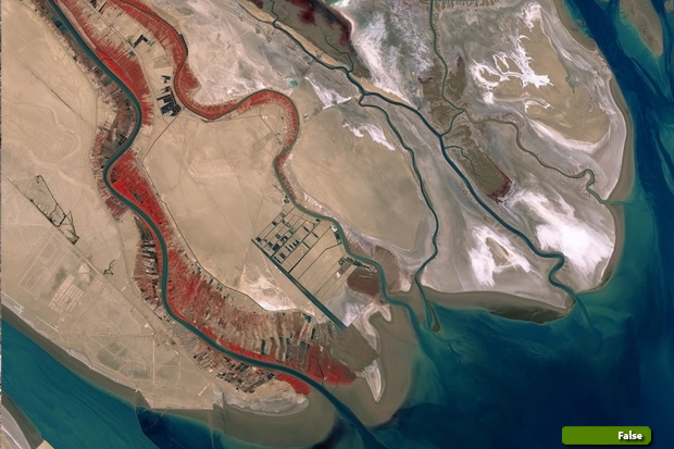 Sentinel-2 high resolution image (natural color) (JPG 5.6 MB) Sentinel-2 high resolution image (false color) (JPG 5.0 MB)
|
||||||||||||||||