 Taal Volcano, Philippines
Taal volcano has erupted pushing streams of lava, dark ash clouds and steam 14km into the air. The Philippine Institute of Volcanology and Seismology (PHIVOLCS) requested a total evacuation of everyone within a 17km radius of the volcano, affecting around half a million people. Volcanic ash has spread 100km and as far north as Quezon city forcing the airport to close temporarily. More than 25 million people are living within 100km of the volcano and could be affected with contaminated air and water. The images below were acquired by the Copernicus Sentinel-2 satellite on 23 January, just 11 days after its eruption. By 26 January PHIVOLCS observed inconsistent, but decreasing volcanic activity in Taal, prompting the agency to downgrade its warning to alert level 4 to level 3. Read more on the Disasters Charter and Wikipedia websites. 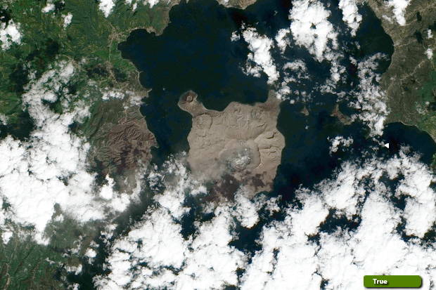 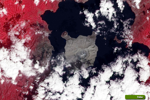 View high resolution image in natural colour (JPG 6.4 MB) View high resolution image in false colour (JPG 7.2 MB)
|
||||||||||||||||