 Sydney, Australia
This week the Copernicus Sentinel-2 mission takes us over the city of Sydney, the state capital of New South Wales and the most populous city in Australia and Oceania. Sydney is a coastal basin with the Tasman Sea to the east, the Blue Mountains to the west, the Hawkesbury River to the north, and the Woronora Plateau to the south. Sydney spans two geographic regions. The Cumberland Plain lies to the south and west of the Harbour and is relatively flat. The Hornsby Plateau is located to the north and is dissected by steep valleys. The Copernicus Sentinel-2 images overlaid below are processed in True and False colour to highlight urban areas. 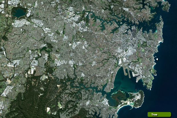 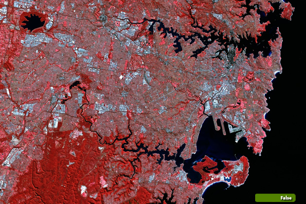 View Sentinel-2 high resolution image (True) (JPG 7.5 MB) View Sentinel-2 high resolution image (False) (JPG 8.5 MB)
|
||||||||||||||||