 Fires in Santa Rosa, California
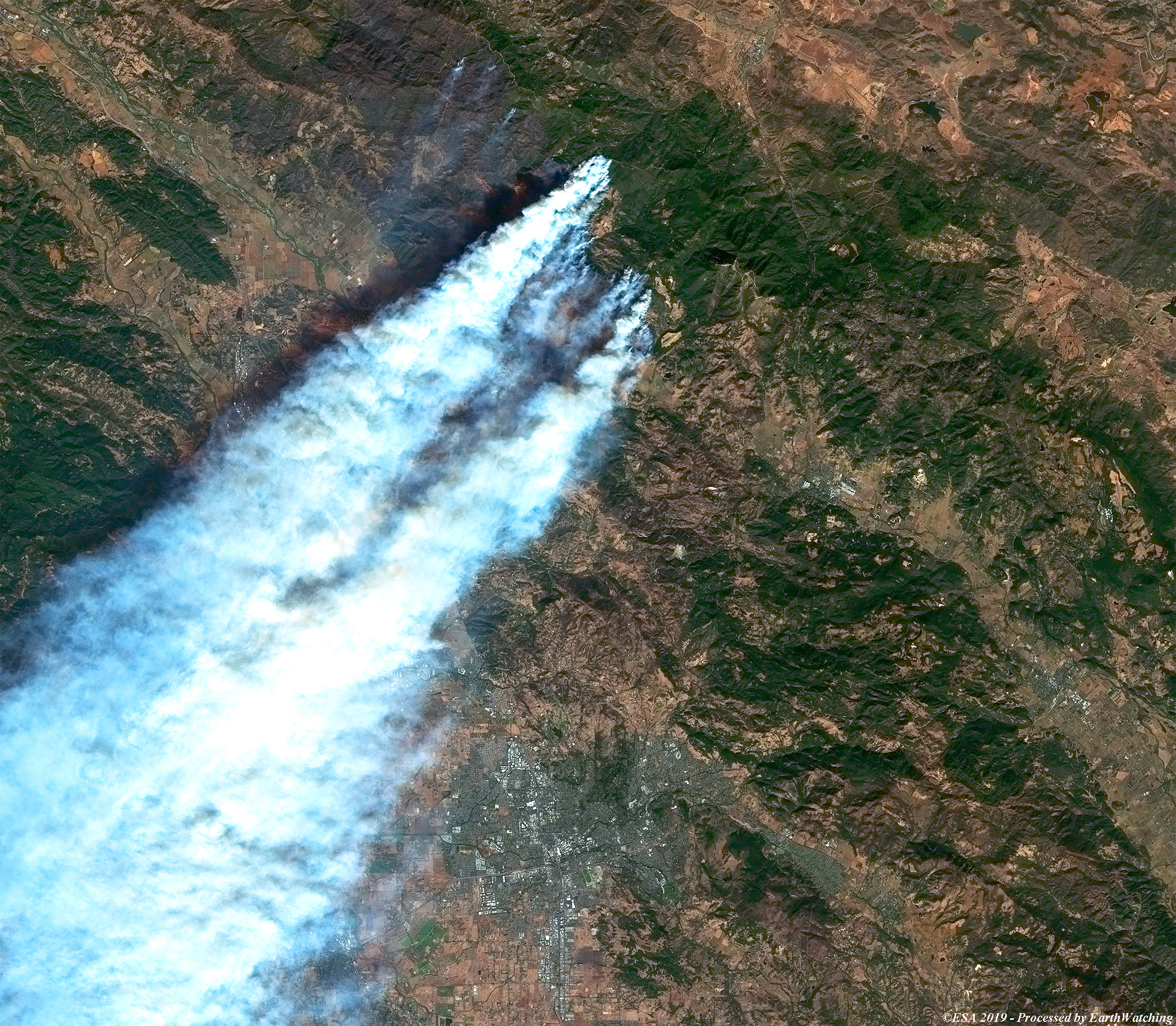
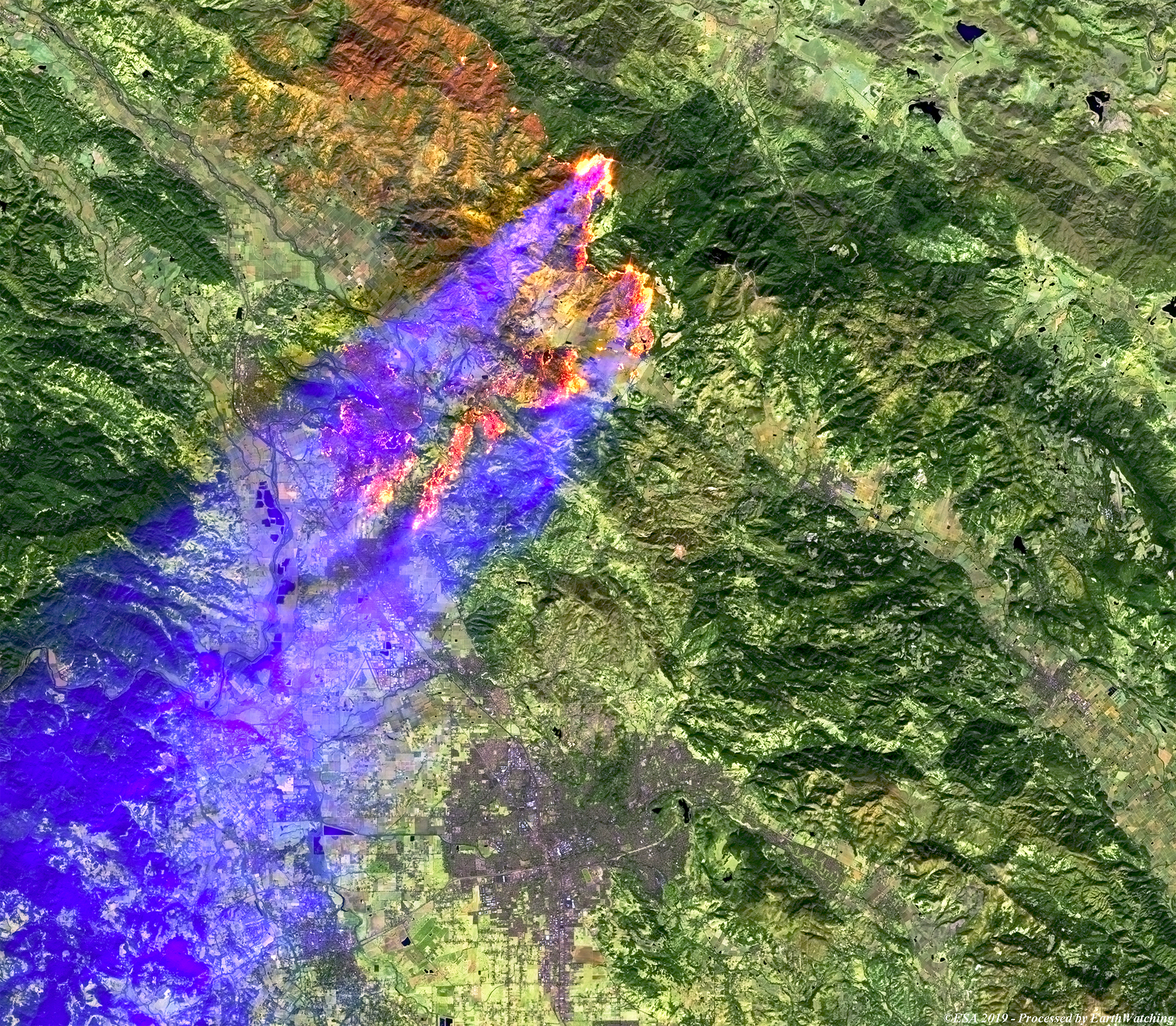
This Copernicus Sentinel-2 image acquired on 27 October 2019, shows the north of Santa Rosa, California, and the large fires that are currently burning there. Using a combinations of bands, in natural (4,3,2) and infrared (12,11,4), these images aim to show the intensity of the Kincade fires and enhance the plumes of smoke whcih are spreading across the state of California. The current winds, temperatures and humidity have promted the National Weather Service to raise the warning to its highest possible level. A state of emergency has also been declared in Los Angeles and Sonoma counties.
Power cuts are expected to affect up to 1.5 million people across California and surrounding states. 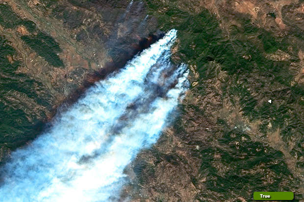 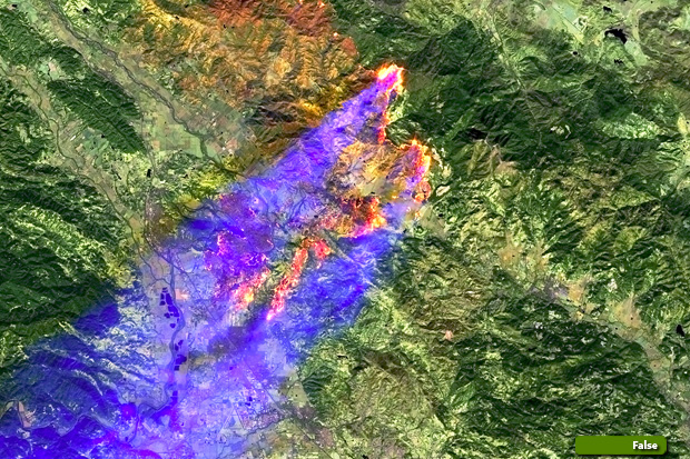 View high resolution image (Natural Colour) (JPG 5.8 MB) View high resolution image (Infrared Colour) (JPG 6.0 MB)
|
||||||||||||||||