 Rovaniemi, Finland
Rovaniemi is a city and municipality of Finland. It is the administrative capital and commercial centre of Finland's northernmost province, Lapland. It is situated about 6 kilometres south of the Arctic Circle and is between the hills of Ounasvaara and Korkalovaara, at the confluence of the river Kemijoki and its tributary, the Ounasjoki. The city and the surrounding Rovaniemen maalaiskunta (Rural municipality of Rovaniemi) were consolidated into a single entity on 1 January 2006. The new municipality has an area of 8,016.75 square kilometres, thus making it the largest city in the European Union by land. Rovaniemi has an approximate population of 63,000. Rovaniemi is a unilingual Finnish-speaking municipality and uncommonly for larger Finnish towns, it is also known by its Finnish name and spelling in the Swedish language.
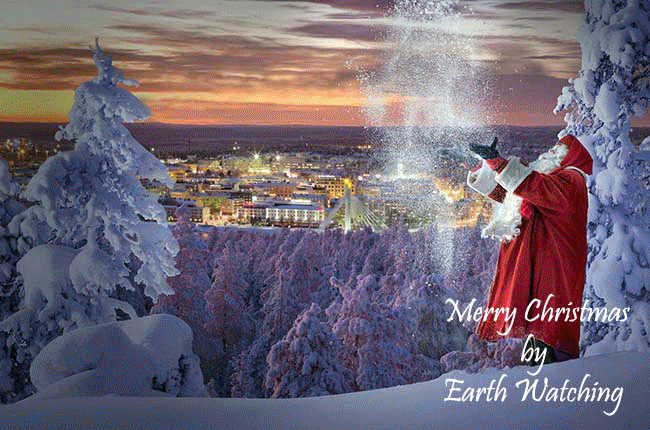
Over 100 years ago, the word spread about Ear Mountain and the existence of its inhabitants. Santa wanted to safeguard his secret hiding place and came up with the idea to visit the village of Rovaniemi which allowed him to meet people who love Christmas and his many friends who come to greet him.
In 1950 the Roosevelt Cabin (named after Eleanor Roosevelt) was built as an exhibition related to the history of tourism at the Arctic Circle.
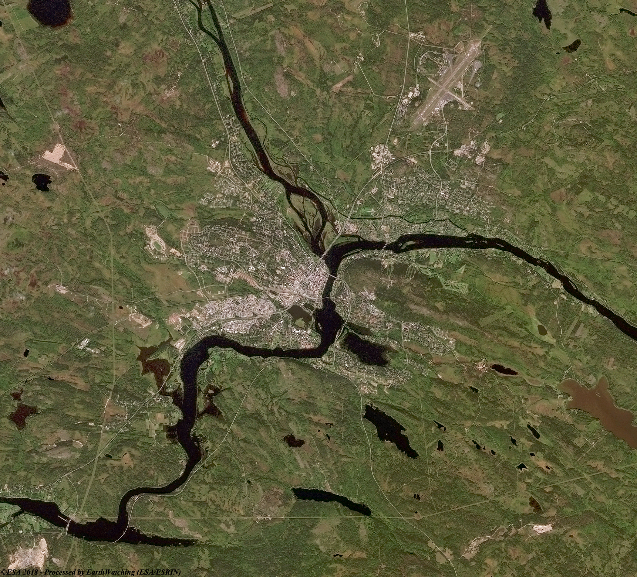
Today the Santa Claus Village of Rovaniemi recieves thousands of visitors from around the world each year. These images from the Coperncius Sentinel-2 satellite captured in September 2017 and March 2018 show the village and its surrounding areas.
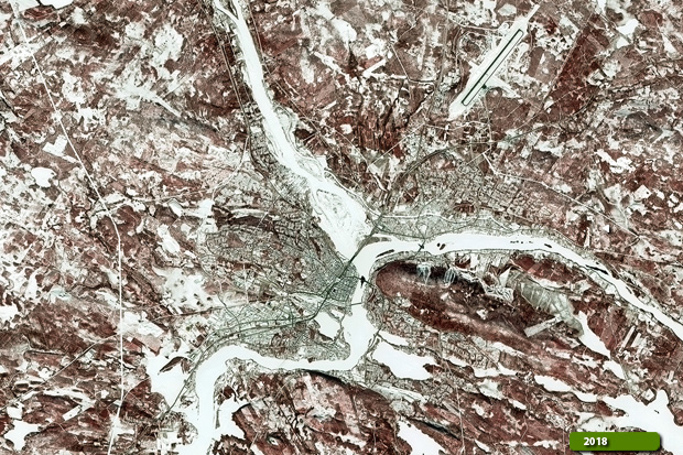 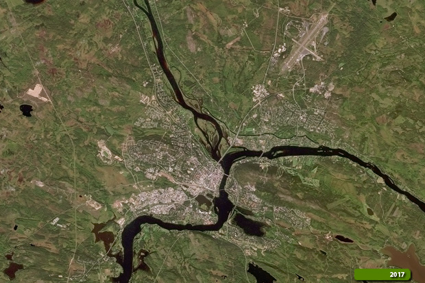 View Sentinel 2 high resolution image in false color (JPG 6.9 MB) View Sentinel 2 high resolution image in natural color (JPG 5.0 MB)
|
|||||||||||||||||||