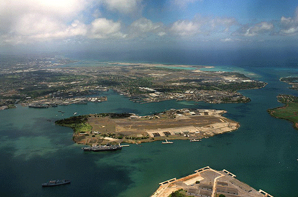
Pearl Harbor is a lagoon harbor on the island of Oahu, Hawaii, west of Honolulu. It has been long visited by the Naval fleet of the United States, before it was acquired from the Hawaiian Kingdom by the U.S. with the signing of the Reciprocity Treaty of 1875. Much of the harbor and surrounding lands is now a United States Navy deep-water naval base. It is also the headquarters of the United States Pacific Fleet. The U.S. government first obtained exclusive use of the inlet and the right to maintain a repair and coaling station for ships here in 1887. The attack on Pearl Harbor by the Empire of Japan on December 7, 1941, was the immediate cause of the United States' entry into World War II.
More information is available on Wikipedia.
|
Pearl Harbor (Island of Oahu)
|
|
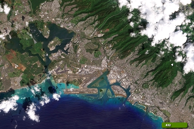
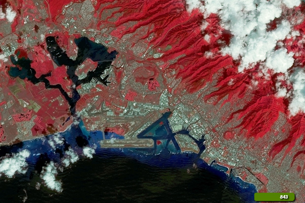
Sentinel -2 images acquired over the area
|
These images acquired from the Sentinel 2 satellite and processed in natural & false color bands, show Pearl Harbour. It is an inlet of the island of Oahu, Hawaii, about 10 km west of Honolulu, and the site of one of the principal naval bases of the United States. The United States government first obtained exclusive use of the inlet and the right to maintain a repair and coaling station for ships here in 1887. The harbour was surveyed then and later, but improvements were not begun until after the United States annexed the Hawaiian Islands in 1898. In 1911 the work of dredging a wide channel from the sea, across the sandbar and coral reef at the mouth of the harbour, was completed. The channel is about 11m deep, and the harbour has a maximum depth of 18m, making it available to the largest naval vessels.
View large format slider
View Sentinel-2 high resolution image (Natural Color) (JPG 7.3 MB)
View Sentinel-2 high resolution image (False Color) (JPG 7.5 MB)
|
Technical Information of original image |
|
Product: |
Geo Tiff format |
|
Satellite/Sensor: |
Sentinel-2 |
|
Resolution: |
10 metres (Optical) |
|
Acq. Date: |
21 Oct 2018 |
|
Band Combination used to create this image: |
4, 3, 2 (Visible color) & 8,4,3 (False Color) R-G-B bands |
Back to top
 Pearl Harbor, Hawaii