 Niagara Falls
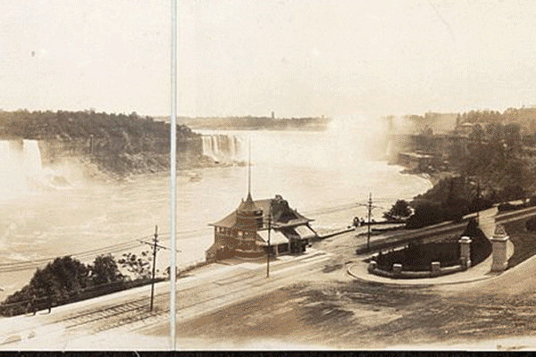
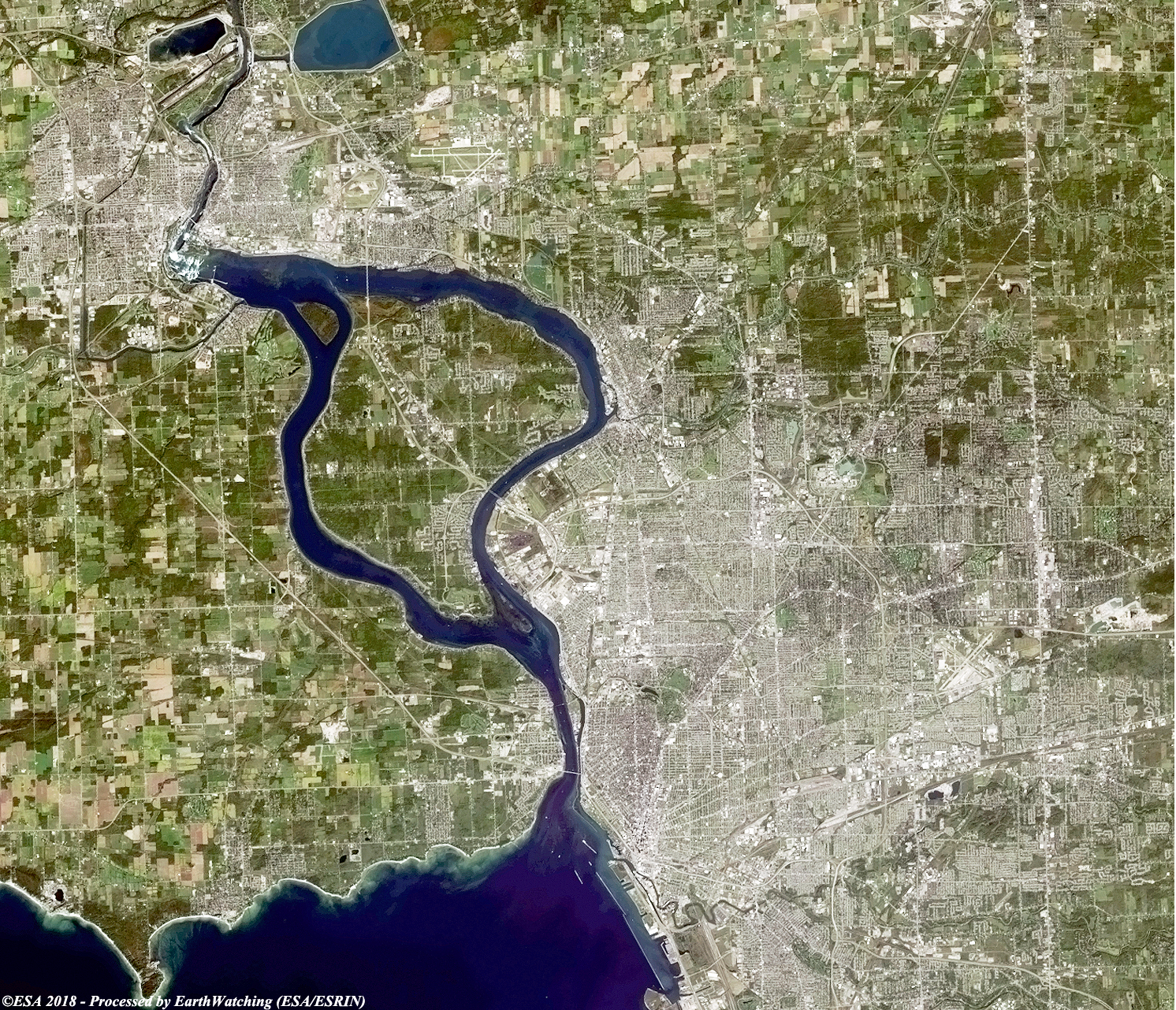
Niagara Falls is the collective name for three waterfalls that straddle the international border between the Canadian province of Ontario and the American state of New York. They form the southern end of the Niagara Gorge. From largest to smallest, the three waterfalls are the Horseshoe Falls, the American Falls and the Bridal Veil Falls. The Horseshoe Falls lies on the border of the United States and Canada with the American Falls entirely on the United States' side, separated by Goat Island. The smaller Bridal Veil Falls are also on the United States' side, separated from the American Falls by Luna Island. Located on the Niagara River, which drains Lake Erie into Lake Ontario, the combined falls form the highest flow rate of any waterfall in North America that has a vertical drop of more than 50 metres. During peak daytime tourist hours, more than 168,000 m3 of water goes over the crest of the falls every minute. Horseshoe Falls is the most powerful waterfall in North America, as measured by flow rate. The falls are 27 kilometres north-northwest of Buffalo, New York, and 121 kilometres south-southeast of Toronto, between the twin cities of Niagara Falls, Ontario, and Niagara Falls, New York. Niagara Falls was formed when glaciers receded at the end of the Wisconsin glaciation (the last ice age), and water from the newly formed Great Lakes carved a path through the Niagara Escarpment en route to the Atlantic Ocean. Niagara Falls is famed both for its beauty and as a valuable source of hydroelectric power. Balancing recreational, commercial, and industrial uses has been a challenge for the stewards of the falls since the 19th century. More information is available on Wikipedia
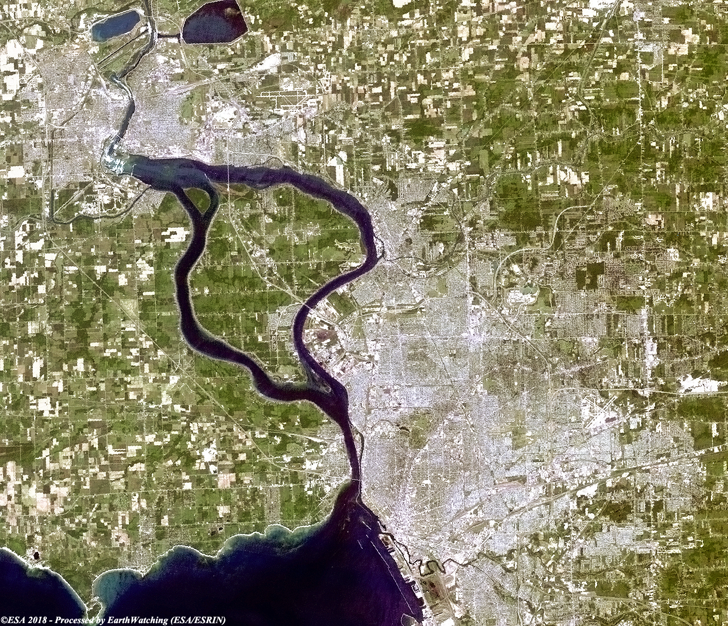
These images acquired by the Landsat 5, 8 and Sentinel-2 satellites, show the Niagara falls, with the Landsat images being 25 years apart. The Niagara Falls were formed over 12,000 years ago, when glaciers retreated north, allowing water from Lake Erie to flow over the Niagara Escarpment, a ridge that extends from southern Ontario to Rochester, New York. Since that time, erosion has slowly pushed the waterfall approx 11 km upstream, forming the Niagara Gorge. At present the Canadian Falls are receeding at an average yearly rate of about 1.5 metres, and the American Falls are being cut away at an annual pace of about 15 cm. The Canadian Falls erodes at a faster rate mainly because it carries more water.
Another aim of these images is to promote the opportunity to download Landsat data through the ESA portals (or third party mission free catalogue), where images captured every day are made available in near real time to the users and the scientific community, and with the use the new generation of Sentinel satellite by European Commission (Copernicus Project) to monitoring with high resolution every changes around the world. Landsat full resolution data products are freely available for immediate download at: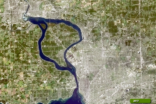 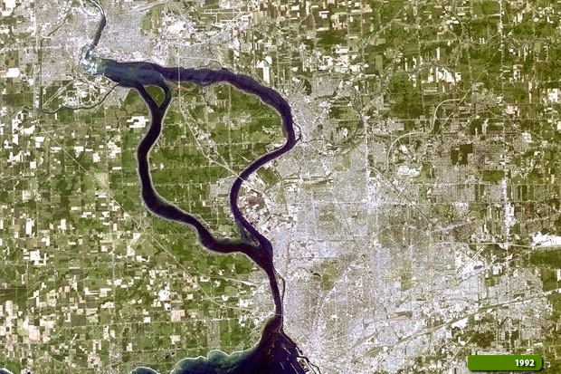 View large format slider in Visible Colour View Landsat 5 TM high resolution image (JPG 2.8 MB) View Landsat 8 OLI high resolution image (JPG 2.7 MB)
 View Sentinel-2 high resolution image (JPG 7.7 MB)
|
||||||||||||||||||||||||||||||||||