 New South Wales, Australia
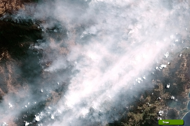
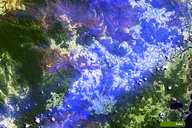
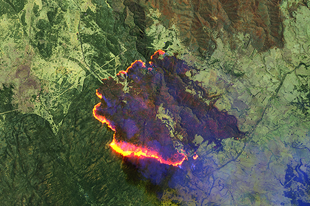
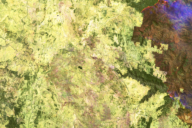
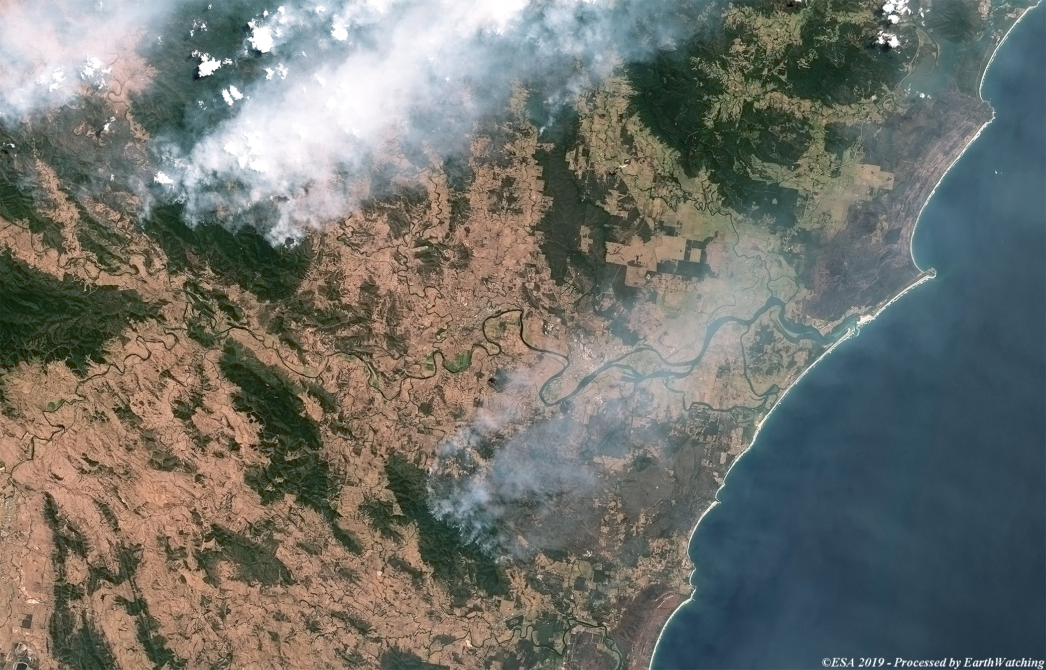
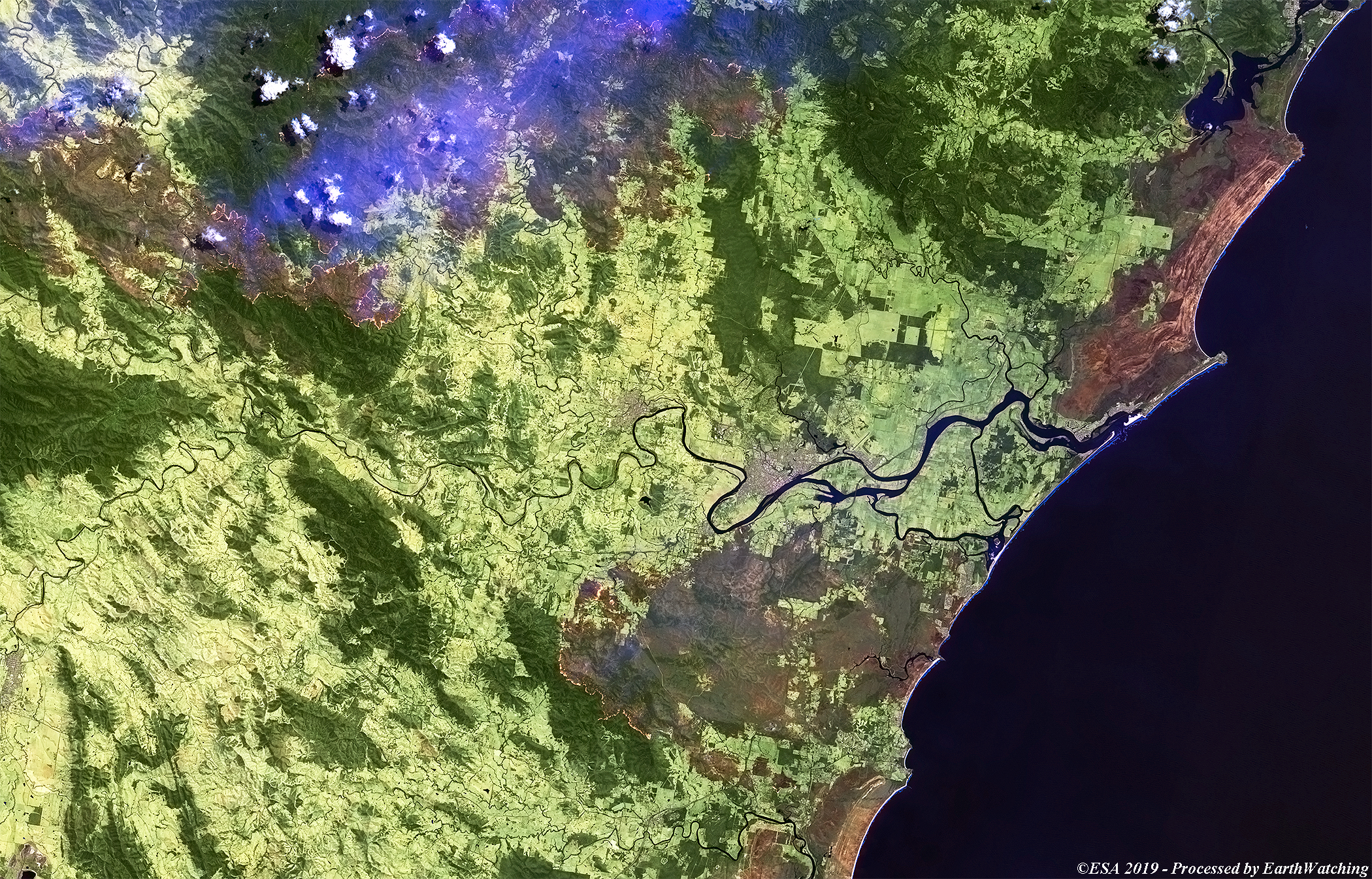
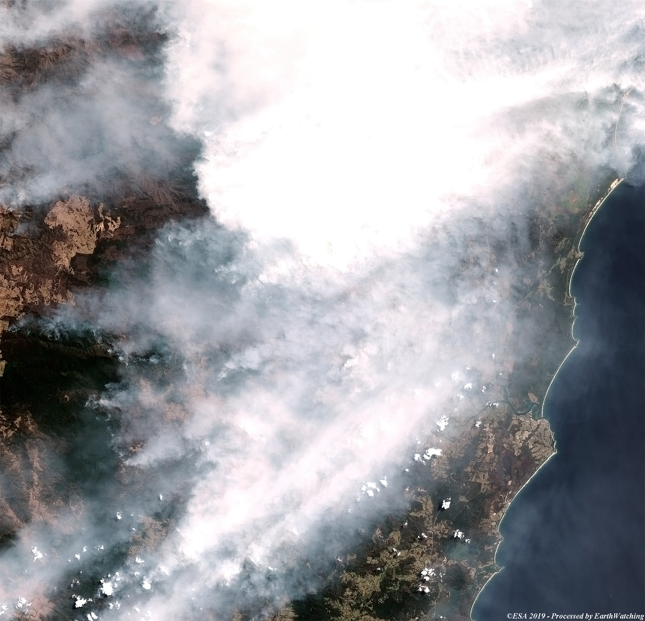
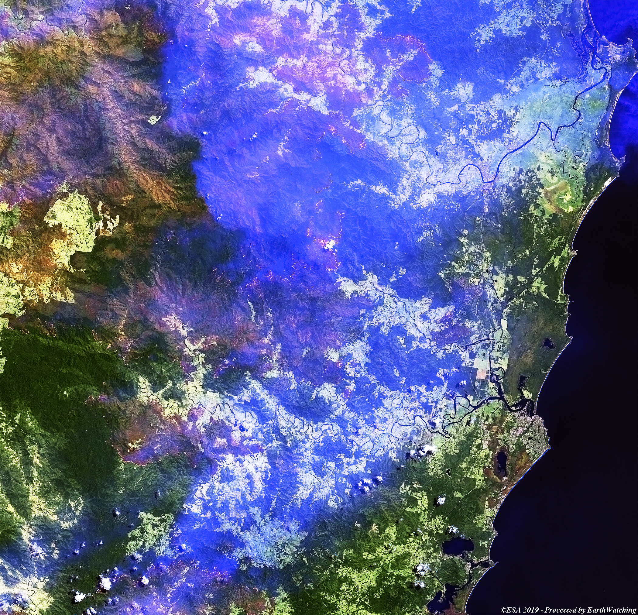
New South Wales is featured in these images acquired on 12 November 2019 by the Sentinel-2 satellite, which show large wildfires affecting the area. Around 150 fires are burning near the coastline and are being tackled by fire teams and the military. Plumes of smoke are visible in the true colour imagery while in the images in false colour show more detail to the areas of burned forest (brown areas). The fires have razed about 300 homes, and burnt through over 1 million hectares of land in New South Wales. With little sustained rainfall forecast for the coming months, the fires could burn for weeks and even months. More information on the BBC website. 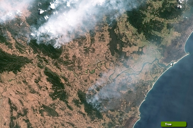 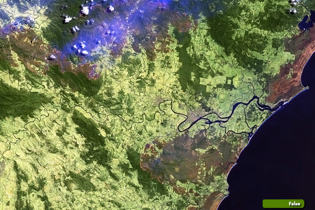 View large format slider (Area A) acquired on 12 Nov 2019 View high resolution (True colour) (JPG 3.2 MB) View high resolution (False colour) (JPG 3.5 MB)
  View large format slider (Area B) acquired on 12 Nov 2019 View high resolution image (True colour) (JPG 2.8 MB) View high resolution image (False colour) (JPG 6.0 MB)
View high resolution image (JPG 5.0 MB)
View high resolution image (JPG 6.8 MB)
|
||||||||||||||||||||||||||||