 Morandi Bridge, Genoa, Italy
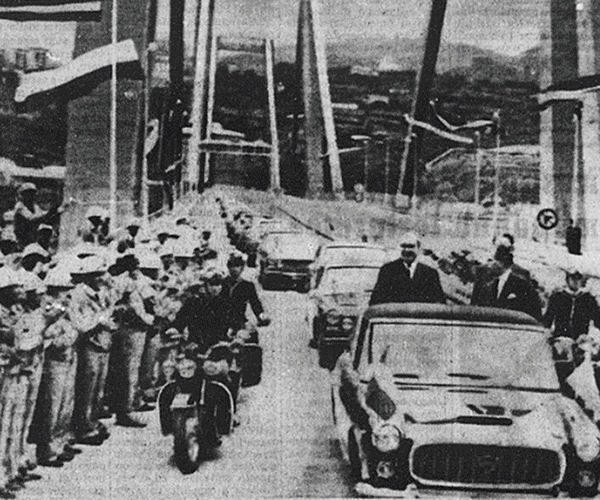
Morandi Bridge is part of the Polcevera viaduct on the A10 motorway in Genoa, Italy. The bridge, on one of the major links from Italy to France and part of the European route E80, crossed the Polcevera river between the Sampierdarena and Cornigliano districts of Genoa. The viaduct was built between 1963 and 1967, costing €2 million, and opened on 4 September 1967; the bridge was named after its designer, Riccardo Morandi. On 14 August 2018, the bridge partially collapsed. More information is available on Wikipedia
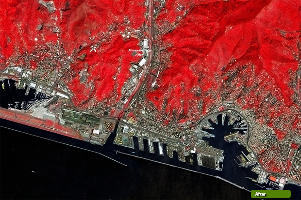
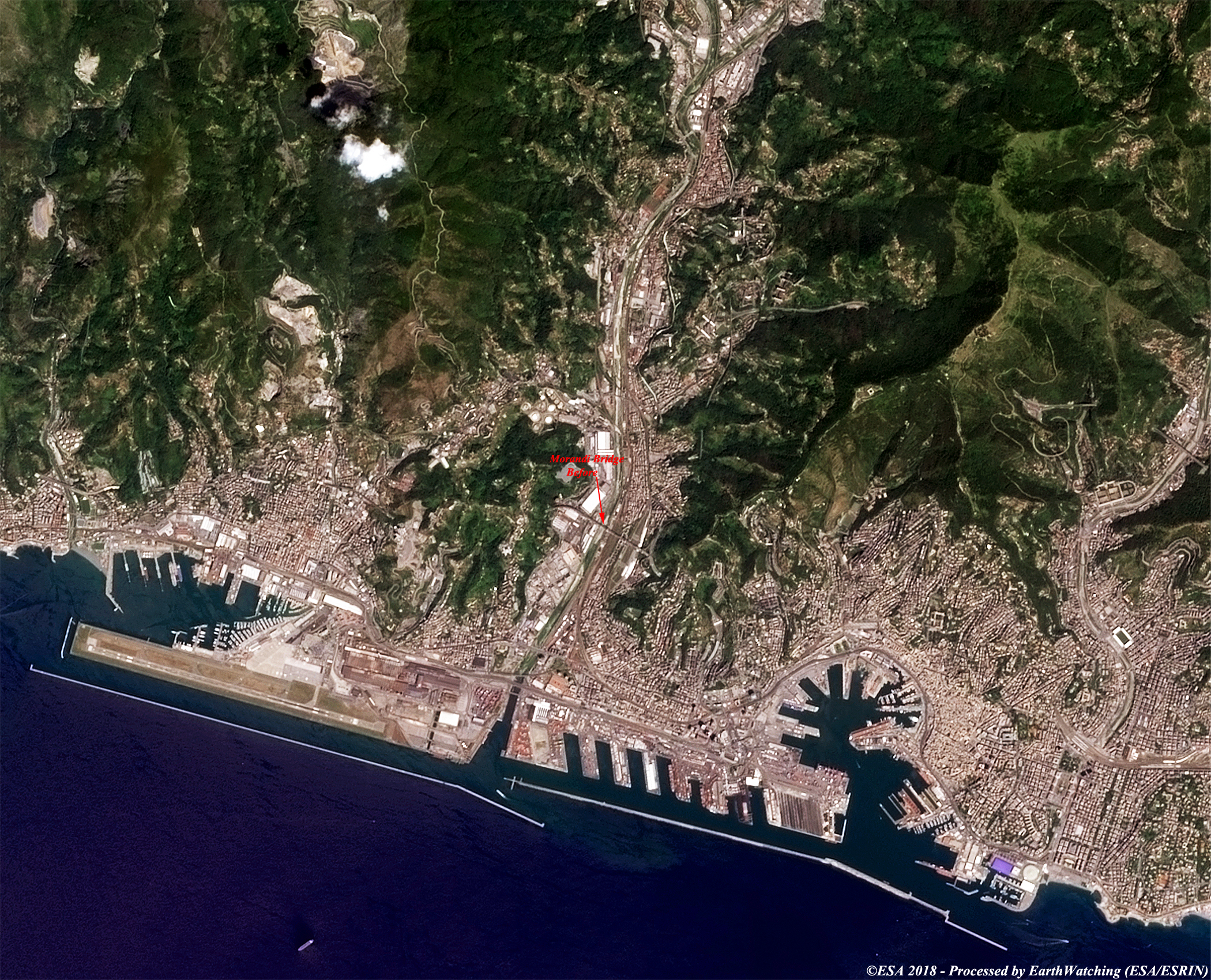
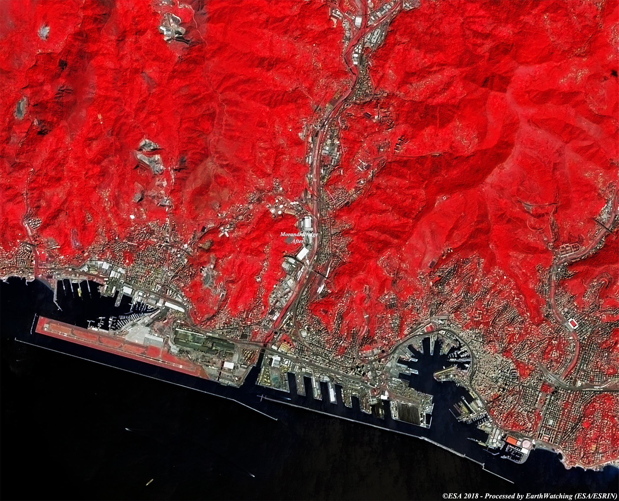
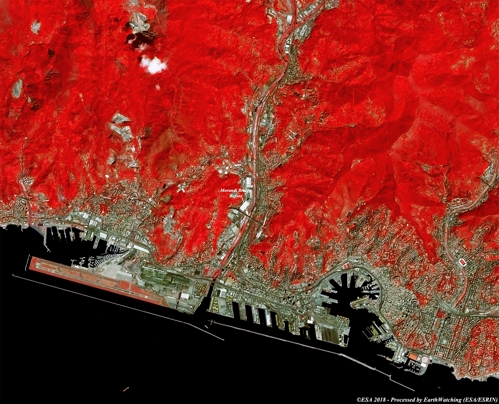
These images acquired by the Copernicus Sentinel-2 satellite show Morandi Bridge before and after it collapsed on the morning of 14 August 2018. This bridge on the A10 motorway in Italy connected Genoa to Savona and Ventimiglia. When the bridge collapsed large sections ended up in the Polcevera River, but some debris fell onto houses and industrial areas. The following images processed in band combinations in natural and false colour, show the stretch of viaduct that collapsed. This area is more clearly visible in the false colour image. The aim of these images is to promote to the users and the scientific community, the new generation of the European Commission's Copernicus Sentinel satellites which are capable of monitoring changes around the world with high resolution images. 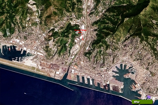 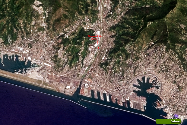 View large format slider in natural colour bands View Sentinel 2 high resolution image after (JPG 4.8 MB) View Sentinel 2 high resolution image before (JPG 4.3 MB)
 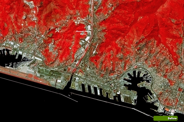 View large format slider in false colour bands View Sentinel 2 high resolution image after (JPG 4.1 MB) View Sentinel 2 high resolution image before (JPG 4.1 MB)
|
|||||||||||||||||||||||||||||||