 Mont Saint-Michel, France
Le Mont-St-Michel in Normandy, France, is a rocky islet on which sits an abbey church. The original Benedictine abbey was built in 966, and in the 11th century a Romanesque nave was added. Following a fire in the early 1200s a monastery was constructed. The Gothic choir was built 1450-1521, and the tower and spire were added in the 19th century. Known as "the Wonder of the West", the abbey and the surrounding bay were designated a UNESCO World Heritage Site in 1979.
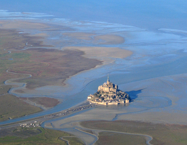
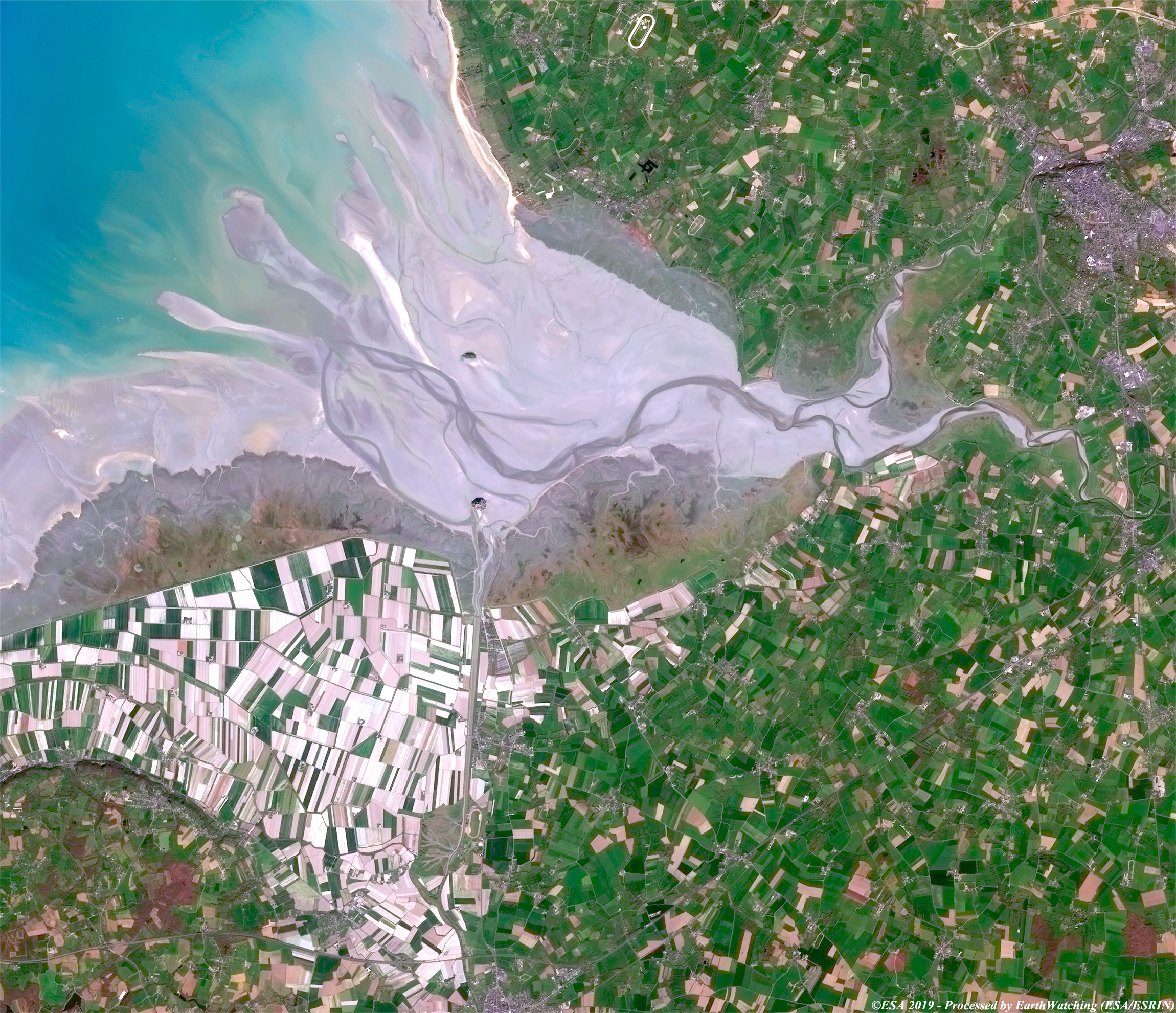
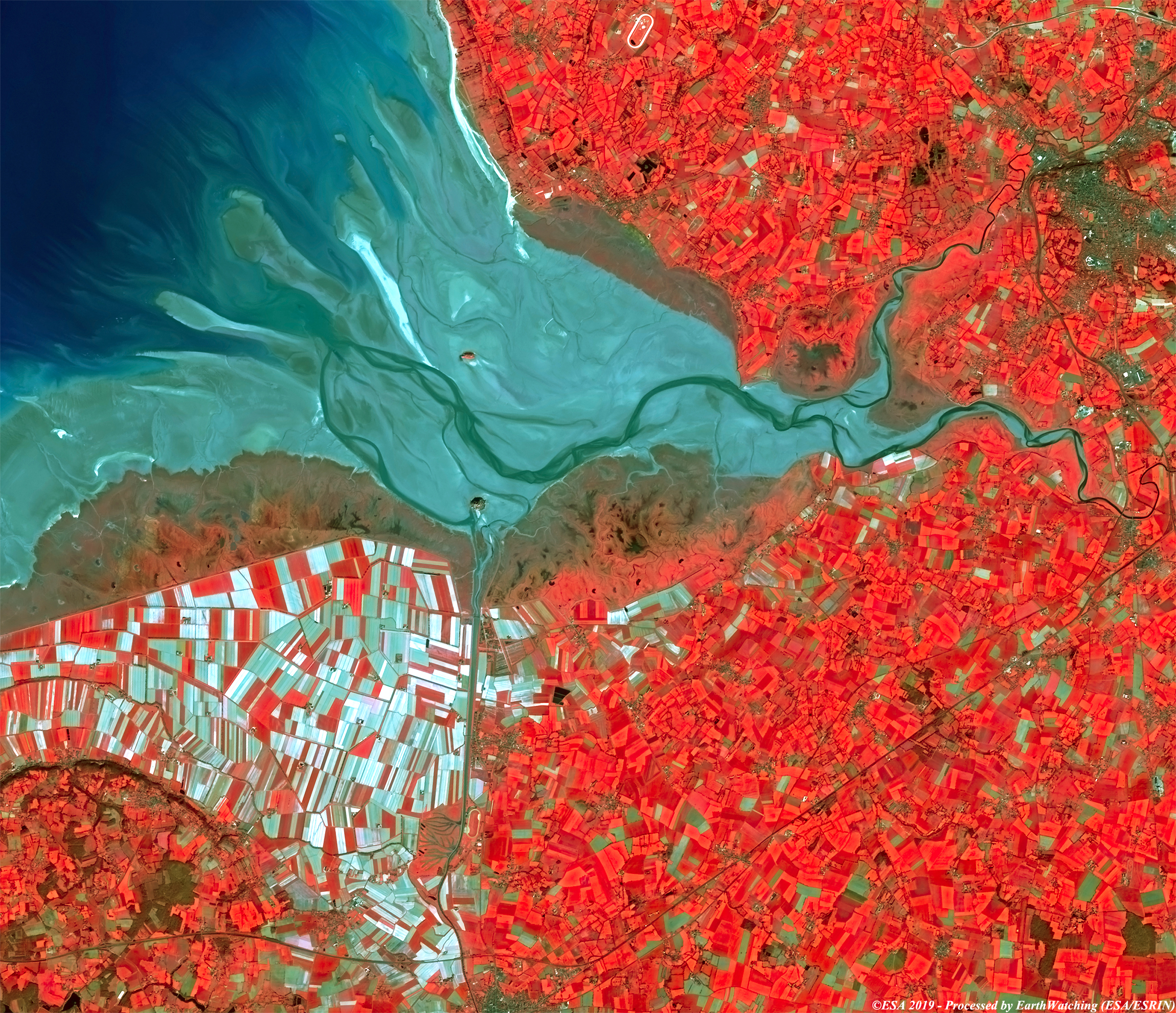
This comparison of images, acquired by Sentinel-2 (optical Sensor, with resampling data from 10 to 5 metres) satellite over Mont-St-Michel, shows the different results obtained with the multispectral bands Sentinel-2 offers. Located at the northern coast of France, Mont Saint-Michel is located at the mouth of the Coulson River, a short river which flows almost entirely in the department of Ille-et-Vilaine, in the Brittany region. Thanks to its magnificent bay, the charm of the medieval village, the majesty of the Abbey and the marvelous spectacle of the tides, the mount is named after the patron saint of San Michel Archangel, to whom the imposing abbey is dedicated. With this demonstration of images taken by Sentinel-2, we aim to show the large field of application that the Copernicus Sentinel satellite family can cover. 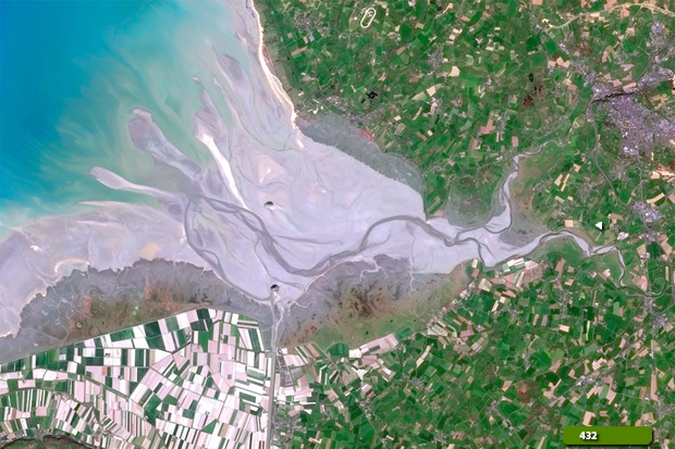 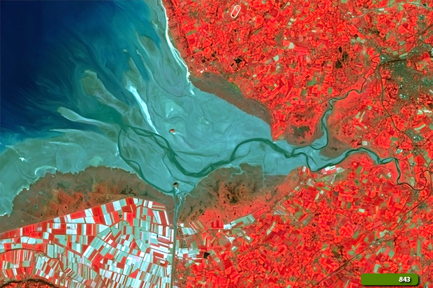 View Sentinel-2 high resolution image in natural colour (JPG 4.8 MB) View Sentinel-2 high resolution image in false colour (JPG 4.9 MB)
|
|||||||||||||||||||