 Las Vegas, Nevada, USA
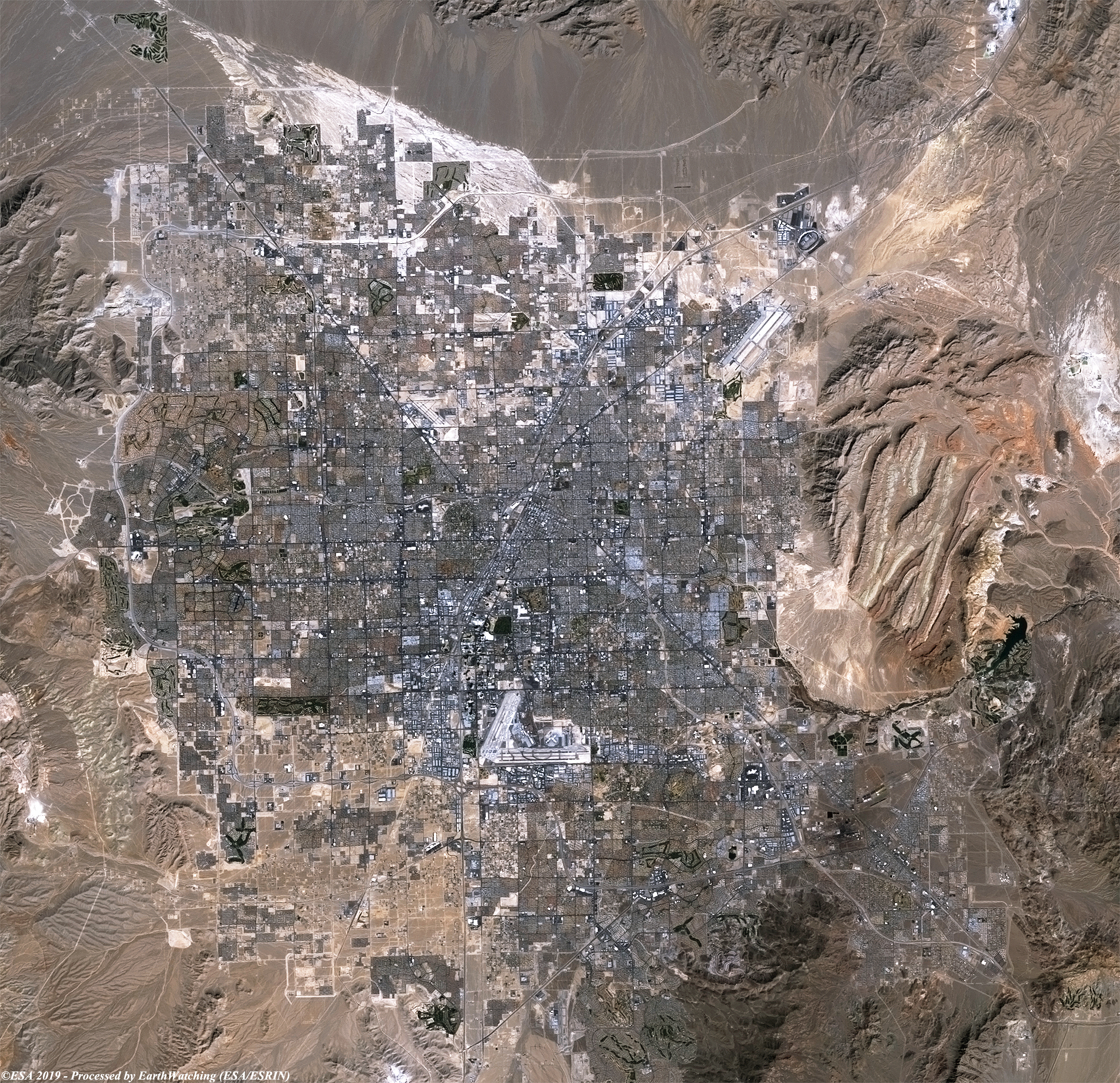
This week, our comparison of images, acquired from the Landsat 5 and Copernicus Sentinel-2 satellites, show the city of Las Vegas, Nevada, USA. The city bills itself as the entertainment capital of the world, and is famous for its mega casino–hotels and associated activities. It is a top three destination in the United States for business conventions and a global leader in the hospitality industry. Las Vegas is situated within Clark County in a basin on the floor of the Mojave Desert and is surrounded by mountain ranges on all sides. The aim of this comparison is to highlight how the city has developed over a timeframe of 12 years. Urban spread can be see in the areas surrounding the centre, and the city airport. 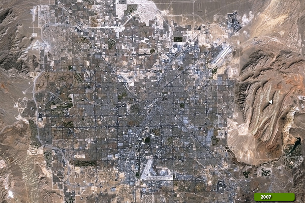 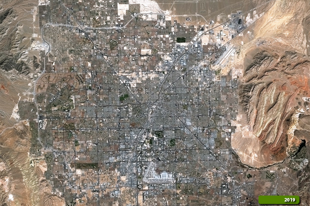 Sentinel-2 high resolution image (JPG 6.8 MB) Landsat-5 high resolution image (JPG 6.3 MB)
|
||||||||||||||||