 L'Aquila Italy 2019
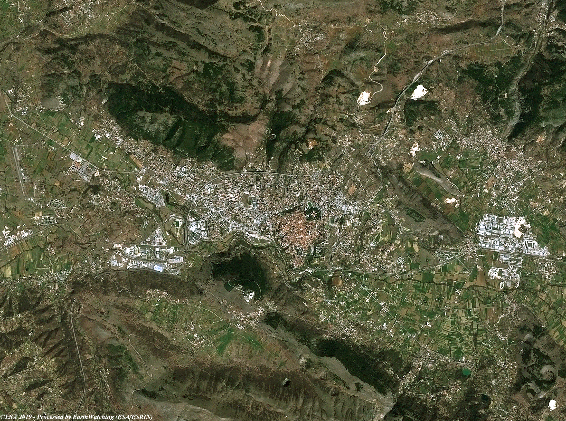
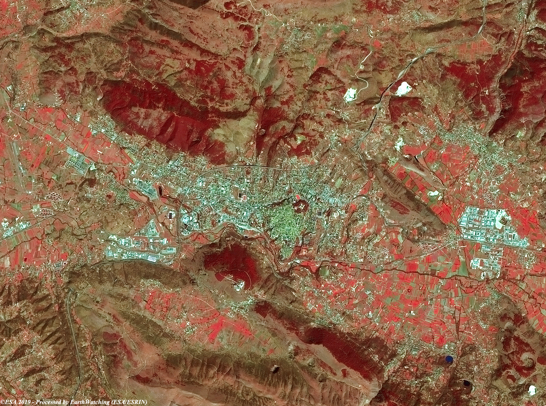
This week, our image comparison uses imagery acquired from the Copernicus Sentinel-2 satellite over the city of L'Aquila. Located in the heart of a wide basin of the Abruzzese Apennines, to the left of the river Aterno, it is included in the Gran Sasso and Mount of Laga National Park. Severely damaged in the earthquake of 1703, the city was rebuilt according to the primitive plan and experienced an intense urban development during the century XVIII, experiencing a further expansion after the unification of Italy. Starting from the second post-war period urban and industrial development spread both inside and outside the city walls. This image processed in different combination bands (natural color 4, 3, 2, and the second in false color 8, 4, 3), shows L'Aquila 10 years after the strong earthquake that has destroyed the city on the night of 6 April 2009, which caused the death of nearly 300 people. 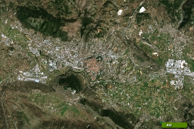 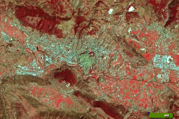 View Sentinel-2 high resolution image (natural color) (JPG 5.5 MB) View Sentinel-2 high resolution image (false color) (JPG 5.9 MB)
|
||||||||||||||||