 Kīlauea Volcano, Hawaii
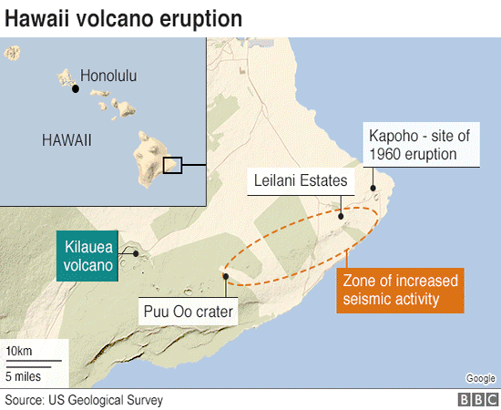
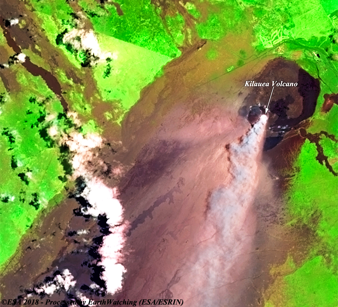
Kilauea is a currently active shield volcano in the Hawaiian Islands, and the most active of the five volcanoes that together form the island of Hawaii. Located along the southern shore of the island, the volcano is between 300,000 and 600,000 years old and emerged above sea level about 100,000 years ago. It is the second youngest product of the Hawaiian hotspot and the current eruptive center of the Hawaiian–Emperor seamount chain. Because it lacks topographic prominence and its activities historically coincided with those of Mauna Loa, Kilauea was once thought to be a satellite of its much larger neighbor. Structurally, Kilauea has a large, fairly recently formed caldera at its summit and two active rift zones, one extending 125 km (78 mi) east and the other 35 km west, as an active fault of unknown depth moving vertically an average of 2 to 20 mm (0.1 to 0.8 in) per year. Kilauea has been erupting nearly continuously since 1983 and has caused considerable property damage, including the destruction of the town of Kalapana in 1990. On 3 May 2018, several lava vents opened in the lower Puna area, downrift from the summit. The new volcanic episode was accompanied by a strong earthquake of Mw 6.9, and nearly 2,000 residents were evacuated from Leilani Estates and the adjacent Lanipuna Gardens development. By 9 May 2018, the eruption had destroyed 27 houses in the Leilani Estates subdivision. On 17 May 2018 at 4:17 AM, the volcano explosively erupted, throwing ash 30,000 feet into the air. More information is available on Wikipedia
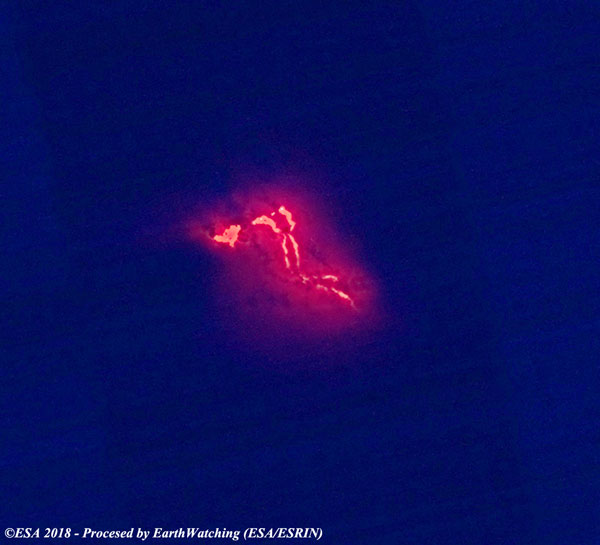
These Landsat 8 images have been acquired over the Big Island of Hawaii, and show Kīlauea volcano which is in the process of erupting. This latest eruption of Kīlauea has destroyed a total of 35 buildings, mostly homes, and threatens hundred more. Nearly 2,000 people have been evacuated so far. Kīlauea is one of the world's most active volcanoes and has been in constant eruption for more than 35 years. The eruption is visible in this image comparison, and we can see the plume of smoke that rises from the crater. The Landsat image acquired on the night of 25 May shows the flow of lava (in red) along the top of the crater, using infrared and visible bands. Another aim of these images is to promote the opportunity to download Landsat data through the ESA portals (or third party mission free catalogue), where images captured every day are made available in near real time to the users and the scientific community. Landsat full resolution data products are freely available for immediate download at: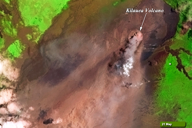 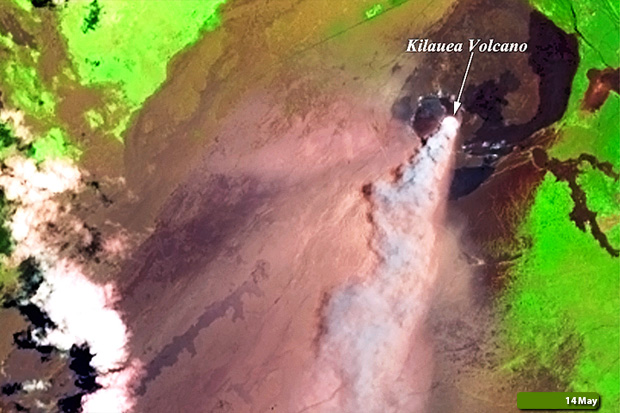 View large format slider in Visible Colour View Landsat 8 OLI high resolution image on 14 May (JPG 1.4 MB) View Landsat 8 OLI high resolution image on 21 May (JPG 1.3 MB)
 View Landsat 8 OLI high resolution image (JPG 1.1 MB)
|
|||||||||||||||||||||||||||||||||||