 Izmir, Turkey
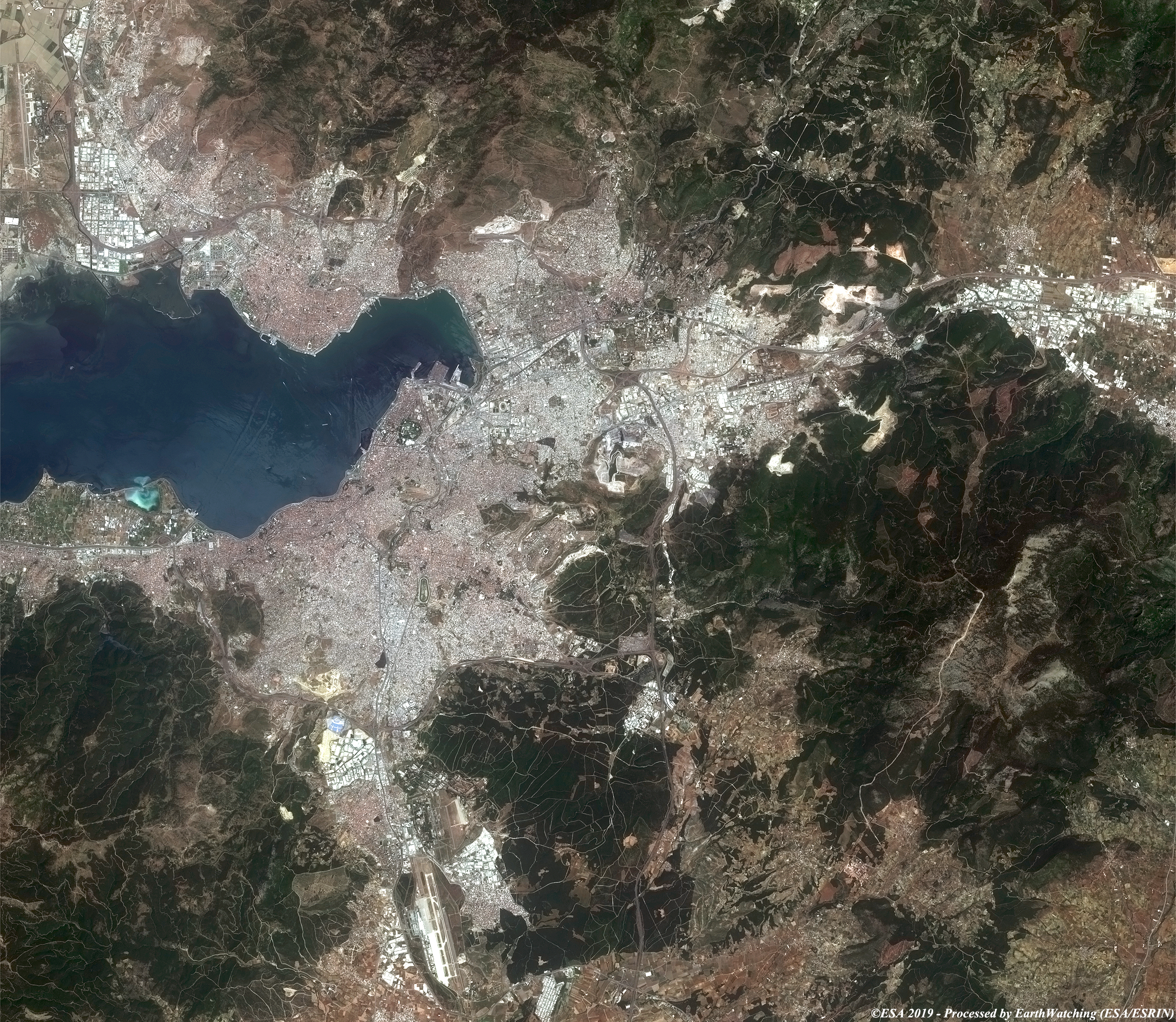
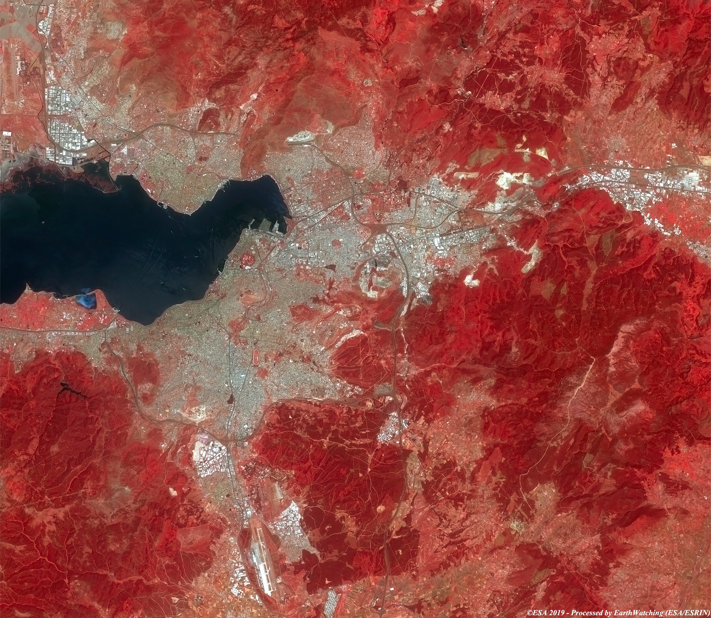
This week the Copernicus Sentinel-2 satellite shows us the city of Izmir, on the Aegean coast of Turkey. Known in ancient times as Smyrna, it was founded by the Greeks, conquered by the Romans and rebuilt by Alexander the Great, before becoming part of the Ottoman Empire in the 15th century. Inside one of its great archaeological sites is the Roman agora of Smyrna, today an open-air museum. The Kadifekale, or 'velvet castle', built during the era of Alexander the Great, dominates the city from the top of a hill. Today Smyrna is a commercial center and an important port for the export of agricultural products. The aim of this comparison of images is to process the images in true (bands 4,3,2) and false colour (bands 8,4,3) to highlight urban change. 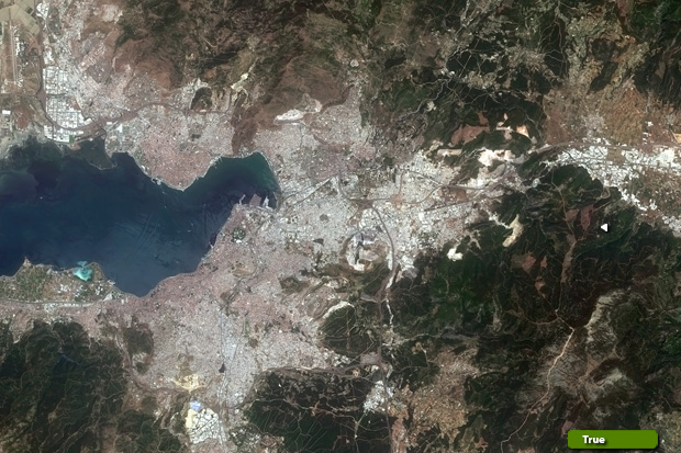 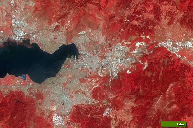 View high resolution image (natural colour) (JPG 5.2 MB) View high resolution image (false colour) (JPG 5.3 MB)
|
||||||||||||||||