 Istanbul, Turkey
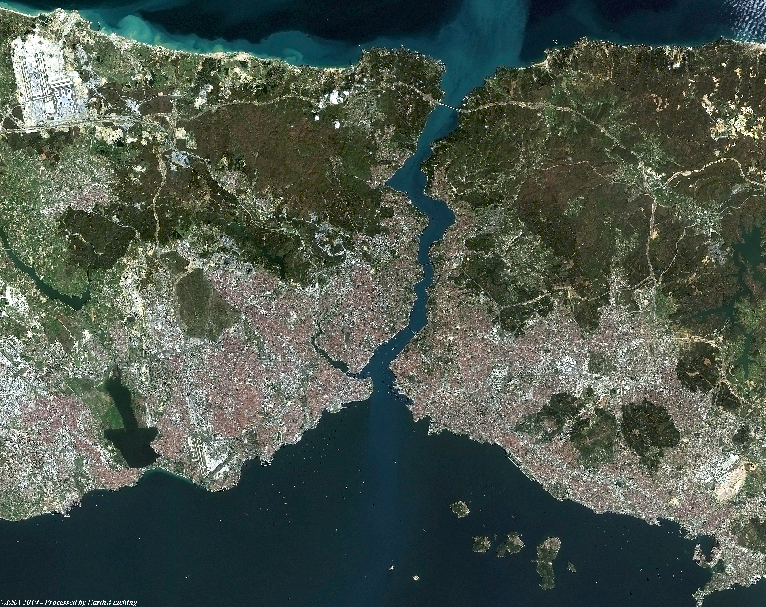
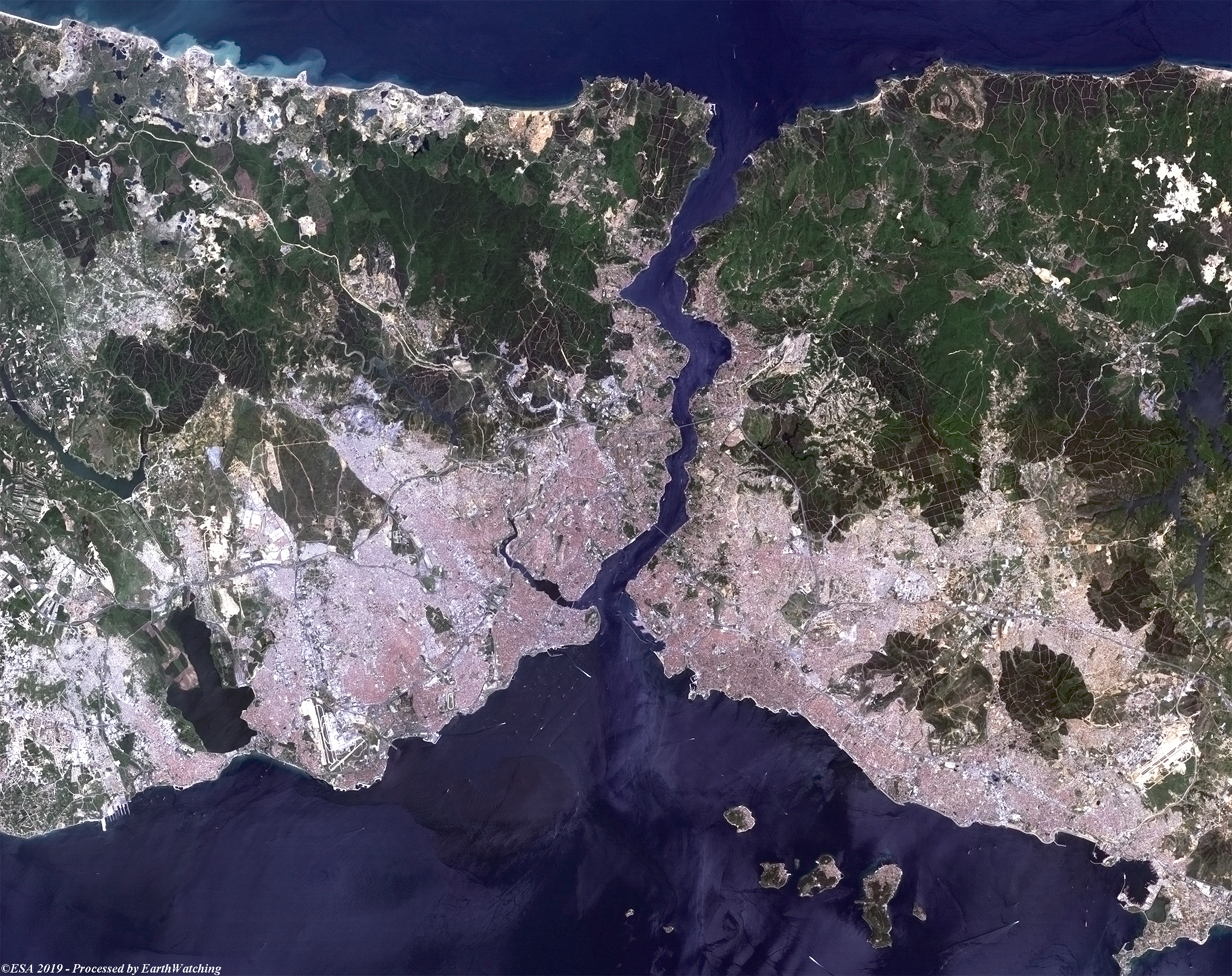
This week's comparison uses imagery from Landsat-7 and Coperncus Sentinel-2. The images were captured 19 years apart and aim to show new bridges that span the strait separating the city, as well as to highlight the significant urban spread. Istanbul is in north-western Turkey within the Marmara Region on a total area of over 5,300km2. The Bosphorus, which connects the Sea of Marmara to the Black Sea, divides the city into a European, Thracian side and an Asian, Anatolian side. The city is further divided by the Golden Horn, a natural harbor bounding the peninsula where the former Byzantium and Constantinople were founded. The highest point in Istanbul is Çamlıca Hill, with an altitude of 288 meters (945 ft). The northern half of Istanbul has a higher mean elevation compared to the south coast, with locations surpassing 200 meters (660 ft), and some coasts with steep cliffs resembling fjords, especially around the northern end of the Bosphorus, where it opens up to the Black Sea. Istanbul has two international airports. The larger is Istanbul Atatürk, which can be seen in the south western section of the images. 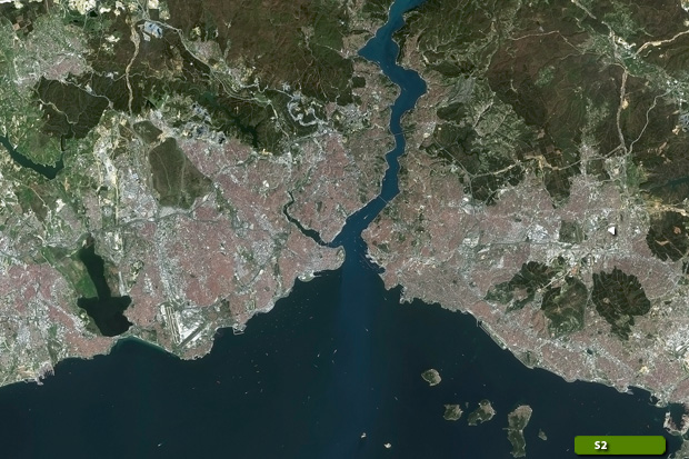 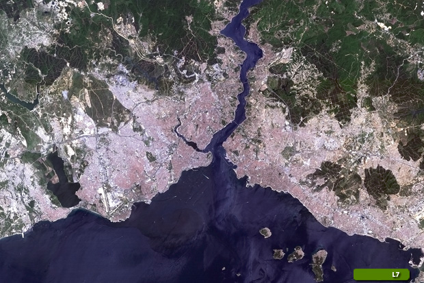 View Sentinel-2 high resolution image (JPG 5.0 MB) View Landsat-7 high resolution image (JPG 5.8 MB)
|
|||||||||||||||