 Icebergs A-68 and B-46 in Antarctica
Pine Island Glacier (PIG) is a large ice stream, and the fastest melting glacier in Antarctica, responsible for about 25% of Antarctica's ice loss. The glacier ice streams flow west-northwest along the south side of the Hudson Mountains into Pine Island Bay, Amundsen Sea, Antarctica. It was mapped by the United States Geological Survey (USGS) from surveys and United States Navy (USN) air photos, 1960–66, and named by the Advisory Committee on Antarctic Names (US-ACAN) in association with Pine Island Bay. The area drained by Pine Island Glacier comprises about 10% of the West Antarctic Ice Sheet. Satellite measurements have shown that the Pine Island Glacier Basin has a greater net contribution of ice to the sea than any other ice drainage basin in the world and this has increased due to recent acceleration of the ice stream. The ice stream is extremely remote, with the nearest continually occupied research station at Rothera, nearly 1,300 km away. The area is not claimed by any nations and the Antarctic Treaty prohibits any new claims while it is in force. More information is available on Wikipedia
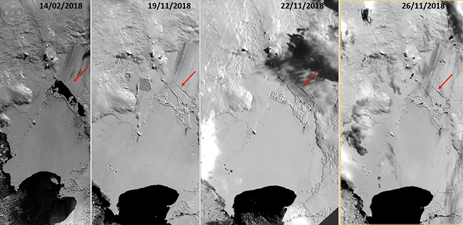
A new iceberg formed in October in the Antarctic Sea. The animation below, using data from ESA's Proba-V mission, shows the evolution of the iceberg - called B-46 - which broke off from the Pine Island glacier. The iceberg initially covered 225 square kilometres, a large area twice the size of the Municipality of Naples. 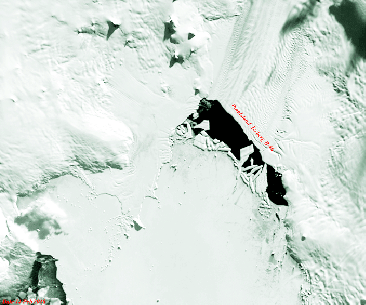
View large animation (GIF 4.8 MB)
The Larsen Ice Shelf is a long ice shelf in the northwest part of the Weddell Sea, extending along the east coast of the Antarctic Peninsula from Cape Longing to Smith Peninsula. In 2005, it covered approximately 78500 km2 of the earth's sea with exceptionally thick ice. It is named for Captain Carl Anton Larsen, the master of the Norwegian whaling vessel Jason, who sailed along the ice front as far as 68°10' South during December 1893. In finer detail, the Larsen Ice Shelf is a series of shelves that occupy (or occupied) distinct embayments along the coast. From north to south, the segments are called Larsen A (the smallest), Larsen B, and Larsen C (the largest) by researchers who work in the area. Further south, Larsen D and the much smaller Larsen E, F and G are also named. The breakup of the ice shelf since the mid-1990s has been widely reported, with the collapse of Larsen B in 2002 being particularly dramatic. A large section of the Larsen C shelf broke away in July 2017. More information is available on Wikipedia
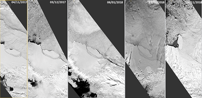
The animation below, shows the evolution of Iceberg A-68 off the Larsen-C Ice Shelf. This animation used Proba-V images acquired in November 2017 to November 2018, and verifies the movement of the Iceberg. A-68 is about 5800 square kilometres and weighs more than a trillion tonnes. 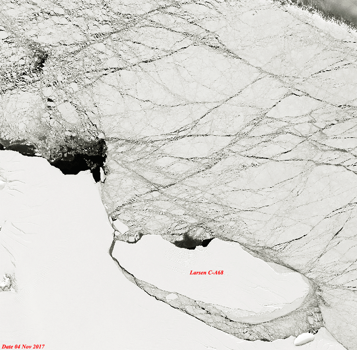 View large animation (GIF 4.8 MB)
|
|||||||||||||||||||||||