 Hong Kong-Zhuhai-Macau Bridge
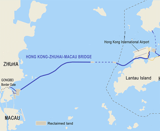
The Hong Kong–Zhuhai–Macau Bridge (HKZMB) is a bridge–tunnel system, which consists of a series of three cable-stayed bridges and one undersea tunnel, as well as 3 artificial islands. It spans the Lingdingyang channel, which connects Hong Kong with Macau and Zhuhai, three major cities on the Pearl River Delta. For the construction cost of the HZMB Main Bridge, the total contribution of the three places (Hong Kong, Mainland and Macau) will be RMB¥15.73 billion, among which the Government of the Hong Kong SAR will contribute RMB¥6.75 billion. It is among the longest fixed-links in the world and is a major landmark in the area. Originally set to be opened to traffic in October 2016, the structure was completed on 14 November 2017 and is planned to open in late 2018 with journalists already given rides over the bridge. More informations is available on Wikipedia The Hong Kong – Zhuhai – Macao Bridge (HZMB), being situated at the waters of Lingdingyang on the Pearl River Estuary, is a mega-size sea crossing linking the Hong Kong Special Administrative Region (HKSAR), Zhuhai City of Guangdong Province and Macau Special Administrative Region. It consists of a main bridge in mainland waters together with boundary crossing facilities and roads which link three locations. The functions of the bridge are to meet the demand for passenger and freight land transport among Hong Kong, the mainland (particularly the region of Pearl River West) and Macau, to establish a new land transport link between the east and west banks of the Pearl River, and to enhance the economic and sustainable development of the three cities. More informations are available on the HZMB project website
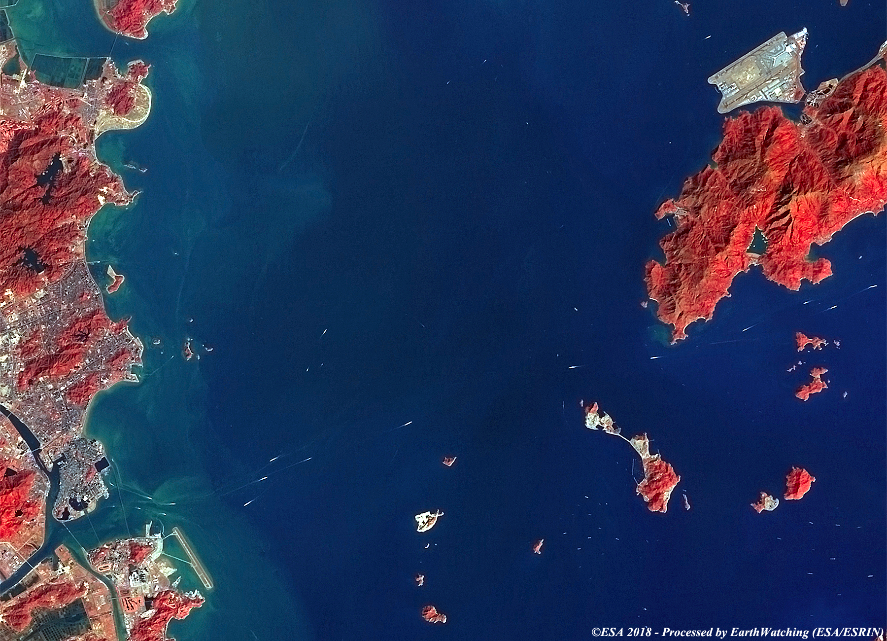
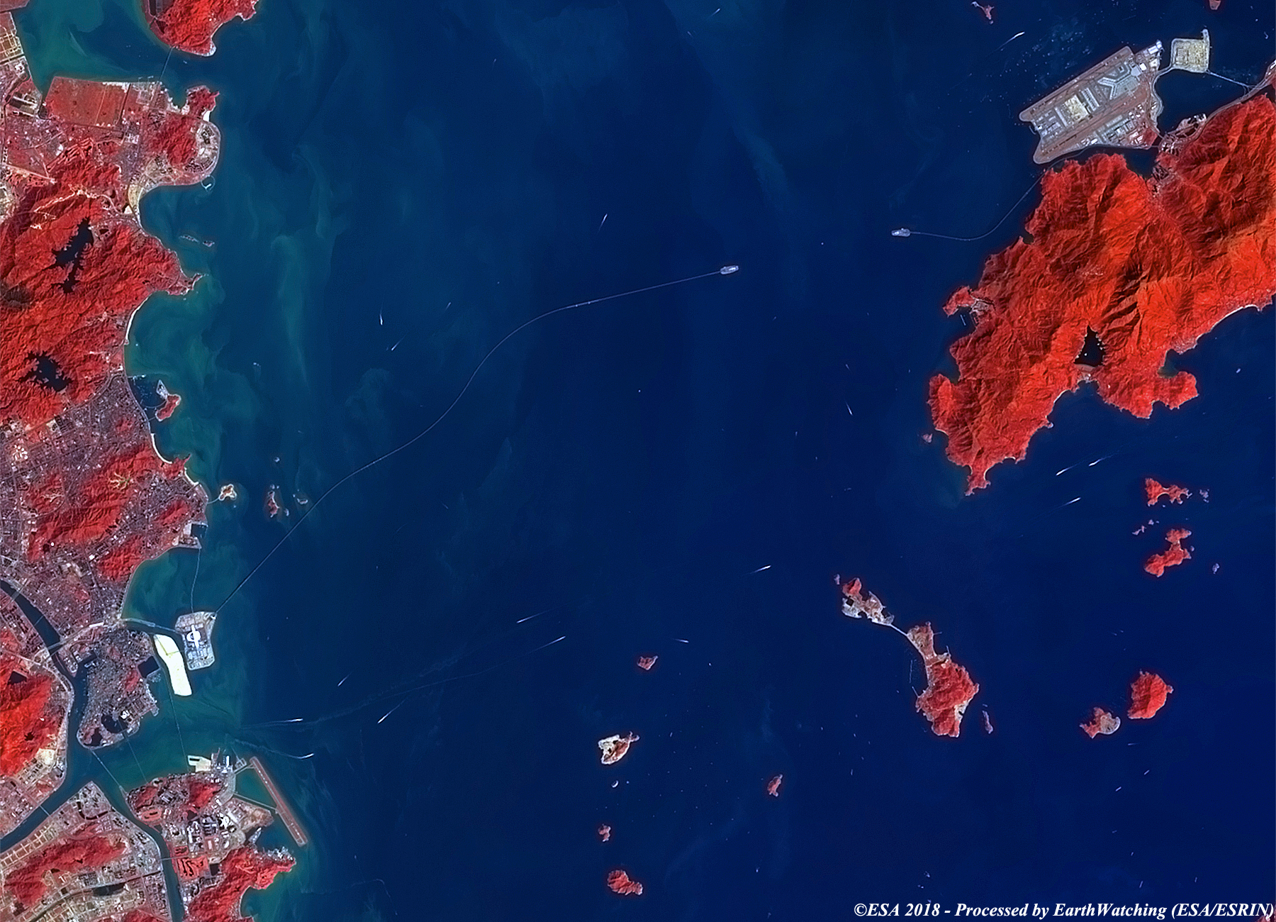
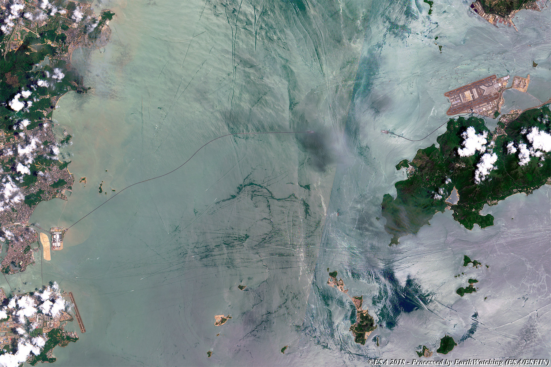
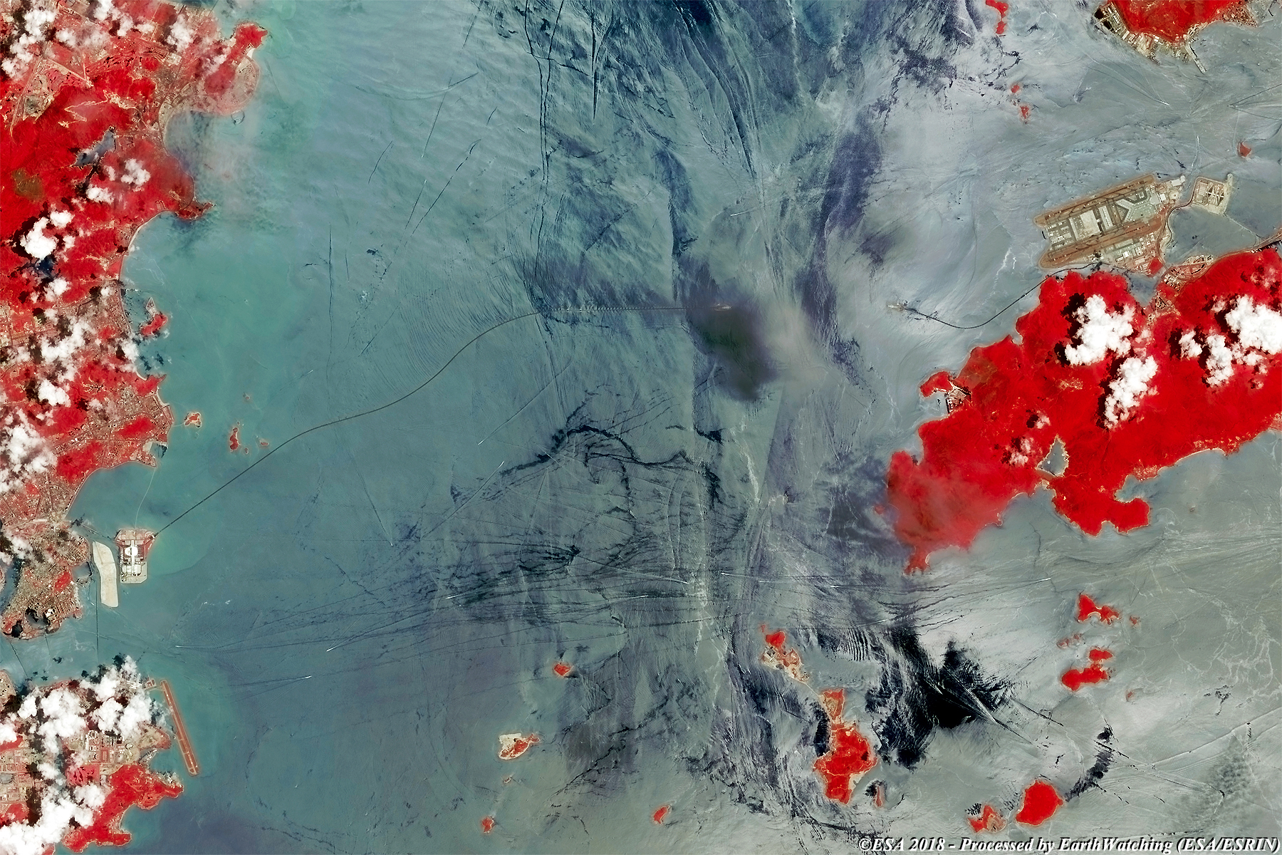
These images acquired by the Landsat 5 and 8 (using TM and OLI) and Copernicus Sentinel-2 satellites, shows the Hong Kong-Zhuhai-Macau main Bridge. After eight years of work, China has completed another spectacular venture: a 55 kilometre bridge, including 6 kilometres of submarine tunnel and three artificial islands by junction, which links Hong Kong to Zhuhai in China and Macau. It is ready for the opening to traffic which is expected to begin in the coming months. The bridge will reduce the connection time between the three cities in the Great Bay Area and others in a region with a total population of 60 million. It is designed to last for 120 years and withstand earthquakes of 8 degrees on the Richter scale. In this comparison of images taken from the Landsat 5 and 8 satellite in false colour, the bridge is visible connecting the artificial islands, which are also connected to each other by the submarine tunnel (visible in the centre of the image). The bridges also connect to a third artificial island which is north of the International Airport of Macau. Landsat full resolution data products are freely available for immediate download at: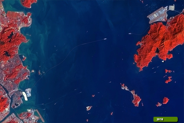 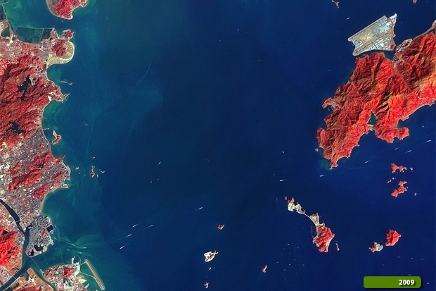 View large format slider in Visible Colour View Landsat 5 TM high resolution image (Before) (JPG 2.7 MB) View Landsat 8 OLI high resolution image (After) (JPG 2.4 MB)
The construction is emphasised with the images processed by Sentinel-2, which use bands in visible and false colour (although the clouds in this image are remarkable). Another aim of these images is to promote the opportunity to download Landsat data through the ESA portals (which is a third party mission), where images captured every day are made available in near real time to users and the scientific community, and the use of the new generation of satellites in the European Commission's Copernicus Sentinels to monitor changes around the world with high resolution.  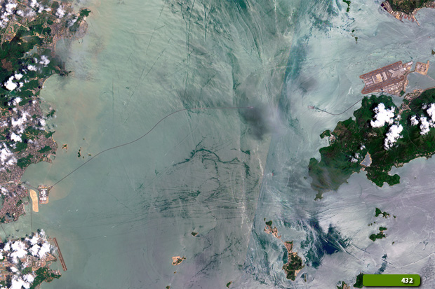 View Sentinel 2 high resolution image in natural colour (JPG 2.8 MB) View Sentinel 2 high resolution image in false colour (JPG 2.2 MB)
|
|||||||||||||||||||||||||||||||||