 Gran Canaria Wildfires
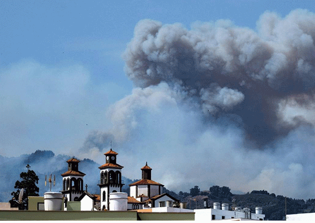
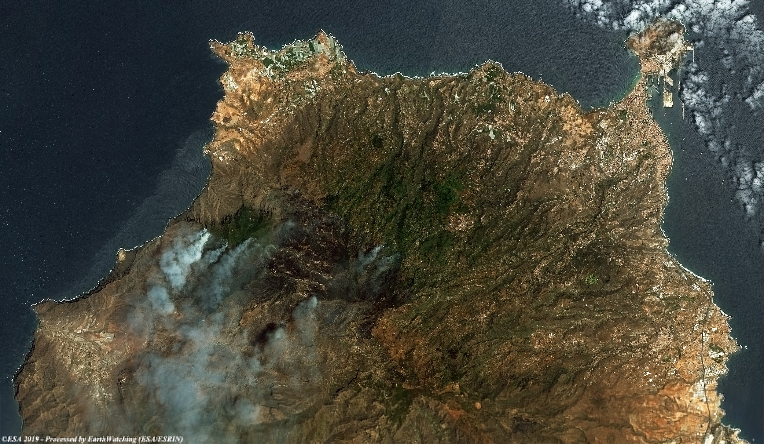
A wildfire that has raged across vast areas of the Spanish holiday island of Gran Canaria since the weekend has abated as winds have dropped, limiting damage to protected areas, local officials reported. Flames as high as 50 metres (160 feet) had complicated the battle against the blaze burning since Saturday on the western slopes of the volcanic island located off northwest Africa, prompting the evacuation of several villages with a combined population of around 10,000. Read more on AFP
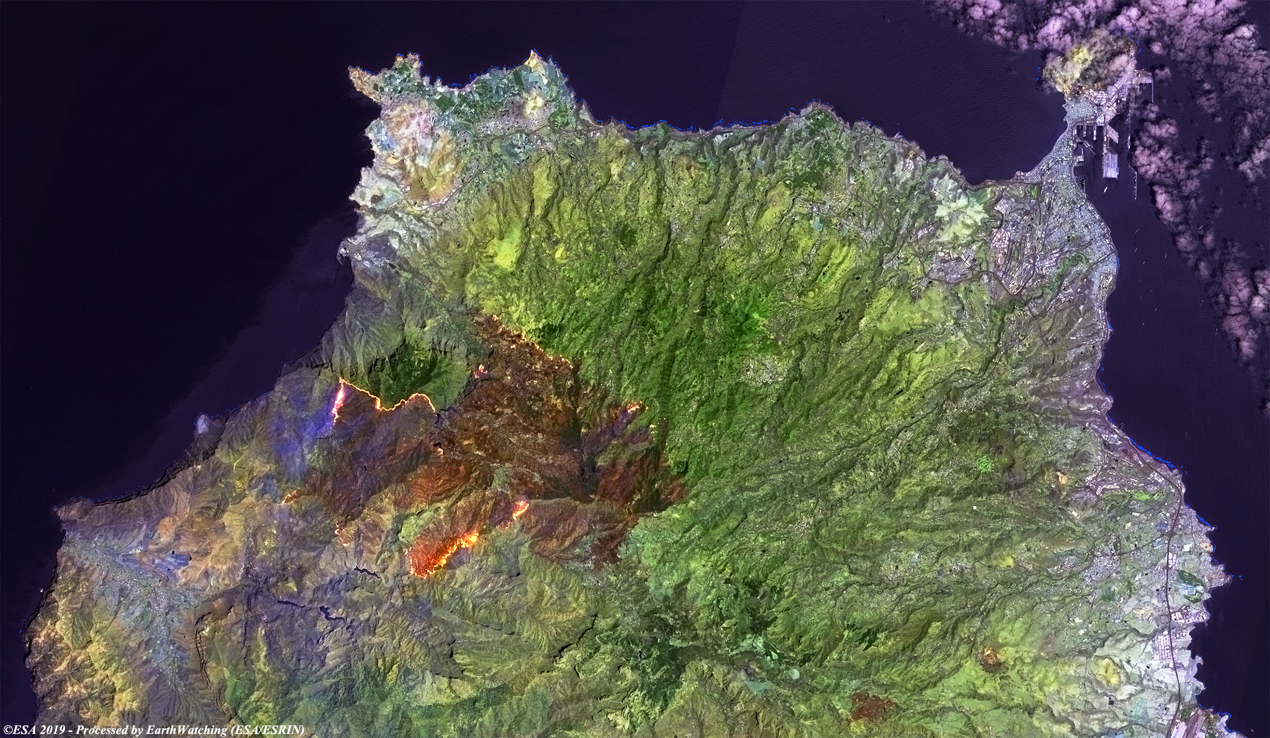
This image acquired on 19 August 2019 by the Copernicus Sentinel-2 satellite, shows the fires that devastated the north-west part of Gran Canaria. Authorities were forced to evacuate over 8000 people from their homes. The image comparison shows the the vastness of the fire which has burned 3,400 hectares of vegetation. The false colour image clearly defines how the fire advances on two fronts, also showing the area already devastated by the fire (in brown). 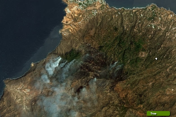 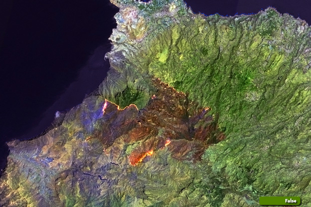 View Sentinel-2 high resolution image (false colour) (JPG 3.8 MB) View Sentinel-2 high resolution image (natural colour) (JPG 4.2 MB)
|
|||||||||||||||||||