 Floods in Iran
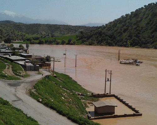
Between 13 and 17 April 2016, heavy rains in Iran's western and southwestern provinces have resulted in flash floods that killed three people. In total, 16 provinces in the country including Lorestan, Ilam, Fars, Kermanshah, Khuzestan, Chaharmahal-Bakhtiyari, Hamedan, Esfahan, Khorasan Shomali, Khorasan Razavi, Kurdestan, Alborz, Yazd, Zanjan, Kohgiluyeh-Boyer Ahmad and Azarbaijan Sharghi were hit by heavy torrential rains and major flooding whilst three provinces of Ilam, Lorestan and Khuzestan are badly damaged. From: IFRC, 18 Apr 2016
This comparison of Sentinel-1 (ASAR) images was acquired over Iran's western and south-western provinces. In this case the aim is to show the flooding in this area in the middle of April. In particular we want to show in this comparison of images the area under the flood. This difference is evident in the image acquired on 16 April 2016 (after the flood), where Sentinel-1's radar shows a dark area along the river, indicating large bodies of water. With the use of Sentinel-1 (satellites of the Copernicus programme) the users have the possibility of monitoring events like this. 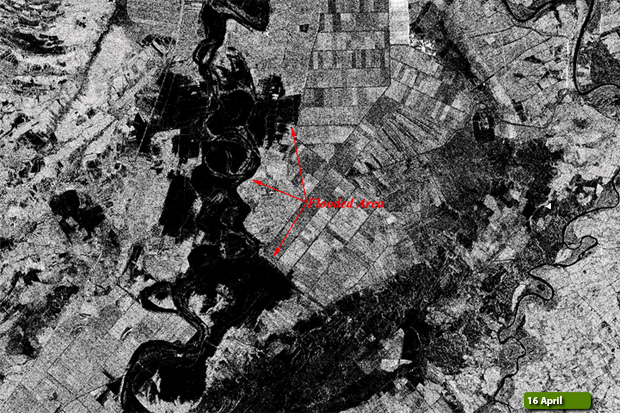 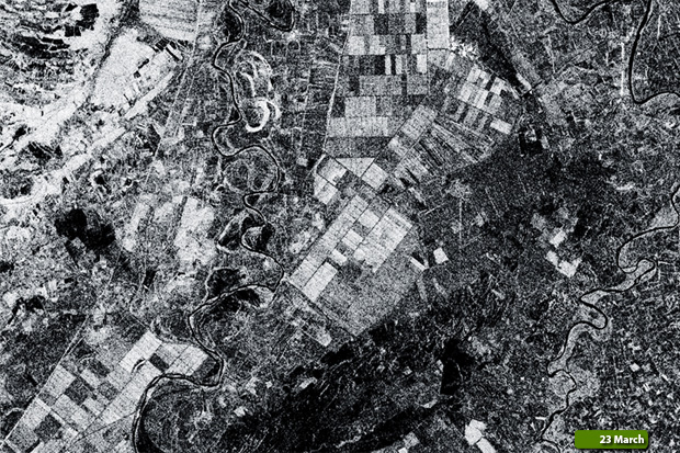 View Sentinel-1 high resolution image before flood (JPG 1.7 MB) View Sentinel-1 high resolution image after flood (JPG 1.5 MB)
|
|||||||||||||||||||